Great Appalachian Valley
The Great Appalachian Valley is a longitudinal chain of valley lowlands that forms part of the Appalachian mountain system in North America. Stretching from…
What is Great Appalachian Valley?
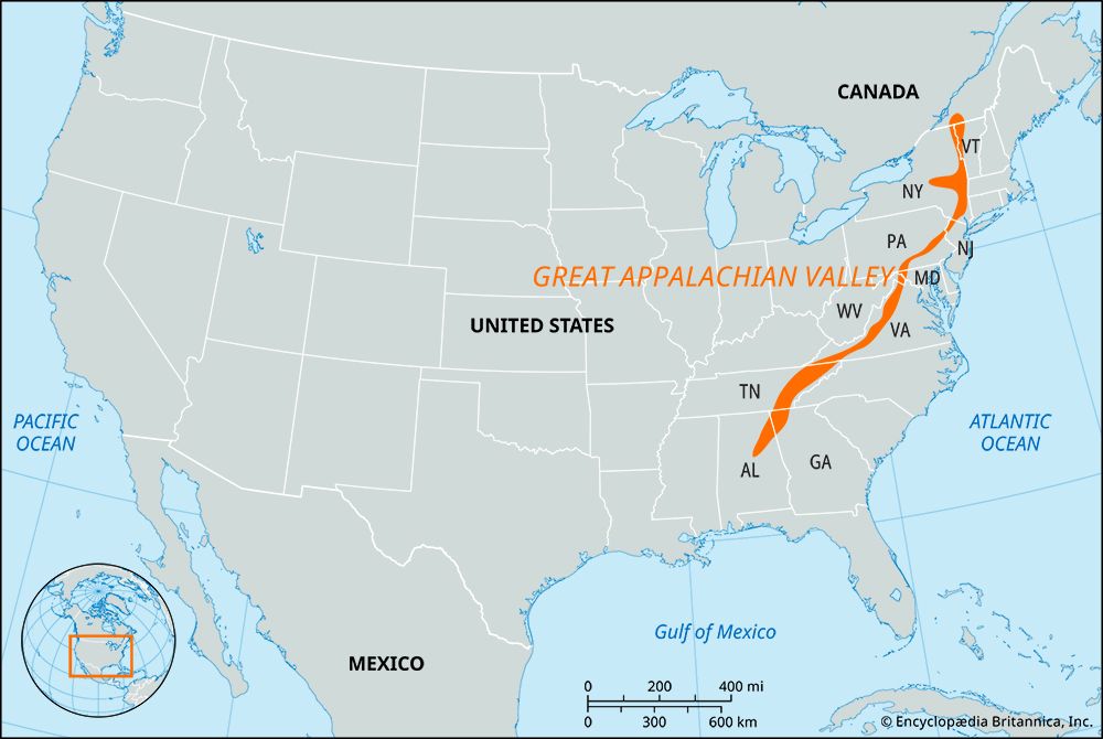
The Great Appalachian Valley is a longitudinal chain of valley lowlands that forms part of the Appalachian mountain system in North America. Stretching from Canada in the northeast to Alabama in the southwest, the region encompasses several notable river valleys, including the St. Lawrence River valley, as well as the Kittatinny, Cumberland, Shenandoah, and Tennessee river valleys.1
Geologically, the valley is characterized by Paleozoic age sedimentary rocks, distinguishing it from the older crystalline rocks found in the regions to its east. In its southern reaches, the valley serves as a divider, splitting the Appalachian Mountains into two subequal portions. In the north, it lies west of the Appalachian ranges of New England and Canada, effectively separating them from the Adirondack group. The valley is well-regarded for its fertile soil, supporting rich farmland, particularly within the Cumberland and Shenandoah sections.21
How did the Appalachian Revolution shape the mountains?
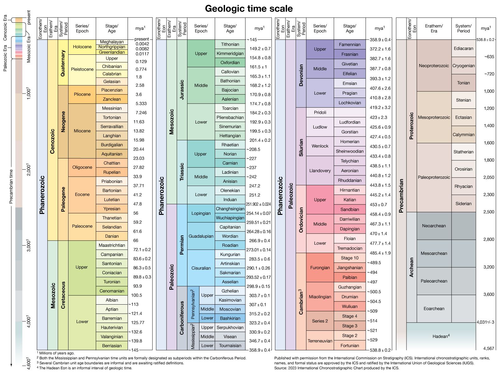
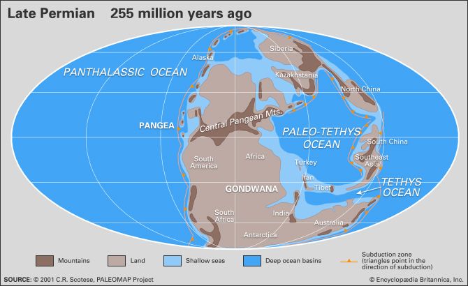
The term “Appalachian Revolution” refers to the Alleghenian orogeny, a major mountain-building event that occurred during the Permian Period (approximately 300 to 250 million years ago). This event was a critical phase in the formation of the Appalachian Mountains and the Pangaea supercontinent.435
The revolution shaped the mountains through several intense geological processes:
- Interior Crumpling: The event caused a vast “interior crumpling” of the Earth’s crust due to immense stress on subterranean rock masses.3
- Folding and Faulting: As the crust buckled, it created parallel ridges and deep folds. The compression resulted in significant faulting, where rock masses were thrust over one another.35
- Westward Thrusting: In the southern Appalachians, massive crustal slabs were thrust hundreds of kilometers westward over the former continental margin. This movement pushed older, ancient crystalline rocks atop more recent sedimentary rock deposits.43
- Continental Collision: These structural changes were driven by the collision of the North American continental margin with that of North Africa.5
What are water gaps and how are they formed?
A water gap is a pass in a mountain ridge through which a stream or river flows. These features are a form of cross-axial, or discordant, drainage, where rivers appear to carve paths through resistant rock ridges rather than flowing around them.67
Water gaps are typically formed through one of the following geological processes:
- Antecedence: The river was already established in its course before the mountain ridge began to rise. If the rate of the river’s downcutting keeps pace with the rate of tectonic uplift, it maintains its path, cutting a gorge through the rising structure.87
- Superimposition: A river develops on a layer of younger sedimentary material that buries older, complex structures. As the river erodes downward, it is “let down” onto the underlying resistant rock, imposing its existing drainage pattern across the structures as they are exposed.87
- Headward Erosion and Stream Capture: Rivers may exploit zones of weakness, such as faults, to cut through ridges. Through stream capture, a more aggressive stream may erode into the valley of another, potentially leaving behind abandoned, dry sections known as wind gaps.87
Why are the southern Appalachians considered a refuge for northern plant species?
The southern Appalachians serve as a refuge for northern plant species primarily due to the historical impact of the Pleistocene Epoch. During this period, massive continental ice sheets advanced across North America, covering regions as far south as the Ohio River valley. As these glaciers moved, they stripped away topsoil and forced northern flora and fauna to migrate southward to survive.3
The southern mountains provided a critical sanctuary for these displaced life forms because the glaciers did not reach them. When the ice sheets eventually retreated, the southern Appalachians acted as a “giant bed” for reseeding, allowing many northern species to recolonize the north while maintaining populations in the southern region.3
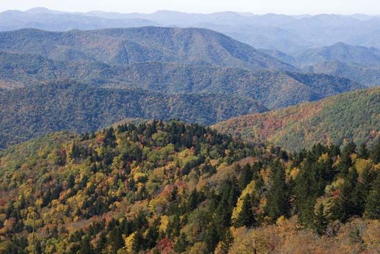
Today, these species persist in the southern Appalachians, particularly at higher elevations such as the Great Smoky Mountains. In these areas, the combination of cooler temperatures and relative isolation creates a microclimate that mimics northern conditions, allowing plants typically associated with Canadian forests—such as red spruce and balsam fir—to thrive far from their primary northern ranges.310
Sources
- Great Appalachian Valley — Encyclopædia Britannica
- Appalachian Mountains - Economic growth — Encyclopædia Britannica
- Appalachian Mountains - Geology of the Appalachian Mountains — Encyclopædia Britannica
- Appalachian orogenic belt — Encyclopædia Britannica
- Alleghenian orogeny — Encyclopædia Britannica
- water gap — Merriam-Webster
- Appalachian Mountains - Drainage — Encyclopædia Britannica
- river - Formation of canyons and gorges — Encyclopædia Britannica
- valley - Cross-axial drainage — Encyclopædia Britannica
- Pleistocene Epoch - Migration of plants and animals — Encyclopædia Britannica
- Appalachian Mountains - Climate — Encyclopædia Britannica
- Mountain ecosystem - Environment — Encyclopædia Britannica
- Appalachian Mountains - Plant and animal life — Encyclopædia Britannica
Published on · 3 min read