Great Dividing Range
The Great Dividing Range serves as a major hub for outdoor recreation and conservation in eastern Australia, offering numerous national parks and tourist…
What are some popular national parks and recreational areas within the Great Dividing Range?
The Great Dividing Range serves as a major hub for outdoor recreation and conservation in eastern Australia, offering numerous national parks and tourist destinations across Queensland, New South Wales, and Victoria.12
Key areas include:
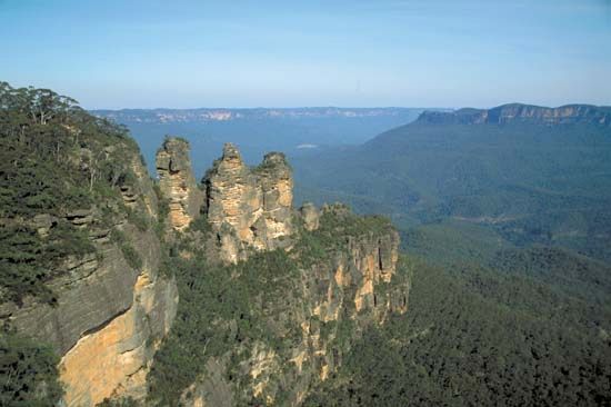
- Blue Mountains National Park: Located in New South Wales, this is one of the most popular regions for visitors. It features the scenic Grose River valley, the famous Jenolan Caves, and various townships that serve as gateways for tourism.23
- Wollemi National Park: Notable for the 1994 discovery of the Wollemi pine, a rare “living fossil” found within its borders.1
- New England National Park: Situated on the eastern slope of the New England Range in New South Wales, this park covers 90 square miles and is known for its diverse landscape.4
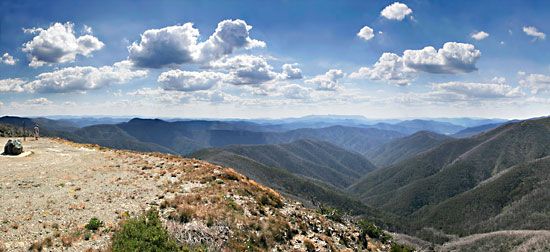
- Australian Alps: This segment near the border of New South Wales and Victoria is a primary destination for skiing and alpine recreation, containing Mount Kosciuszko, the highest peak in Australia.12
What are some of the major peaks and sections of the Great Dividing Range?
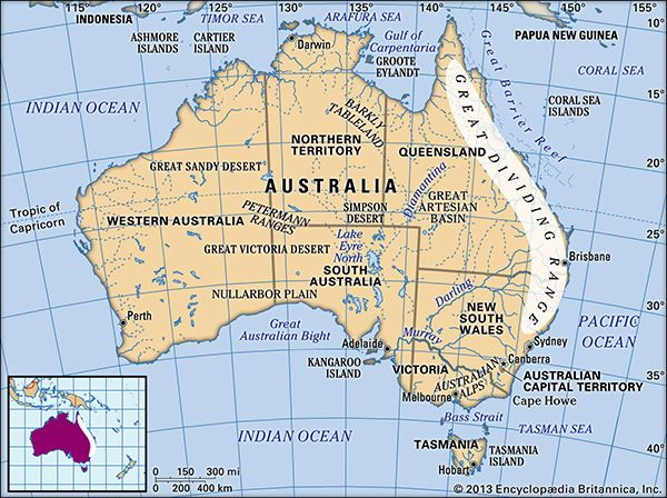
The Great Dividing Range is a vast mountain system extending approximately 2,300 miles (3,700 km) along the eastern coast of Australia, from the Cape York Peninsula in the north to the Grampians in Victoria.12
Major Sections and Peaks
The range is topographically complex, consisting of various plateaus and mountain segments:
- Northern Ranges (Queensland): In this region, the mountains average 2,000–3,000 feet (600–900 meters) in elevation. Notable features include the Bellenden Ker Range, the McPherson Range, and the Lamington Plateau, which reach heights of up to 5,000 feet (1,500 meters).12
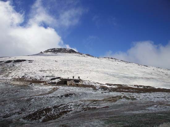
- Australian Alps: Located near the border of New South Wales and Victoria, this segment contains the highest elevations in the system. It is home to Mount Kosciuszko, which stands at 7,310 feet (2,228 meters) and is the highest peak in Australia.12
- Southern Terminus: The highlands bend westward in Victoria, ending at the Grampians, while a southern spur continues across the Bass Strait to form the central uplands of Tasmania.) to form the central uplands of Tasmania.2
How does the Great Dividing Range impact Australia’s water resources and river systems?
The Great Dividing Range acts as the primary watershed for eastern Australia, fundamentally shaping the continent’s hydrology by directing water flow and supporting critical infrastructure.2
The range creates a distinct divide in water distribution:
- Eastern Slope: Rivers such as the Snowy River flow down steep gradients toward the coast, carrying significant volumes of water that support fertile alluvial plains.26
- Western Slope: Rivers including the Darling, Lachlan, Murrumbidgee, and Goulburn drain the gentle western slopes to join the Murray River.26
These western-flowing systems are vital for the Australian interior. Because these regions are often arid, the rivers are heavily managed through dams and weirs, which capture between one-half and four-fifths of the average annual flow to sustain irrigation, hydroelectric projects, and domestic water supplies. While evaporation rates are high, these engineering projects—such as the Menindee Lakes storage scheme—allow for agricultural development in otherwise dry pastoral regions.267
What is the Great Dividing Range and where is it located in Australia?
The Great Dividing Range is the primary watershed and a major mountain system in eastern Australia. It consists of a complex series of plateaus and low mountain ranges that roughly parallel the coasts of Queensland, New South Wales, and Victoria.12
Spanning approximately 2,300 miles (3,700 km), the range begins in the north at the Cape York Peninsula and extends southward to the Grampians in Victoria. A southern spur continues across the Bass Strait to form the central uplands of Tasmania.123
While the range is generally characterized by moderate elevations, it includes the Australian Alps near the New South Wales–Victoria border, which features Mount Kosciuszko—the highest peak in Australia at 7,310 feet (2,228 meters). The region is ecologically diverse, featuring forests of eucalyptus, acacia, and casuarina, and serves as a vital area for agriculture, mining, and tourism.12
Sources
- Exploring 7 of Earth’s Great Mountain Ranges - Great Dividing Range — Encyclopædia Britannica
- Great Dividing Range — Encyclopædia Britannica
- Great Dividing Range — Merriam-Webster
- Blue Mountains — Encyclopædia Britannica
- New England Range — Encyclopædia Britannica
- New South Wales - Drainage — Encyclopædia Britannica
- Darling River — Encyclopædia Britannica
Published on · 3 min read