Gulf of Cádiz
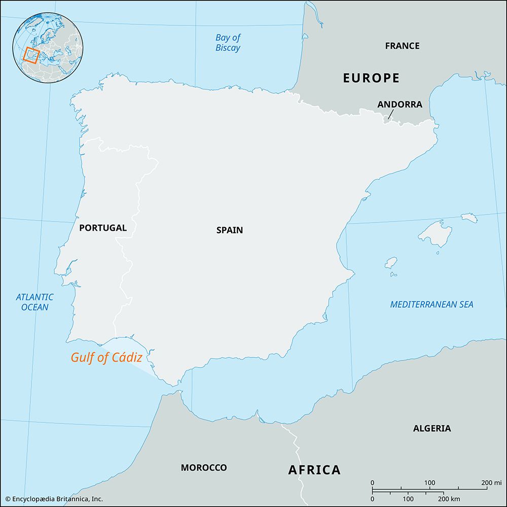
The Gulf of Cádiz is a wide embayment of the Atlantic Ocean located along the southwestern Iberian Peninsula. It stretches approximately 200 miles (320 km)…
What is Gulf of Cádiz?
The Gulf of Cádiz is a wide embayment of the Atlantic Ocean located along the southwestern Iberian Peninsula. It stretches approximately 200 miles (320 km) from Cape Saint Vincent in Portugal to Gibraltar.1
The coastline varies significantly along its length:
- Portuguese Coast: Characterized by bold headlands and high cliffs interspersed with bay beaches and river mouths.1
- Spanish Coast: Features extensive marshes behind coastal dunes, intersected by tidal channels from rivers such as the Guadiana and Guadalquivir) and Guadalquivir.1
- Southern Stretch: From Cape Trafalgar to Gibraltar, the landscape shifts between rocky coasts and beaches.1
The Bay of Cádiz, a smaller inlet within the gulf, serves as a significant commercial and industrial hub, hosting major ports and supporting industries ranging from salt production to oil and gas services.2
What role do the Guadalquivir and Guadiana rivers play in the region’s ecosystem?
The Guadalquivir and Guadiana rivers are vital to the ecosystem of the southwestern Iberian Peninsula, primarily by sustaining diverse habitats and supporting regional biodiversity as they flow toward the Gulf of Cádiz.345
The Guadalquivir River
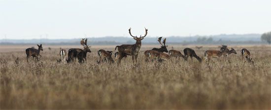
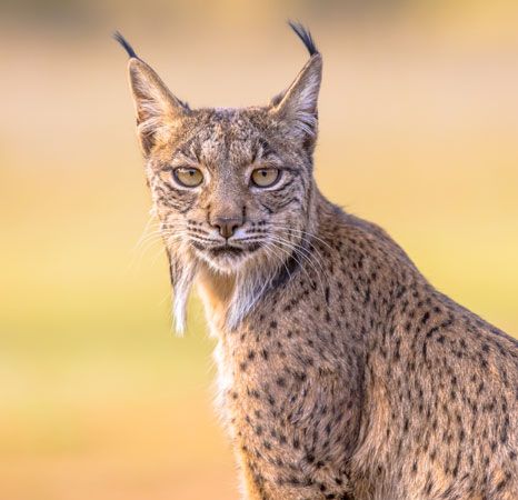
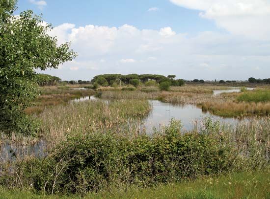
The Guadalquivir supports one of Europe’s richest natural environments, containing a vast array of plant and animal species. Its lower course traverses Las Marismas, Spain’s largest coastal marshland, which is a critical sanctuary for wildlife. This area, largely protected within the Coto Doñana National Park, serves as a vital winter home for migratory ducks and geese and provides a habitat for numerous bird species, as well as mammals like the southern European lynx, wild boar, and fallow deer.31
The Guadiana River
The Guadiana contributes to the region’s ecological health through its unique hydrological features. In its upper reaches, the river forms the “Ojos del Guadiana” (Eyes of the Guadiana), a series of marshy lakes that act as a significant wildfowl sanctuary. While the river’s flow is often irregular due to the arid climate of its basin, its presence—along with its tributaries—supports local flora and fauna, even as its waters are heavily utilized for irrigation and hydroelectric power.46
How does the Strait of Gibraltar connect the Gulf of Cádiz to the Mediterranean Sea?
The Strait of Gibraltar serves as the vital maritime link between the Gulf of Cádiz in the Atlantic Ocean and the Mediterranean Sea.71
This connection is defined by a significant, continuous exchange of water through the channel, which is essential for the hydrological balance of the Mediterranean. The interaction functions as follows:78
- Surface Flow: A surface current generally flows eastward from the Atlantic through the center of the strait into the Mediterranean.78
- Deep Outflow: Beneath this surface movement—specifically at depths greater than about 400 feet (120 meters)—a westward flow of heavier, colder, and more saline water exits the Mediterranean and moves into the Atlantic.78
This dual-layer exchange is critical; without the constant influx of Atlantic water and the outflow of dense, saline Mediterranean water, the Mediterranean Sea would effectively become a shrinking salt lake.7
What are the main differences between the Portuguese and Spanish coastlines in this area?
The coastline along the Gulf of Cádiz exhibits distinct geological and topographical characteristics as it transitions from the Portuguese Algarve into the Spanish territory.
Portuguese Coastline (Algarve)
At the Portuguese end of the gulf, the landscape is defined by:
- Bold Relief: The coast is characterized by high cliffs and prominent headlands.1
- Fragmentation: These elevated features are frequently interrupted by small bay beaches and the mouths of various rivers.1
- Settlement Patterns: The area is marked by numerous coastal settlements nestled within this rugged terrain.1
Spanish Coastline
Continuing southward into Spain, the coastal environment shifts significantly:
- Marshlands: The most recurrent feature is the presence of extensive marshes, which can extend inland for up to 30 miles (50 km).1
- Coastal Dunes: These marshes are typically situated behind coastal dunes.1
- River Channels: The landscape is frequently broken by tidal channels associated with major rivers, including the Guadiana, Guadalquivir, Tinto-Odiel, and Guadalete.1
- Industrial and Urban Features: This stretch is notable for numerous saltworks and specific urban centers, such as the city of Cádiz. Farther south, toward Gibraltar, the terrain transitions again, with rocky coasts alternating with sandy beaches.1
Sources
- Gulf of Cádiz — Encyclopædia Britannica
- Bay of Cádiz — Encyclopædia Britannica
- Guadalquivir River — Encyclopædia Britannica
- Las Marismas — Encyclopædia Britannica
- Guadiana River — Encyclopædia Britannica
- Spain - Drainage — Encyclopædia Britannica
- Strait of Gibraltar — Encyclopædia Britannica
- Atlantic Ocean - The North Atlantic — Encyclopædia Britannica
- Cádiz — Encyclopædia Britannica
- Portugal - Drainage — Encyclopædia Britannica
- Iberian Peninsula — Encyclopædia Britannica
- Portugal - South — Encyclopædia Britannica
Published on · 3 min read