Kyrgyz Ala Range
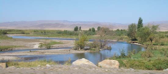
The Kyrgyz Ala Range (also known as the Kyrgyz Alatau) is a prominent mountain range located in Central Asia. It serves as a western spur of the Tien Shan…
What is Kyrgyz Ala Range?
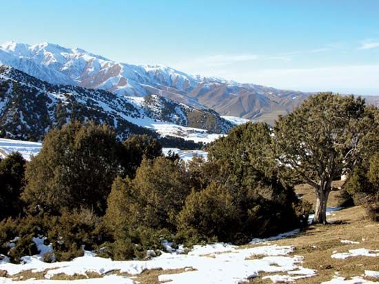
The Kyrgyz Ala Range (also known as the Kyrgyz Alatau) is a prominent mountain range located in Central Asia. It serves as a western spur of the Tien Shan mountain system and forms a significant portion of the border between Kazakhstan and Kyrgyzstan.12
Spanning approximately 230 miles (370 km), the range extends westward from the Chu River to the Talas River, near the city of Taraz, Kazakhstan1. Its highest point is West Alamedin Peak, which reaches an elevation of 15,994 feet (4,875 meters). Geographically, the range is part of the outer chain of the northern Tien Shan and is linked to the Ysyk-Köl region via the Chatkal Range. The steep slopes and high elevations of the range contribute to the formation of deep gorges and fan-shaped alluvial deposits, which support fertile lands and population centers, including the Kyrgyz capital, Bishkek.132
What is the Tien Shan mountain system?
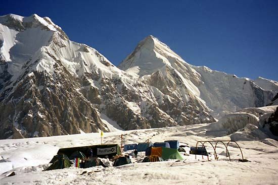
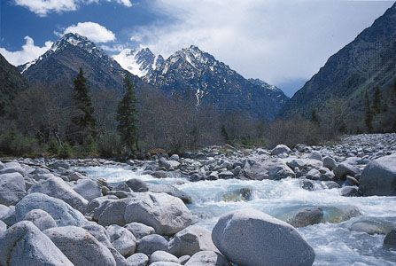
The Tien Shan, a name meaning “Celestial Mountains” in Chinese, is a vast mountain system in Central Asia spanning approximately 1,500 miles (2,500 km). It primarily straddles the border between China and Kyrgyzstan, covering an area of about 386,000 square miles (1,000,000 square km).4
Physical Features
The system is characterized by east-west trending mountain ranges, valleys, and basins. It features extreme elevation differences, ranging from the Turfan Depression—the lowest point in Central Asia—to high peaks like Victory Peak (24,406 feet) and Khan Tängiri Peak (22,949 feet). Geologically, the Tien Shan is a site of active block-faulting, where tectonic processes continue to elevate mountain blocks relative to adjacent valleys.345
Climate and Ecology
The region experiences a sharply continental climate with significant temperature extremes. Precipitation is highest on the western and northwestern slopes, while interior regions are much drier. This variation in elevation and moisture creates distinct ecological zones:6
- Foothills: Characterized by desert and semidesert vegetation.7
- Steppe: The most common landscape, occurring between 3,500 and 11,000 feet.7
- Forests: Found primarily on northern slopes, featuring deciduous trees like maple and aspen, as well as coniferous forests and ancient nut-bearing stands.7
- Alpine Zones: High-altitude meadows and “cold deserts” transition into glacial zones at the highest elevations.7
How do mountain ranges influence the climate of Kyrgyzstan?
Mountain ranges are the primary drivers of Kyrgyzstan’s climate, creating a striking contrast between the arid surrounding plains and the diverse, mountainous interior. Their influence is exerted through several key mechanisms:8
- Barrier Effect and Precipitation: The mountains act as significant barriers to moisture-laden winds. Westward- and northward-facing slopes receive substantially more precipitation as they force air upward, with some ranges like the Kyrgyz and Fergana ranges receiving 30 to 40 inches (760 to 1,000 mm) annually. Conversely, leeward slopes and interior basins often lie in a rain shadow, resulting in much drier conditions.839
- Elevation-Based Zoning: Climate varies dramatically with altitude. While lower foothills and valleys experience hot, dry summers and desert-like conditions, higher elevations transition into cooler, wetter zones. This vertical layering creates distinct microclimates across short distances.89
- Temperature Extremes: The country’s distance from oceans, combined with the massive relief of the Tien Shan, leads to sharp temperature fluctuations. Valleys can experience intense heat in summer and severe cold in winter, while high-altitude peaks remain glaciated.82
- Wind Patterns: Mountains influence local wind climates by funneling air through valleys and generating mountain-valley wind circulations. Additionally, the foehn effect can cause warm, dry, and erratic winds to descend into leeward areas.93
What are some other major mountain ranges in Central Asia?
Central Asia is home to several massive mountain systems, often referred to as “High Asia” or “Alpine Asia,” which were formed through complex tectonic processes and extensive uplift. Beyond the Tien Shan, other major ranges include:
- Pamirs: Located primarily in Tajikistan, this system is a high-altitude knot of ranges known for its extreme relief, deep gorges, and massive glaciers, such as the Fedchenko Glacier. It contains some of the highest peaks in the region, including Imeni Ismail Samani Peak.1213
- Karakoram Range: Extending from the Pamirs and Tibet into Pakistan, this range was uplifted during the late Cenozoic. It is one of the most glaciated regions outside the polar areas and is closely linked geologically to the Hindu Kush.ologically to the Hindu Kush.1214
- Kunlun Mountains: Stretching 1,250 miles across southern Central Asia, these mountains form a massive rampart between the Plateau of Tibet and the Takla Makan Desert. Its highest point is Mount Muztag.1516
- Altai Mountains: A complex system extending through China, Mongolia, Russia, and Kazakhstan. Unlike the alpine ranges further south, these mountains are characterized by ancient faulted and folded blocks that have undergone renewed uplift.1217
- Kopet-Dag Range: Running along the border of Turkmenistan and Iran, this range features a Mediterranean climate and supports distinct ecological zones ranging from desert vegetation to juniper forests.18
Sources
- Kyrgyz Ala Range — Encyclopædia Britannica
- Kyrgyzstan - Relief — Encyclopædia Britannica
- Tien Shan - Physiography — Encyclopædia Britannica
- Tien Shan — Encyclopædia Britannica
- mountain - Geomorphic characteristics — Encyclopædia Britannica
- Tien Shan - Climate — Encyclopædia Britannica
- Tien Shan - Plant life — Encyclopædia Britannica
- Kyrgyzstan - Climate — Encyclopædia Britannica
- Tien Shan - Glaciation — Encyclopædia Britannica
- Asia - The influence of topography — Encyclopædia Britannica
- Highland climate — Encyclopædia Britannica
- Asia - Central Asia and South Siberia — Encyclopædia Britannica
- Altai Mountains — Encyclopædia Britannica
- Pamirs - Physiography — Encyclopædia Britannica
- Hindu Kush - Geology of the Hindu Kush — Encyclopædia Britannica
- Kopet-Dag Range — Encyclopædia Britannica
- Kunlun Mountains — Encyclopædia Britannica
- Kunlun Mountains - Physiography — Encyclopædia Britannica
Published on · 4 min read