Mu River
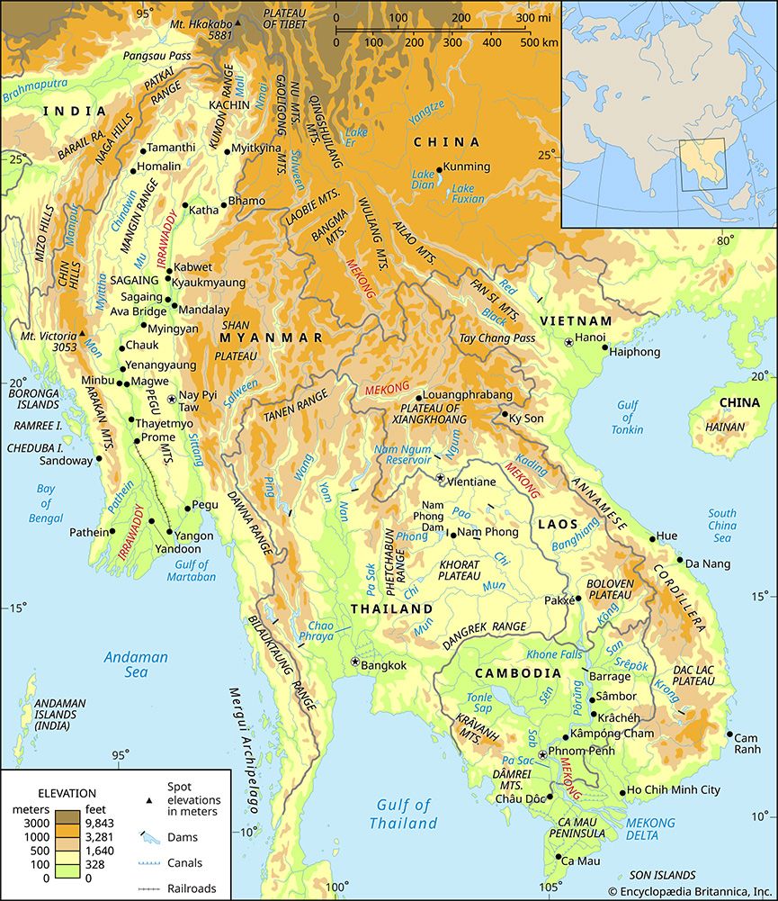
The Mu River is a waterway located in north-central Myanmar (Burma). Stretching approximately 170 miles (275 km) in length, it flows in a southward direction…
What is Mu River?
The Mu River is a waterway located in north-central Myanmar (Burma). Stretching approximately 170 miles (275 km) in length, it flows in a southward direction until it reaches the Irrawaddy River west of Sagaing.1
The river has played a vital role in regional agriculture since the 9th century, serving as a primary source for irrigation within the country’s Dry Zone. Today, the Mu Valley Irrigation Project stands as one of the largest irrigation initiatives in Myanmar.1
What is the significance of the Irrawaddy River?
The Irrawaddy River is the principal waterway of Myanmar, serving as the nation’s historical, cultural, and economic heartland. Stretching approximately 1,350 miles (2,170 km), it flows entirely within the country’s borders.2
Economic Significance
The river is Myanmar’s most important commercial artery, facilitating the transport of passengers and goods. It supports a vast network of navigation, with over 800 miles of the main river and 2,000 miles of the delta waterways serving as vital transit routes. Key commodities transported include:23
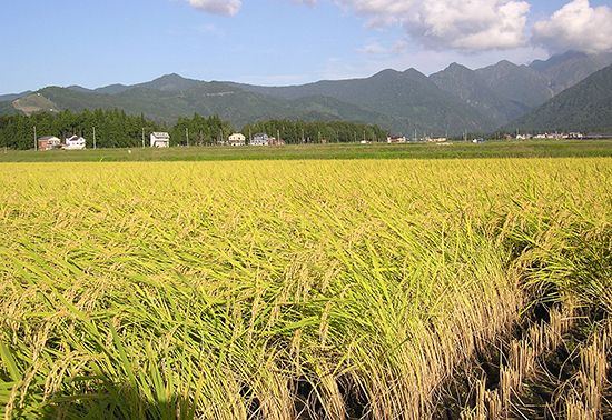
- Rice: The delta is one of the world’s major rice-growing regions.3
- Teak: Myanmar is the world’s leading exporter of teak, which is floated downstream in large rafts.3
- Petroleum and other goods: The river connects oil-field districts like Chauk to major urban centers.3
Agricultural and Cultural Impact
The river’s basin supports a diverse population, including the Kachin, Burmese, and Karen peoples. Its fertile alluvium and irrigation capabilities—supplemented by tributaries like the Mu River—are essential for cultivating crops such as wheat, cotton, and rice, particularly in the central dry zone and the delta.45
How does the Dry Zone affect agriculture in Myanmar?
The Dry Zone of central Myanmar is a distinct agricultural region characterized by its location in the rain shadow of the Rakhine Mountains, which limits annual precipitation to between 20 and 40 inches (500 to 1,000 mm). Because of this limited and irregular rainfall, irrigation is essential for successful cultivation in the area.78
Agricultural Practices and Crops
Most of Myanmar’s irrigated land is located within the Dry Zone, and the majority of this area is dedicated to rice production, and the majority of this area is dedicated to rice production. However, the region also supports a wide variety of other crops, including:7
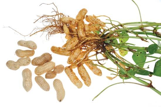
- Legumes and oilseeds: Peanuts, sesame, and various legumes7.5
- Other staples: Corn, sugarcane, onions, cotton, and millet.85
In non-irrigated portions of the Dry Zone, farmers prioritize crops that are less sensitive to the seasonality or irregularity of rainfall.8
Infrastructure and Soil
The region relies on both ancient and modern water management systems. Irrigation works have been utilized in the area since the 9th century, with the Mu River serving as a critical water source for the modern Mu Valley Irrigation Project Mu Valley Irrigation Project. The soils in this central belt are typically red-brown and rich in calcium and magnesium, though they can become saline in areas with low clay content due to high evaporation rates.519
What are the major irrigation projects in Southeast Asia?
In Southeast Asia, irrigation development has been significantly shaped by the management of major river basins, though progress has often been influenced by regional political complexities.
The Mekong River Basin
The most prominent collaborative efforts in the region have occurred within the Mekong River basin. Since 1957, the Mekong Committee—comprising countries such as Cambodia, Laos, Thailand, and Vietnam—has coordinated scientific investigations and infrastructure construction to improve water management. Key projects include:
- Nam Phong: A multipurpose dam located in northeastern Thailand.10
- Nam Ngum: A hydroelectric dam situated in Laos.10
These initiatives focus on flood control and water storage, which allow farmers to move beyond single-crop cycles by enabling second or third harvests during the dry season.10
Regional Challenges and Approaches
While irrigation is vital for managing the monsoonal variations in rainfall common across Southeast Asia, development has faced hurdles:
- Political Constraints: Regional political difficulties have historically stalled large-scale integrated projects along the Mekong.11
- Technological Shifts: Beyond large dams, agricultural productivity has been bolstered by the adoption of high-yielding cereal strains developed in partnership with organizations like the International Rice Research Institute (IRRI) in the Philippines. These advancements rely heavily on access to reliable water supplies.12
- Historical Context: Ancient practices, such as the land drainage channels found at the Kuk Swamp site in New Guinea, demonstrate that water management has been a foundational element of agriculture in the region for thousands of years.13
Sources
- Mu River — Encyclopædia Britannica
- Irrawaddy River — Encyclopædia Britannica
- Irrawaddy River - Physiography — Encyclopædia Britannica
- Irrawaddy River - Navigation — Encyclopædia Britannica
- Irrawaddy River - Irrigation — Encyclopædia Britannica
- Irrawaddy River - People of the Irrawaddy River — Encyclopædia Britannica
- Myanmar - Agriculture, forestry, and fishing — Encyclopædia Britannica
- Myanmar - Drainage and soils — Encyclopædia Britannica
- Myanmar - Climate of Myanmar — Encyclopædia Britannica
- Mekong River - Irrigation and flood control — Encyclopædia Britannica
- Asia - Water resources — Encyclopædia Britannica
- Asia - Agricultural technology — Encyclopædia Britannica
- Mekong River - Study and exploration — Encyclopædia Britannica
- Origins of agriculture - Irrigation — Encyclopædia Britannica
- Origins of agriculture - Southeast Asia — Encyclopædia Britannica
Published on · 3 min read