Central Siberian Plateau
The Central Siberian Plateau is a vast, elevated region in north-central Siberia, Russia, covering approximately 600,000 square miles (1,500,000 square km).…
What is Central Siberian Plateau?
The Central Siberian Plateau is a vast, elevated region in north-central Siberia, Russia, covering approximately 600,000 square miles (1,500,000 square km). It is situated across the Krasnoyarsk region, the Sakha Republic, and the Irkutsk province.1
Geographically, the plateau is bounded by the Yenisey River to the west and the Lena River to the east. Its southern border is defined by the Vostochny Sayan and the Baikal region, while it descends to the North Siberian Lowland in the north. While the average elevation ranges from 1,000 to 2,300 feet (300 to 700 metres), the region features higher tablelands, such as the Putoran Mountains, which reach 5,581 feet (1,701 metres).12
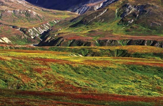
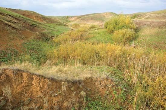
The plateau is underlain by the stable Siberian Platform, though its surface is covered by marine deposits and newer rock series. Its vegetation transitions from tundra in the north to steppe-grasslands in the south.1
What is the difference between tundra and taiga vegetation?
The primary difference between taiga and tundra lies in their vegetation structure and climate adaptation.
Taiga (Boreal Forest)
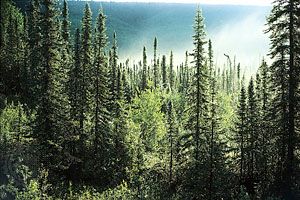
- Vegetation: The taiga is a forested biome dominated by cone-bearing, needle-leaved evergreen trees, such as pine, spruce, larch, and fir.4
- Characteristics: It forms a circumpolar belt across the Northern Hemisphere. The landscape is defined by closed-canopy forests, though it transitions into sparse lichen woodland and forest-tundra at its northern limits.45
Tundra
- Vegetation: The tundra is a treeless region characterized by low-growing vegetation, including mosses, lichens, herbs, and small shrubs like willows6.6
- Characteristics: Found north of the Arctic Circle or above the timberline on mountains, the tundra is shaped by a freeze-thaw cycle and often features permafrost.6
While the taiga represents the northernmost extent of forest growth, the tundra begins where the climate becomes too harsh for trees to survive.46
How does permafrost affect the landscape of Siberia?
Permafrost significantly shapes the landscape of Siberia, where it can reach depths exceeding 2,000 feet—the deepest known in the world. Its influence on the terrain is primarily driven by the presence of ground ice within fine-grained sediments, which creates distinct geomorphic features when it thaws.89
Surface Manifestations
The melting of ground ice leads to thermokarst topography, an uneven, hummocky landscape characterized by mounds, sinkholes, tunnels, and steep-walled ravines. As ice-rich silts thaw, they lose their structural strength and change in volume, often resulting in the formation of thaw lakes and ponds in the resulting depressions. Other common features include:101198
- Polygonal ground: A network of cracks and mounds formed by the melting of ice wedges.109
- Pingos: Hilly structures created when water in the soil freezes into ice lenses.12
- Solifluction: The slow, downward flow of waterlogged soil over the impermeable permafrost layer, which can create terraces and lobes on slopes.1012
Environmental and Structural Impact
Permafrost acts as an impermeable barrier that prevents water drainage, often turning lowlands into boggy, saturated terrain during the summer. Furthermore, thawing permafrost can trigger a positive feedback loop by releasing trapped methane, a potent greenhouse gas, which further accelerates warming and degradation. These shifts pose significant challenges for infrastructure, as the ground’s instability requires constant maintenance for roads, railroads, and buildings to prevent subsidence and structural failure.1213814
What are some of the major rivers that define the borders of the plateau?
The Central Siberian Plateau is primarily defined by two major river systems that serve as its western and eastern boundaries:
Sources
- Central Siberian Plateau — Encyclopædia Britannica
- Asia - North and Central Asia — Encyclopædia Britannica
- Russia - The Central Siberian Plateau — Encyclopædia Britannica
- Taiga — Encyclopædia Britannica
- Taiga - Distribution — Encyclopædia Britannica
- Tundra - Plant life — Encyclopædia Britannica
- Tundra — Encyclopædia Britannica
- permafrost - Surface manifestations of permafrost and seasonally frozen ground — Encyclopædia Britannica
- Arctic - Terrain of the Arctic — Encyclopædia Britannica
- thermokarst — Encyclopædia Britannica
- permafrost - Agriculture — Encyclopædia Britannica
- permafrost - Highways and railroads — Encyclopædia Britannica
- Tundra - Soils — Encyclopædia Britannica
- permafrost - Climatic change — Encyclopædia Britannica
- permafrost - Thermokarst formations — Encyclopædia Britannica
Published on · 3 min read