Noric Alps
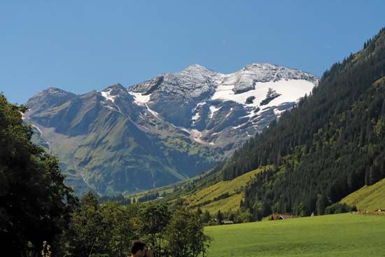
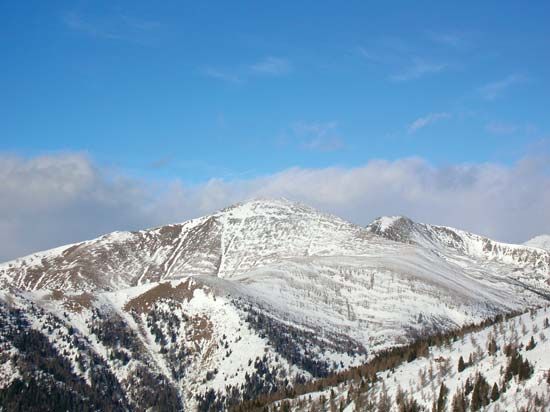
The Noric Alps are a segment of the Eastern Alps located in southern Austria. This mountain range stretches between the Hohe Tauern range and Katschberg Pass…
What is Noric Alps?
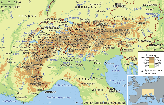
The Noric Alps are a segment of the Eastern Alps located in southern Austria. This mountain range stretches between the Hohe Tauern range and Katschberg Pass to the west and the city of Graz to the east.1
Geographically, the range is bounded by the Drava River to the south and the upper Mur River to the north. The mountains, which include several subranges such as the Gurkthaler Alpen in the west, reach their highest elevation at Eisenhut, standing at 8,008 feet (2,441 meters). Today, the region is known for hosting various summer resorts and skiing centers.1
What are the main subranges that make up the Eastern Alps?
The Eastern Alps are a diverse segment of the Alps characterized by a generally northerly and southeasterly drainage pattern. They are composed of several distinct mountain ranges, including:
- Rhaetian Alps: Located in Switzerland.3
- Dolomite Alps: Situated in Italy.3
- Bavarian Alps: Spanning the border of southern Germany and western Austria.3
- Tauern Mountains: Located in Austria, this group includes the Niedere Tauern (divided into the Radstädter, Schladminger, and Rottenmanner Tauern) and the Hohe Tauern.34
- Julian Alps: Found in northeastern Italy and northern Slovenia.3
- Dinaric Alps: Extending along the western edge of the Balkan Peninsula.3
- Carnic Alps: A range extending along the Austrian-Italian border.5
How do glaciers shape mountain landscapes over time?
Glaciers are powerful agents of landscape transformation that reshape mountains through the dual processes of erosion and deposition.7
Erosional Processes
Glaciers erode the landscape primarily through two mechanisms: abrasion, where rock debris embedded in the ice grinds against the ground, and plucking (or quarrying), where the ice removes large blocks of rock from the glacier bed.27
As glaciers move through existing V-shaped river valleys, they drastically reshape them into characteristic U-shaped valleys with wide, flat bottoms and steep sidewalls. High in the mountains, glaciers carve out cirques—amphitheatre-shaped hollows that often contain lakes called tarns. When multiple cirques erode a mountain from different sides, they leave behind sharp, jagged ridges known as arêtes and pointed peaks called horns, such as the Matterhorn.28
Depositional Processes
As glaciers melt, they deposit the rock debris they have transported, forming landforms called moraines. These include:9
- Lateral moraines: Ridges formed along the sides of the glacier.9
- Terminal moraines: Large ridges marking the glacier’s furthest extent.9
- Recessional moraines: Smaller ridges formed during temporary standstills as the glacier retreats.9
What is the significance of the Drava and Mur rivers in the region?
The Drava River and the Mur River (or Mura) are vital components of the fluvial network in south-central Europe, serving as major tributaries that ultimately discharge into the Danube River.101112
Regional Significance
- Hydroelectric Power: The Drava’s swift course has been extensively harnessed for hydroelectric power generation across Austria, Slovenia, and Croatia. Similarly, the steep topography of the region contributes to significant water and hydroelectric resources.1011
- Historical and Geographic Conduit: The Drava valley historically served as a primary passage for migrations and invasions from the east, including the Huns and Slavs, into Alpine countries. Today, the rivers define significant political borders, with the Drava forming much of the boundary between Croatia and Hungary.103
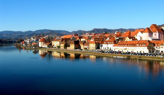
- Urban Development: The rivers support major regional centers, including Klagenfurt and Graz in Austria, Maribor and Ptuj in Slovenia, and Osijek and Varaždin in Croatia.10
The two rivers converge near Legrad, Croatia, uniting their flows before reaching the Danube.1011
Sources
- Noric Alps — Encyclopædia Britannica
- Alps - Geology — Encyclopædia Britannica
- Alps - Physiography — Encyclopædia Britannica
- Carnic Alps — Encyclopædia Britannica
- Bavarian Alps — Encyclopædia Britannica
- Niedere Tauern — Encyclopædia Britannica
- glacial landform - Cirques , tarns, U-shaped valleys, arêtes, and horns — Encyclopædia Britannica
- glacial landform - Moraines — Encyclopædia Britannica
- erosion — Encyclopædia Britannica
- Drava River — Encyclopædia Britannica
- Slovenia - Drainage — Encyclopædia Britannica
- Mur — Merriam-Webster
- Croatia - Drainage — Encyclopædia Britannica
Published on · 3 min read