Phetchabun Range
The Phetchabun Range is a mountain range located in north-central Thailand. It serves as a heavily forested southern extension of the Luang Prabang Range and…
What is Phetchabun Range?
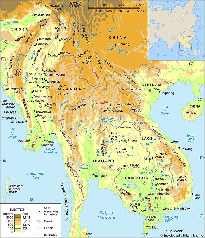
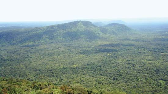
The Phetchabun Range is a mountain range located in north-central Thailand. It serves as a heavily forested southern extension of the Luang Prabang Range and runs in a north-south direction.1
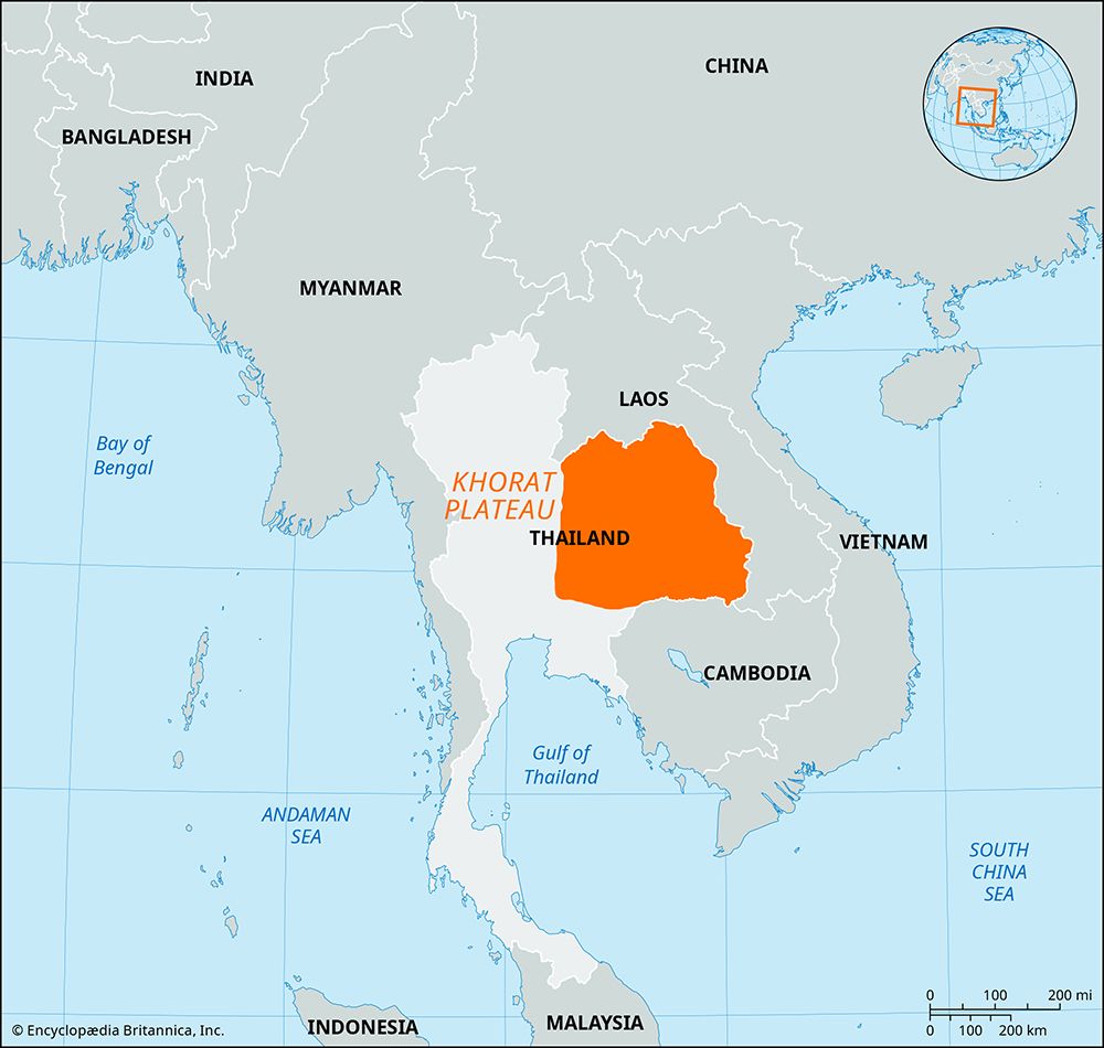
The range is significant for forming the western rim of the Khorat Plateau, a large, saucer-shaped tableland in northeastern Thailand. The mountains rise to an elevation of 5,840 feet (1,780 metres). Along with the Phang Hoei Range, the Phetchabun mountains act as a natural boundary for the plateau, which is otherwise drained by the Chi and Mun rivers.12
What is the Khorat Plateau?
The Khorat Plateau is a vast, saucer-shaped tableland covering approximately 60,000 square miles (155,000 square km) in northeastern Thailand. Situated between 300 and 650 feet (90–200 meters) above sea level, the region tilts southeastward, with its terrain characterized by rolling hills, small lakes, and impermeable soils that experience seasonal flooding and drought.23
The plateau is defined by distinct geographical boundaries:
- North and East: The Mekong River, which forms the border with Laos.23
- West: The Phetchabun and Phang Hoei ranges.2
- South: The Phanom Dong Rak Range.23
Formed by crustal faulting and tilting, the plateau serves as an agricultural hub where inhabitants cultivate rice, cotton, corn, peanuts, and hemp, alongside livestock farming. Major urban centers, including Nakhon Ratchasima and Khon Kaen, are connected to Bangkok by rail.23
How do mountain ranges influence local climates?
Mountain ranges significantly influence local climates by acting as physical barriers to atmospheric flow and altering temperature and precipitation patterns.
Precipitation and the Rain Shadow Effect
As moist air encounters a mountain range, it is forced upward, cooling as it rises. This process often triggers orographic precipitation, resulting in heavy rain or snow on the windward slopes. Conversely, as the air descends on the leeward side, it is compressed and warmed, leading to drier conditions. This phenomenon, known as a rain shadow, creates semiarid or desert-like environments downwind of the range.45678
Temperature and Atmospheric Flow
Mountains also affect temperature and wind:
- Altitude: Temperature, pressure, and humidity generally decrease with increasing elevation, creating distinct highland climates that differ from nearby lowlands.4
- Barrier Effects: North-south ranges can block cold air from continental interiors, leading to milder coastal climates.7
- Wind Patterns: Valleys can “funnel” winds, increasing their speed, while mountain slopes influence local solar radiation receipt and generate mesoscale wind circulations.4
What are the major rivers in Thailand?
Thailand is primarily drained by two major river systems: the Chao Phraya in the west and the Mekong in the east.9
The Chao Phraya System
The Chao Phraya is the principal river of Thailand, flowing south through the central plains to the Gulf of Thailand. Its headwaters originate in the northern mountains and consist of four major rivers:109
- Ping River (and its tributary, the Wang)
- Yom River
- Nan River
These rivers merge at Nakhon Sawan to form the main stream, which is later joined by the Pa Sak River before reaching its delta.109
The Mekong and Khorat Plateau
The Mekong River forms much of the border between Thailand and Laos. The eastern region of Thailand, specifically the Khorat Plateau, is drained by rivers that flow southeast into the Mekong. The most significant of these is the Mun River, which receives the Chi River as its main tributary.91112
Sources
- Phetchabun Range — Encyclopædia Britannica
- Khorat Plateau — Encyclopædia Britannica
- Thailand - Relief — Encyclopædia Britannica
- Highland climate — Encyclopædia Britannica
- India - The southwest monsoon — Encyclopædia Britannica
- Atmosphere - Mountain barriers — Encyclopædia Britannica
- Microclimate — Encyclopædia Britannica
- Orographic precipitation — Encyclopædia Britannica
- Chao Phraya River — Encyclopædia Britannica
- Thailand - Drainage of Thailand — Encyclopædia Britannica
- Mekong River - Irrigation and flood control — Encyclopædia Britannica
- Southeast Asia - Drainage of Southeast Asia — Encyclopædia Britannica
- Mun River — Encyclopædia Britannica
Published on · 3 min read