Rhine Falls
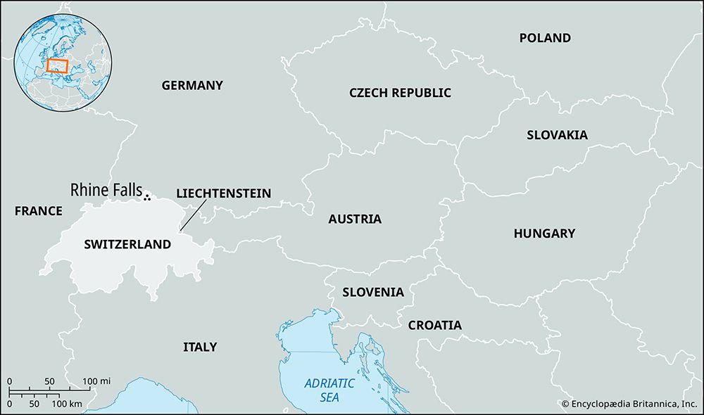
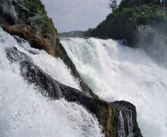
Rhine Falls is the most spectacular waterfall in central Europe, located on the upper Rhine River just below Schaffhausen in northern Switzerland.
What is Rhine Falls?
Rhine Falls is the most spectacular waterfall in central Europe, located on the upper Rhine River just below Schaffhausen in northern Switzerland.1
The cataract features a total drop of approximately 100 feet (30 meters), including its rapids, and spans a width of 492 feet (150 meters). A prominent, pillarlike rock formation divides the waterfall into two main sections: the right bank, which drops about 50 feet (15 meters), and the left bank, which drops 65 feet (20 meters). While the Rhine River generally defines the frontier between Switzerland and Germany, the area around the falls is unique because the border deviates, placing the entirety of the waterfall within Swiss territory.12
How does the Rhine River contribute to European trade and transportation?
The Rhine River serves as one of the world’s most vital industrial transport arteries, facilitating the movement of goods across western Europe for centuries. Its role in trade is defined by several key factors:2
Historical and Economic Significance
Historically, the Rhine was a crucial trade route because it offered a more efficient alternative to poor-quality roads. Its modern importance as a commercial artery is largely due to the removal of political restrictions—such as the 1815 Congress of Vienna agreement—and significant physical improvements to the navigation channel. The river’s ability to provide cheap water transport for raw materials was a primary driver for the industrialization of the Rhineland, and today, approximately one-fifth of the world’s chemical industries are located along its banks.342
Infrastructure and Connectivity
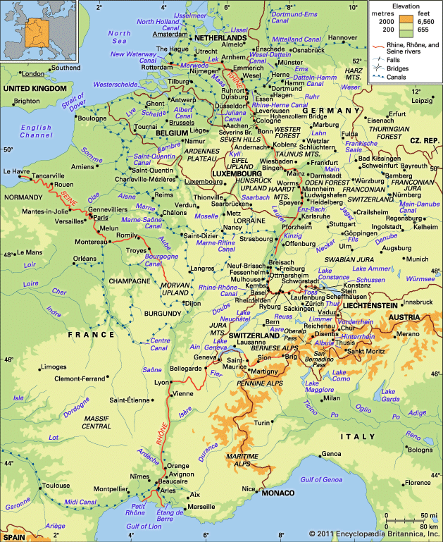
- Navigation: The river is navigable for about 540 miles (870 km), reaching as far as Basel.2
- Integration: The Rhine is integrated into a broader European network through its tributaries, such as the Main, Moselle, and Neckar, and via major canals like the Main-Danube Canal, which connects the Rhine to the Black Sea.56
- Ports: Key industrial hubs like Duisburg handle massive volumes of coal, coke, iron ore, and oil, while Rotterdam serves as a primary gateway to the North Sea via the New Waterway Canal.7
What are some other famous waterfalls located in the Swiss Alps?
The Swiss Alps are home to several iconic waterfalls, many of which were shaped by the region’s history of glaciation. Two of the most notable examples include:
- Trümmelbach Falls: Located in the Bernese Alps, these falls consist of five distinct cascades fed by melting snow. The system is unique for its accessibility via an electric elevator and paths, with a total drop of 1,300 feet (400 meters).
- Staubbach Falls: Also situated in the Bernese Alps near Lauterbrunnen, this waterfall is famous for its veil-like appearance. Its name translates to “spray stream,” reflecting how the water flow can virtually disappear during drier seasons. It features a drop of 984 feet (300 meters).
These waterfalls are classic examples of features that pour from hanging valleys high above the main valley floors, a landscape characteristic formed as glaciers carved and modeled the region over millions of years.8
How do glaciers and mountain geography shape the formation of waterfalls?
Glaciers and mountain geography are primary drivers in the creation of waterfalls, as they fundamentally alter the landscape and disrupt the natural, smooth flow of rivers.1112
Glacial Influence on Waterfall Formation
Glaciation reshapes terrain through powerful erosive processes that leave behind distinct features conducive to waterfall development:
- Hanging Valleys: As large trunk glaciers erode main valleys more deeply than smaller tributary glaciers, the tributary valleys are left “hanging” high above the main valley floor. Once the ice retreats, streams from these elevated valleys must drop vertically to join the main drainage system, creating dramatic waterfalls like those found in Yosemite National Park and the Bernese Alps11.1310
- Glacial Stairways: The passage of ice over bedrock with varying resistance creates a series of giant steps, or a “glacial stairway.” When runoff is established after the ice melts, a series of cascades or waterfalls forms at each riser.11
- Cirques and Basins: Glaciers carve amphitheatre-shaped hollows known as cirques in mountain headwaters. The over-deepened basins within these areas can lead to waterfalls where water spills over the edges of these depressions.1411
- Ice Dams: During glacial periods, ice can block rivers, forming lakes. When these dams breach, they can release massive outburst floods that carve deep canyons and create temporary or permanent waterfalls, such as the now-dry Dry Falls in Washington.15
Mountain Geography and Tectonic Activity
Mountainous regions naturally promote waterfall formation due to steep gradients and tectonic processes:
- Tectonic Uplift: Mountain building creates fault scarps—steep cliffs formed by the shifting of the Earth’s crust. When rivers cross these fault lines, the sudden change in elevation results in waterfalls.11
- Differential Erosion: Mountains often contain layers of rock with varying resistance to erosion. When a river flows from a hard, resistant rock layer to a softer one, it erodes the softer material more rapidly, steepening the riverbed and creating a waterfall.1612
Sources
- Rhine Falls — Encyclopædia Britannica
- Rhine River - Physiography — Encyclopædia Britannica
- Rhine River - The economy — Encyclopædia Britannica
- Rhine River — Encyclopædia Britannica
- canals and inland waterways - Major inland waterways of Europe — Encyclopædia Britannica
- Rhine River - Traffic — Encyclopædia Britannica
- Germany - Waterways — Encyclopædia Britannica
- Trümmelbach Falls — Encyclopædia Britannica
- Staubbach Falls — Encyclopædia Britannica
- Alps - Geology — Encyclopædia Britannica
- river - Falls attributable to discordance of river profile — Encyclopædia Britannica
- glacial landform - Hanging valleys — Encyclopædia Britannica
- glacial landform - Cirques , tarns, U-shaped valleys, arêtes, and horns — Encyclopædia Britannica
- glacier - Glacier hydrology — Encyclopædia Britannica
- river - Falls attributable to constructional processes — Encyclopædia Britannica
- river - Falls attributable to differential erosion — Encyclopædia Britannica
- waterfall — Encyclopædia Britannica
Published on · 4 min read