Santa Ana Volcano
The Santa Ana Volcano, also known as Ilamatepec, is the highest volcanic peak in El Salvador, rising to 7,749 feet (2,362 meters) above sea level. Located in…
What is Santa Ana Volcano?
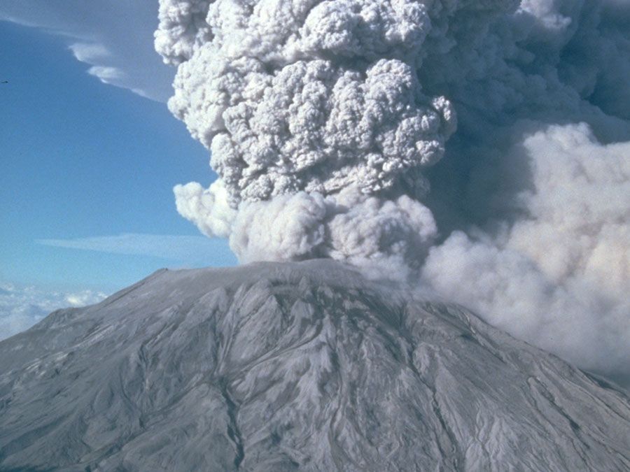
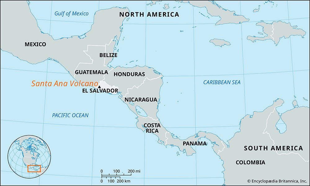
The Santa Ana Volcano, also known as Ilamatepec, is the highest volcanic peak in El Salvador, rising to 7,749 feet (2,362 meters) above sea level. Located in the southwestern part of the country, it features a small sulfurous lake within its crater.1
The volcano has been active since the 16th century, with its most recent eruption occurring in 2005, which was its first in over 100 years. Geographically, the city of Santa Ana is situated at the foot of its northeastern slope, while Lake Coatepeque, a popular recreational site, lies at its eastern base. It is distinct from the nearby Izalco Volcano, which is located on its southern slope and is known for being one of the most active volcanoes in Central America.12
What is the significance of the Izalco Volcano being called the Lighthouse of the Pacific?
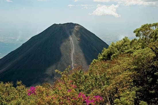
The Izalco Volcano earned the nickname “Lighthouse of the Pacific” due to its near-constant eruptive activity during the 19th century. Because the volcano emitted a continuous glow from its summit, sailors navigating the Pacific Ocean used the light as a reliable navigational beacon to set their course.2
Formed over a period of 200 years, this symmetrical, vegetation-free cone is the most active volcano in Central America, having erupted more than 50 times since 1770. Its persistent activity during that era made it a prominent and functional landmark for maritime travel along the coast of El Salvador.2
How do volcanic crater lakes like the one at Santa Ana form?
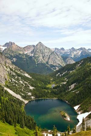
Volcanic crater lakes form when water accumulates in depressions created by volcanic activity. These basins can originate through several distinct geological processes:
- Crater Formation: Lakes may occupy the actual volcanic craters left behind after an eruption. While rare in completely unmodified cinder cones, they frequently form in craters caused by explosive activity or the collapse of underground magma chambers.5
- Caldera Collapse: Large, bowl-shaped depressions known as calderas are a primary source for these lakes. They form when a volcanic cone collapses after its underlying magma reservoir is rapidly emptied during voluminous eruptions. Once the volcanic activity ceases, the resulting immense hole can fill with water, as seen at Crater Lake.56
- Maars: These are broad, low-relief volcanic craters created by explosions that occur when magma interacts with groundwater. These depressions are often built of nonvolcanic material and can subsequently fill with water to form a lake.5
What are the different types of volcanoes found in Central America?
Central America is home to a variety of volcanic landforms, primarily shaped by the subduction of the Pacific Ocean floor beneath the Caribbean Plate at the Middle America Trench13. The region features approximately 40 major volcanic cones, many of which are prominent mountains rising from the plateau highlands.9
The primary types of volcanoes found in the region include:
- Stratovolcanoes (Composite Volcanoes): These are the most common large-scale volcanic structures in Central America. They are steep-sided cones built by alternating layers of lava flows and pyroclastic material. Examples include Mount Momotombo in Nicaragua and Fuego in Guatemala, which are known for their frequent and sometimes violent activity.10
- Pyroclastic Cones (Cinder Cones): These are smaller, steep-sided landforms composed of loose volcanic fragments like cinders or scoria. Cerro Negro in Nicaragua is a notable example of this type.11
- Maars and Tuff Structures: The region also contains low-relief volcanic features such as maars—craters formed by the explosive interaction of magma and groundwater—which are often filled with water to form crater lakes.11
These volcanoes are a direct result of the intense tectonic pressure where tectonic plates meet, a process that also makes the region highly susceptible to earthquakes.12
Sources
- Santa Ana Volcano — Encyclopædia Britannica
- Izalco Volcano — Encyclopædia Britannica
- Santa Ana — Encyclopædia Britannica
- Izalco — Merriam-Webster
- lake - Basins formed by tectonism , volcanism, and landslides — Encyclopædia Britannica
- volcano - Gas clouds — Encyclopædia Britannica
- caldera — Encyclopædia Britannica
- volcano - Major types — Encyclopædia Britannica
- Central America: Top Questions — Encyclopædia Britannica
- world’s major volcanoes — Encyclopædia Britannica
- North America - 120 to 30 million years ago — Encyclopædia Britannica
- Central America - Geography and climate — Encyclopædia Britannica
- North America - Mesozoic and Cenozoic orogenic belts — Encyclopædia Britannica
- volcano - Stratovolcanoes — Encyclopædia Britannica
- volcano - Pyroclastic cones — Encyclopædia Britannica
Published on · 3 min read