Scarborough Shoal
Scarborough Shoal is a disputed atoll located in the South China Sea, approximately 220 km west of the Philippine island of Luzon. It consists of a 46-km…
What is Scarborough Shoal?
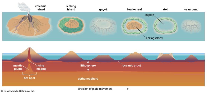
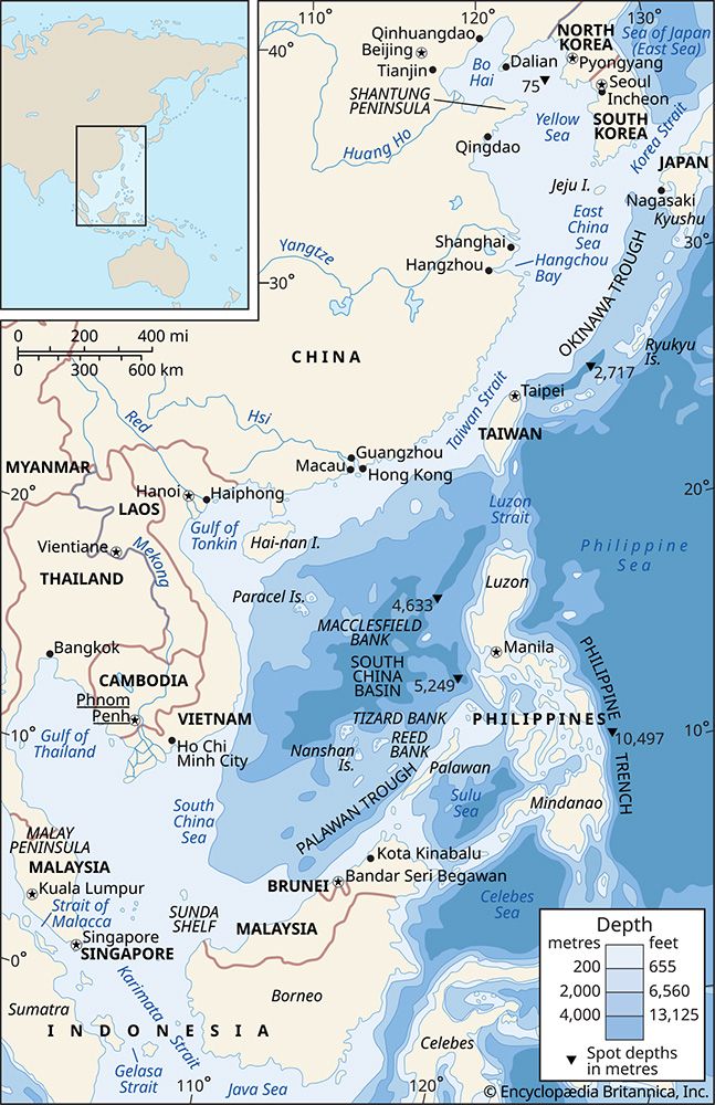
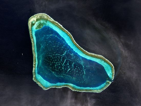
Scarborough Shoal is a disputed atoll located in the South China Sea, approximately 220 km west of the Philippine island of Luzon. It consists of a 46-km circumference featuring a shallow lagoon and several rocks, most notably South Rock, which remain above water at high tide.1
The atoll is the subject of a significant territorial dispute between China and the Philippines. The Philippines asserts that the shoal lies within its exclusive economic zone, a claim supported by a 2016 ruling from the Permanent Court of Arbitration. Conversely, China claims the territory based on historical surveys and its 9-dash line maritime boundary.21
Beyond its sovereignty issues, the shoal is vital due to its rich marine ecosystem and geopolitical location near key sea routes geopolitical location near key sea routes. Since 2012, China has maintained a constant presence in the area, leading to recurring naval and diplomatic tensions.12
What is an exclusive economic zone under international law?
An exclusive economic zone (EEZ) is a maritime area defined by the 1982 United Nations Convention on the Law of the Sea (UNCLOS) that extends up to 200 nautical miles (370 km) from a coastal state’s baseline. Within this zone, the coastal state holds sovereign rights to explore, exploit, conserve, and manage natural resources, including fisheries, energy production from water and wind, and the construction of artificial islands or research installations.345
Key aspects of the EEZ include:
- Resource Management: Coastal states determine fishing quotas to ensure sustainable management and may award surplus resources to other nations.34
- Navigation and Freedom: Unlike territorial waters, where a state has full sovereignty subject to innocent passage, foreign vessels and aircraft are entitled to move freely through and over the EEZ.34
- Delimitation: Where EEZs of neighboring countries overlap, international law requires an equitable resolution, often achieved through an equidistance line or, if necessary, by the International Court of Justice or an arbitration tribunal.34
- Legal Status: The EEZ is distinct from the high seas, which lie beyond these zones and are accessible to all countries.34
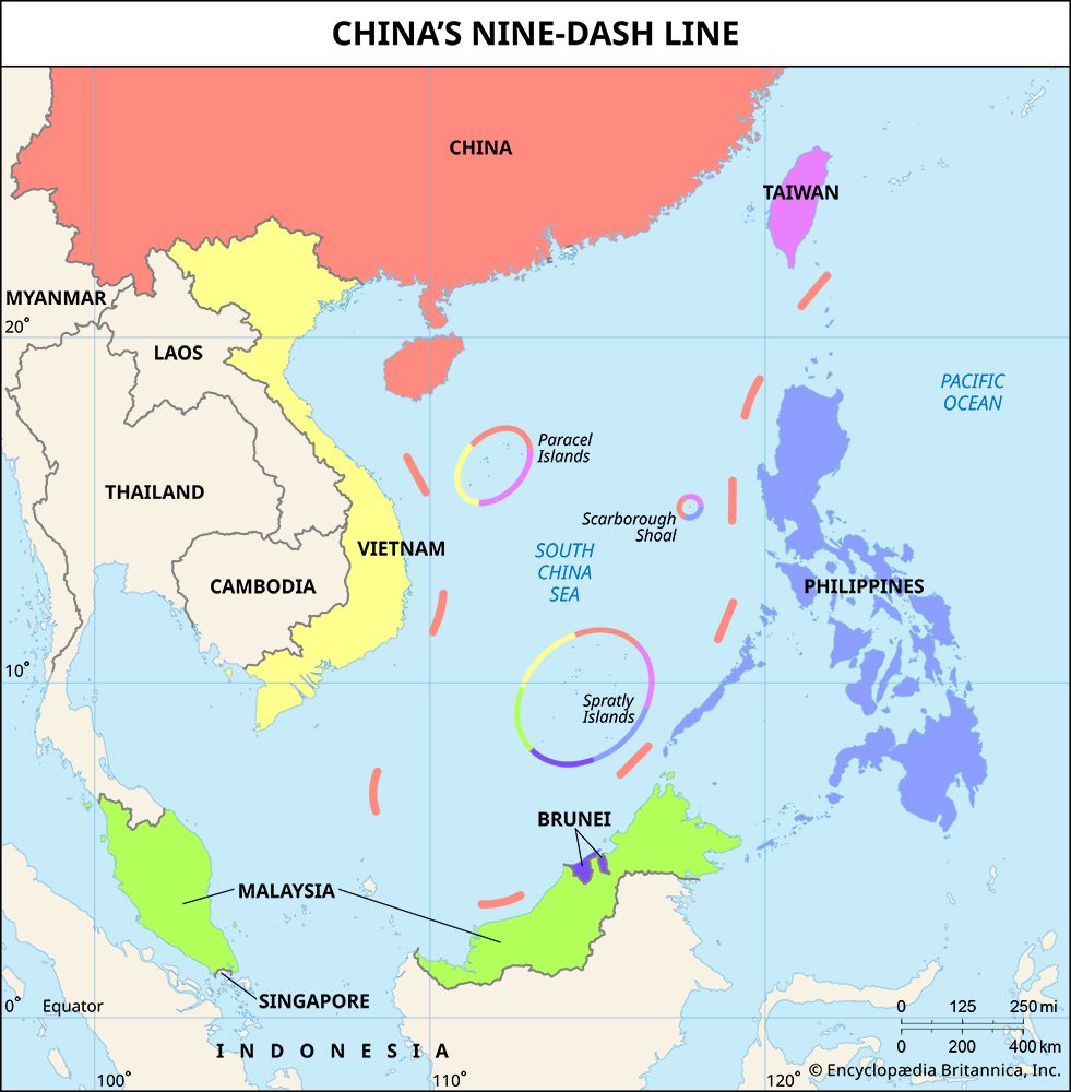
What are the Spratly Islands and why are they also disputed?
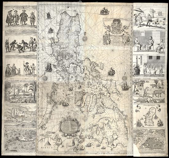
The Spratly Islands are a vast collection of reefs, shoals, atolls, and small islets located in the South China Sea. Spread across approximately 158,000 square miles, the archipelago contains no permanent human population, though it is strategically significant due to its location near major maritime routes and its potential for natural resources.6
Why the Islands Are Disputed
The conflict over the Spratlys is rooted in overlapping territorial claims and the evolution of international maritime law. Following World War II, Japan renounced its claims to the islands, leading China, Taiwan, and Vietnam to declare sovereignty, with the Philippines adding a claim based on proximity in 1955.6
The dispute intensified in the 1970s following the discovery of potential oil and gas reserves and the establishment of exclusive economic zones (EEZ) under the United Nations Convention on the Law of the Sea. Today, China, Vietnam, the Philippines, Malaysia, and Taiwan all maintain conflicting claims, often supported by military garrisons or infrastructure on various features.67
China’s assertion of sovereignty is largely based on its “9-dash line,” a maritime boundary that encompasses much of the South China Sea. This claim has been a major source of regional tension, particularly as China has engaged in extensive land reclamation and the construction of military facilities on reefs and atolls since 2014.687
How does the United Nations Convention on the Law of the Sea work?
The United Nations Convention on the Law of the Sea (UNCLOS), often called the “constitution for the oceans,” provides a comprehensive legal framework to govern public order, navigation, and resource management at sea.5
Maritime Zones and Jurisdiction
UNCLOS establishes specific zones that define a coastal state’s authority:
- Territorial Waters: Extending up to 12 nautical miles from the coast, where the state exercises sovereignty, though foreign vessels retain the right of innocent passage.510
- Exclusive Economic Zone (EEZ): Extending up to 200 nautical miles from the shore, the coastal state has exclusive rights to explore and exploit natural resources, such as fisheries and energy, while foreign vessels and aircraft enjoy freedom of navigation.53
- Continental Shelf: Coastal states have exclusive rights to seabed resources (oil, gas, minerals) up to 200 nautical miles or further, depending on geological margins.5
- High Seas: Areas beyond national jurisdiction are considered a “global commons,” open to all nations for peaceful use.510
Governance and Dispute Resolution
The convention manages the International Seabed Area through the International Seabed Authority, ensuring that deep-sea mineral resources are treated as the “common heritage of mankind” for equitable global benefit.510
When maritime boundaries overlap, UNCLOS mandates that states seek equitable solutions through negotiation. If disputes persist, the convention provides mechanisms for compulsory settlement via the International Court of Justice, arbitration, or the International Tribunal for the Law of the Sea.53
Sources
- Scarborough Shoal: Top Questions — Encyclopædia Britannica
- Scarborough Shoal — Encyclopædia Britannica
- exclusive economic zone — Encyclopædia Britannica
- International law - Maritime spaces and boundaries — Encyclopædia Britannica
- Law of the Sea — Encyclopædia Britannica
- Spratly Islands — Encyclopædia Britannica
- Spratly Islands — Merriam-Webster
- territorial disputes in the South China Sea - Early 21st-century developments — Encyclopædia Britannica
- territorial disputes in the South China Sea - 20th-century history — Encyclopædia Britannica
- Who owns the oceans? — Encyclopædia Britannica
Published on · 4 min read