Croker Island
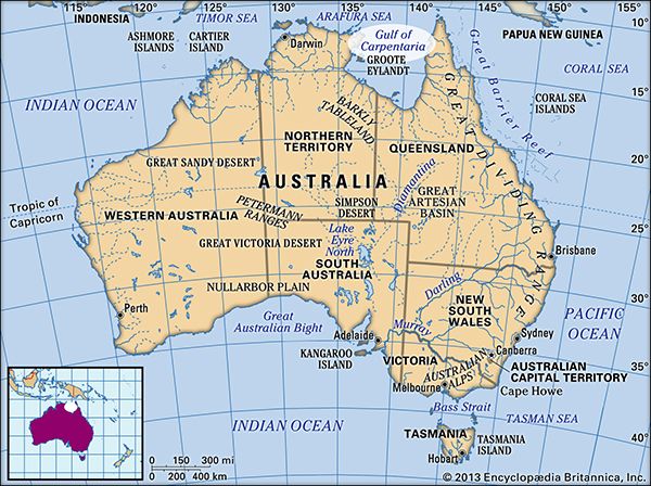
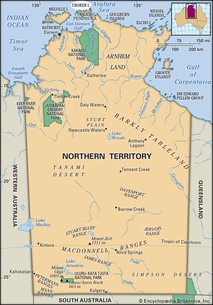
Croker Island is an island located in the Northern Territory of Australia, situated in the Arafura Sea just 2 miles (3 km) from the Cobourg Peninsula.
What is Croker Island?
Croker Island is an island located in the Northern Territory of Australia, situated in the Arafura Sea just 2 miles (3 km) from the Cobourg Peninsula.1
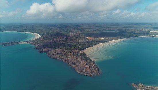
The island measures approximately 30 miles (50 km) long and 4 miles (6 km) wide, covering an area of 126 square miles (326 square km). Its terrain is characterized as low and swampy, reaching a maximum elevation of only 50 feet (15 m).1
First visited by Captain Phillip Parker King of the Royal Navy around 1818, the island is believed to be named after John Wilson Croker, who served as the chief secretary of the British Admiralty at the time. Although it was once considered as a location for a government settlement, that project was ultimately established on the mainland. Today, the island is part of the Arnhem Land Aboriginal Reserve and is managed by its traditional Aboriginal owners.1
What is the significance of Arnhem Land?
Arnhem Land is a significant historical region in Australia’s Northern Territory, covering approximately 37,000 square miles (95,900 square km). Its importance is defined by several key factors:
- Cultural Heritage: The region has been occupied by Aboriginal peoples since the late Pleistocene epoch. It is home to numerous sites featuring ancient rock carvings, serving as a vital repository of Indigenous history and culture.2
- Aboriginal Reserve: Today, the name is primarily associated with a large Aboriginal reserve, where the land remains under the stewardship of its traditional owners.23
- Economic Development: Since World War II, the region has become economically significant due to the extraction of bauxite and uranium.2
- Geography and Exploration: Named after the Dutch ship Arnhem, which visited the coast in 1623, the region features a rugged plateau and tropical climate, bordering the Gulf of Carpentaria and Kakadu National Park.2
Who was Captain Phillip Parker King?
Phillip Parker King (1791–1856) was a prominent British naval officer and explorer recognized for his significant contributions to the mapping of the Australian coastline. Between 1817 and 1822, he commanded a series of Admiralty expeditions that were instrumental in filling critical gaps in the geographical knowledge of the continent.4
While earlier explorers like Matthew Flinders had circumnavigated and charted much of the Australian landmass, the northern coast—stretching from Arnhem Land to the Cape York Peninsula—remained largely unexplored. King’s surveys were vital in completing the maritime charting of these northern regions, providing the British Admiralty with essential data for navigation and potential settlement.4
It is important to clarify that he should not be confused with Arthur Phillip, the first governor of New South Wales, who established the first permanent European colony in Australia in 1788.5
What is the geography of the Arafura Sea?
The Arafura Sea is a shallow body of water in the western Pacific Ocean covering approximately 250,000 square miles (650,000 square km). It is situated between the northern coast of Australia and the southern coast of New Guinea.6
Geological and Physical Features
- Shelf Structure: The sea is primarily underlain by the Arafura Shelf, a component of the Sahul Shelf. It is generally shallow, with depths ranging from 165 to 260 feet (50 to 80 metres).6
- Deepening and Trenches: The sea deepens at its western edge, where coral reefs exist at depths of nearly 2,000 feet (610 metres). To the north, the Aru Islands border the Aru Trough, a trench reaching depths of 12,000 feet (3,660 metres).6
- Connections: It merges with the Timor Sea to the west and the Banda and Ceram seas to the northwest. The Torres Strait provides a connection to the Coral Sea in the east.6
Navigation in the region is challenging due to numerous uncharted shoals and the hazardous nature of the Torres Strait.6
Sources
- Croker Island — Encyclopædia Britannica
- Arnhem Land — Encyclopædia Britannica
- Arnhem Land — Merriam-Webster
- Arthur Phillip — Encyclopædia Britannica
- Australia - Later explorations — Encyclopædia Britannica
- Arafura Sea — Encyclopædia Britannica
- Arafura Sea — Merriam-Webster
Published on · 3 min read