Diego Garcia
Diego Garcia is a coral atoll located in the central Indian Ocean. It serves as the largest and southernmost member of the Chagos Archipelago and is…
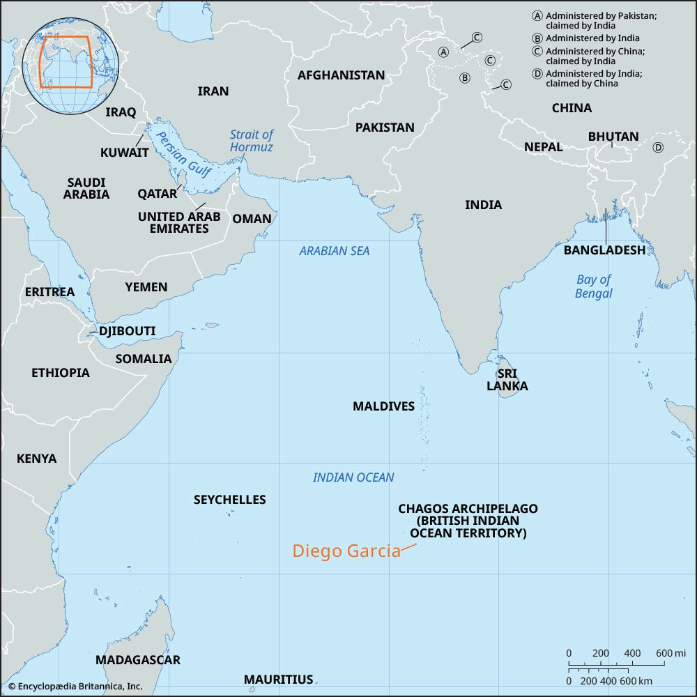
Where is Diego Garcia located in the Indian Ocean, and what is its geographical significance?
Diego Garcia is a coral atoll located in the central Indian Ocean. It serves as the largest and southernmost member of the Chagos Archipelago and is currently part of the British Indian Ocean Territory.12
Its geographical and strategic significance stems from its role as a critical hub for air and naval support. Developed during the Cold War, the base allows the United States and the United Kingdom to project military power across the Middle East, South Asia, and East Africa. The facility has supported major operations, including the Persian Gulf War, the conflict in Afghanistan, and the Iraq War. Most recently, the base’s strategic exposure was highlighted during the . Most recently, the base’s strategic exposure was highlighted during the 2026 Iran War, when it was targeted by long-range missiles.12
How did Diego Garcia become a strategic military base for the United States?
Diego Garcia became a strategic military base for the United States through a series of geopolitical agreements and actions during the Cold War. In 1965, the United Kingdom established the British Indian Ocean Territory by separating the Chagos Archipelago from Mauritius. This move was intended to facilitate the creation of defense and communications facilities to counterbalance the Soviet military presence in the region.12
To enable the construction of these military facilities, the civilian population—known as the Ilois or Chagossians—was forcibly removed from the island between 1967 and 1973. These inhabitants, who had worked on local coconut plantations, were relocated primarily to Mauritius and the Seychelles, leaving the atoll with no permanent civilian residents.32
A major U.S. and British military facility was subsequently established in 1971. The base has since served as a critical hub for air and naval power projection across the Middle East, South Asia, and East Africa, supporting operations such as the Persian Gulf War, the conflict in Afghanistan, and the Iraq War.132
What controversies surround the displacement of the native Chagossian people from Diego Garcia?
The displacement of the native Chagossians (or Ilois) from the Chagos Archipelago between 1967 and 1973 remains a significant human rights and legal controversy. The British government forcibly removed the entire population to facilitate the construction of a joint U.S.–U.K. military base on Diego Garcia.325
Key aspects of the controversy include:
- Legal Battles: In 2000, the British High Court ruled the removal illegal, granting islanders the right to return to the archipelago (excluding Diego Garcia). However, the British government successfully challenged this in the House of Lords in 2008, effectively blocking their return.34
- Environmental Policy: In 2010, the U.K. established a massive marine reserve around the islands. Chagossians argued this was a strategic move to prevent their resettlement by banning the fishing activities necessary for their livelihood.32
- International Law: The International Court of Justice (ICJ) ruled in 2019 that the decolonization of Mauritius was incomplete and illegal due to the separation of the Chagos Archipelago, recommending the U.K. end its administration.34
While the British government has expressed regret for the original removal, the displacement continues to be a focal point of international scrutiny regarding sovereignty and the rights of indigenous populations.342
How large is Diego Garcia, and what is its shape?
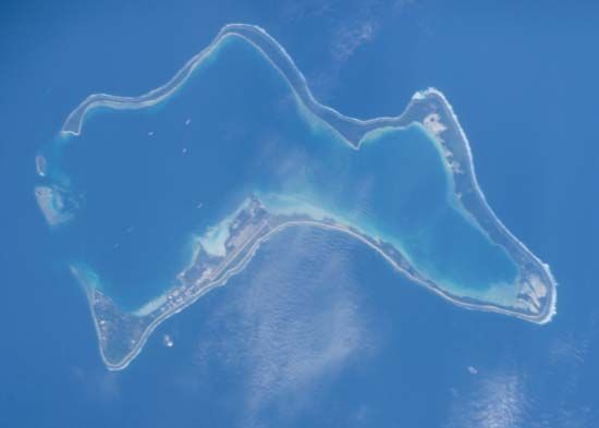
Diego Garcia is a coral atoll located in the central Indian Ocean. It is the largest landmass within the Chagos Archipelago, covering an area of 17 square miles (44 square km).15
Regarding its shape, the island is a V-shaped, sand-fringed cay. It measures approximately 15 miles (24 km) in length with a maximum width of about 7 miles (11 km), and it features a lagoon that is open at the north end.5
Sources
- Diego Garcia: Top Questions — Encyclopædia Britannica
- Diego Garcia — Encyclopædia Britannica
- British Indian Ocean Territory — Encyclopædia Britannica
- Chagos Archipelago: Top Questions — Encyclopædia Britannica
- Chagos Archipelago — Encyclopædia Britannica
Published on · 3 min read