Fjord
Fjords, bays, and estuaries are distinct coastal features defined by their formation, shape, and physical characteristics.
How do fjords differ from other coastal features like bays or estuaries?
Fjords, bays, and estuaries are distinct coastal features defined by their formation, shape, and physical characteristics.
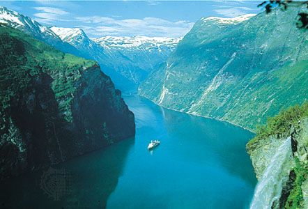
A fjord is a long, narrow arm of the sea created by the marine inundation of a glaciated valley. These features are characterized by steep, vertical walls and a distinct U-shaped profile. Because they were carved by heavy glaciers, they are often exceptionally deep, though they typically feature a shallow threshold or “sill” at their mouth.12
In contrast, a bay is a semicircular or nearly circular concavity in a coastline. Unlike the glacial origin of fjords, bays are generally formed by the differential erosion of softer rocks between more resistant headlands.3
An estuary is defined by the mixing of fresh water and seawater rather than by a specific shape. While fjords are a specific type of glaciated valley, they can also function as estuaries if they contain a mix of river and salt water. Estuaries are typically funnel-shaped, whereas bays are more rounded.423
What are some famous fjords around the world, and what makes them unique?
Fjords are iconic geological features formed by the marine inundation of glaciated valleys, resulting in deep, narrow channels with steep, vertical walls. Several fjords are world-renowned for their dramatic scenery and unique physical characteristics:56
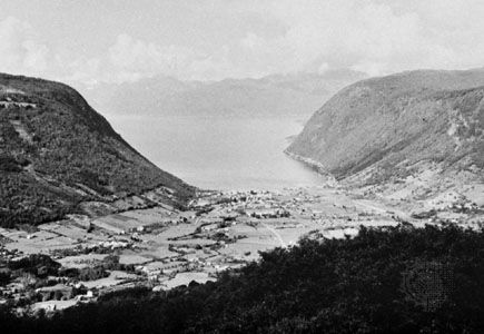
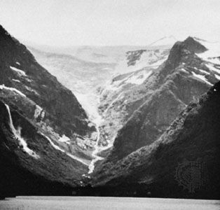
- Sogn Fjord (Norway): As the longest and deepest fjord in Norway, it reaches a maximum depth of 4,291 feet (1,308 meters). Its complex system of tributary channels extends toward the Jotunheim Mountains and the Jostedals Glacier, featuring numerous waterfalls that have been harnessed for hydroelectric power.75
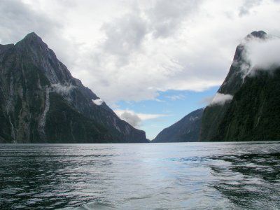
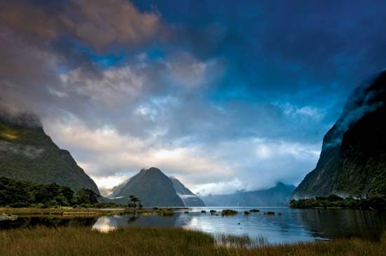
- Milford Sound (New Zealand): Located in Fiordland National Park, this fjord is famous for its sheer valley walls that plunge up to 1,680 feet (512 meters) beneath the water. It is surrounded by towering peaks like Mitre Peak and is fed by multiple rivers from surrounding side valleys.1
- Canal Messier (Chile): Notable for its extreme depth of 4,167 feet (1,270 meters), this fjord exemplifies the immense erosive power of ancient glaciers in the Southern Hemisphere.5
These sites are often characterized by a shallow “sill” at their mouth—a ridge of glacial deposits that can lead to stagnant deep-water conditions—and are frequently home to unique ecosystems, including diverse marine life and temperate rainforests.586
What is a fjord and how is it formed?
A fjord is a long, narrow arm of the sea that extends inland, characterized by steep, vertical walls and significant depth. These features are formed through the marine inundation of a glaciated valley following the retreat of massive glaciers.121
Formation Process
The creation of a fjord begins when heavy, thick glaciers move through mountain valleys. Because glaciers have high viscosity and mass, they erode the valley floor and walls, transforming typical V-shaped river valleys into deep, U-shaped valleys.1213
- Glacial Erosion: As glaciers descend from coastal mountains, they carve deep depressions into the landscape, often reaching far below current sea level.121
- Inundation: Following the Pleistocene Epoch, as the climate warmed and glaciers melted, sea levels rose, flooding these deep, steep-sided troughs with ocean water.121
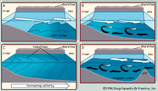
- Sill Formation: Fjords often feature a shallow ridge or “sill” at their mouth, composed of glacial debris left behind by the retreating ice. This sill can restrict water circulation, sometimes leading to stagnant conditions in the deepest parts of the basin.1214
How deep are typical fjords, and why does this matter for marine life?
Fjords are remarkably deep, often extending thousands of feet below sea level. For example, Norway’s Sogn Fjord reaches depths of 1,308 meters (4,290 feet), while Chile’s Canal Messier reaches 1,270 meters (4,167 feet).1
This extreme depth and the presence of a shallow ridge, or “sill,” at the mouth of the fjord significantly impact marine life and water quality. The sill acts as a barrier that can trap deep, undiluted seawater within a basin, often leaving these bottom waters undisturbed by surface currents. Because water circulation is restricted, the deepest parts of many fjords can become stagnant and accumulate black mud rich in hydrogen sulfide, which creates a challenging environment for many organisms. Furthermore, because fjords typically feature steep, rocky sides with very little shallow water, there is minimal space for the development of salt marshes or seagrass beds, meaning marine life is often limited to species that can colonize rocky shores, such as various types of seaweed.31
Sources
- fjord — Encyclopædia Britannica
- bay — Encyclopædia Britannica
- estuary - Fjords — Encyclopædia Britannica
- estuary — Encyclopædia Britannica
- Milford Sound — Encyclopædia Britannica
- list of fjords — Encyclopædia Britannica
- Sogn Fjord — Encyclopædia Britannica
- Fiordland National Park — Encyclopædia Britannica
- Andes Mountains - Physiography of the Southern Andes — Encyclopædia Britannica
- Chile - The Chilean Andes — Encyclopædia Britannica
- list of World Heritage sites - Norway — Encyclopædia Britannica
- fjord — Merriam-Webster
- glacial valley — Encyclopædia Britannica
- coast — Encyclopædia Britannica
Published on · 4 min read