Bay
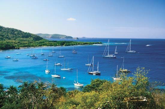
A bay is a coastal concavity formed through several distinct geological processes, primarily involving the interaction between land and water.
How are bays formed, and what are the main geological processes involved?
A bay is a coastal concavity formed through several distinct geological processes, primarily involving the interaction between land and water.
Differential Erosion
The most common formation occurs along coastlines with varying rock hardness. Softer materials, such as clays and silts, are subjected to more rapid erosion by wave action compared to harder, resistant formations like granite or limestone. These harder rocks remain as projecting promontories, while the softer areas between them are carved out to create the bay’s characteristic semicircular shape.1
Large-Scale Geological Processes
Larger bays are often the result of more significant earth movements:
- Glacial Erosion: Massive ice sheets can carve out large depressions in the landscape, which later become bays when sea levels rise, as seen in Hudson Bay.1
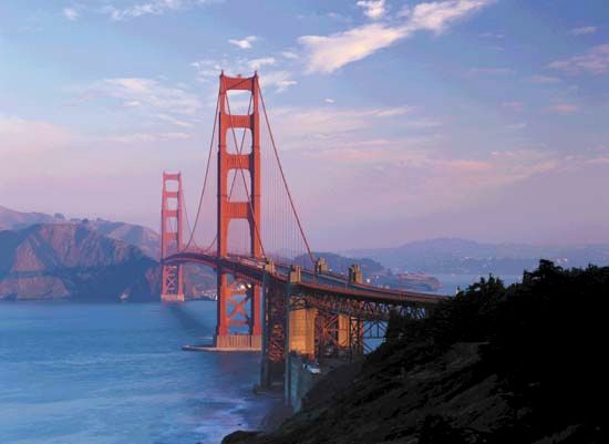
- Tectonic Activity: Vertical earth movements, such as the downfaulting or broad subsidence of a coastal area, can create large basins that fill with water, exemplified by San Francisco Bay.2
What are some of the largest and most famous bays in the world?
Bays vary significantly in size and global distribution, ranging from small coastal inlets to massive bodies of water that rival seas in scale. While the term “bay” typically denotes a body of water smaller than a “gulf,” there are notable exceptions where the naming convention does not reflect size.45
Notable Global Bays
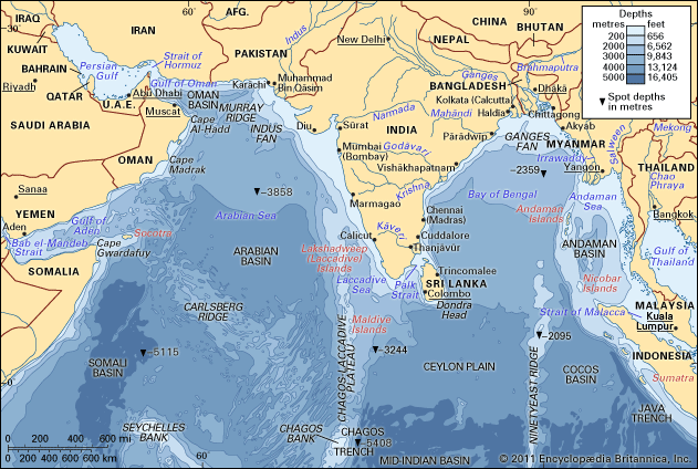
- Bay of Bengal: One of the world’s largest embayments, it covers approximately 839,000 square miles (2,173,000 square km) in the northeastern Indian Ocean. It is fed by major rivers, including the Ganges and Brahmaputra, and is larger than the Gulf of Mexico.65
- Hudson Bay: Located in Canada, this massive body of water was formed by glacial erosion. It is historically significant for the Hudson’s Bay Company, which played a central role in the economic and political development of Canada.75
- Bay of Biscay: Situated off the coasts of Spain and France, this is another example of a large-scale bay spanning several hundred kilometers.5
- Chesapeake Bay: A prominent and historically vital inlet in the United States, known for its role in maritime history and coastal ecology.1
- San Francisco Bay: A major coastal feature on the U.S. West Coast, formed by tectonic subsidence.1
What are the different types of bays, such as coastal bays, barrier bays, and fjords?
Bays are coastal concavities formed by the erosion of land by water or through large-scale geological shifts. While there is no strict scientific classification system for all bays, they are often categorized by their formation processes:
Common Types of Bays
- Erosional Bays: These are the most common type, formed where softer rocks (such as clay or silt) are eroded more rapidly than surrounding harder, resistant rock formations (like granite or limestone). The harder rocks remain as projecting promontories, while the softer areas are carved into semicircular shapes by wave action.7
- Glacial Bays (Fjords): Fjords are deep, steep-sided inlets created by glaciers. They typically feature a submerged ridge or “sill” at the mouth, composed of glacial deposits. Because of their glacial origin, they often have very little shallow water and are distinct from typical coastal bays.81
- Tectonic Bays: Some large bays are formed by significant vertical earth movements, such as the subsidence or downfaulting of coastal land, which creates a basin that subsequently fills with water.7
- Barrier-Enclosed Bays: While often referred to as lagoons, some bays are formed when barrier islands or spits of sand and shingle enclose a body of water behind them.9
How do tides and currents affect the characteristics of a bay?
Tides and currents are fundamental forces that shape the physical characteristics and sediment distribution of bays. Their influence is primarily exerted through the following mechanisms:
The Role of Tidal Currents
Tidal currents are driven by the rise and fall of the sea level and are most influential in constricted areas, such as inlets or the mouths of estuaries. The speed of these currents is determined by the “tidal prism”—the volume of water that must pass through an inlet during a flood or ebb-tide cycle. In large coastal bays, even areas with a low tidal range can experience swift currents if the bay’s surface area is vast, as a significant volume of water must be exchanged through a narrow opening. These currents are capable of transporting large quantities of sediment and can even erode bedrock in constricted zones.10
Tidal Influence on Shorelines
Beyond direct current transport, the rise and fall of the tide indirectly affects bays by shifting the shoreline. This movement redistributes wave energy across the shore zone. In environments with a high tidal range, such as the Bay of Fundy, this process can alter the shoreline by as much as one kilometer during a single cycle, significantly impacting where waves and longshore currents perform their erosional and depositional work.10
Wave and Longshore Dynamics
While tides dictate water levels, waves and longshore currents are responsible for the characteristic semicircular shape of many bays. As waves approach a coast at an angle, they refract and turn to enter the bay head-on. This process, combined with longshore currents, transports sediment along the shoreline, often leading to the formation of features like sand dunes or the smoothing of coastal margins.111
Sources
- bay — Encyclopædia Britannica
- estuary - Geology and geomorphology — Encyclopædia Britannica
- coastal landforms - Barrier island/estuarine systems — Encyclopædia Britannica
- Bay of Bengal — Encyclopædia Britannica
- list of bays and gulfs - North America — Encyclopædia Britannica
- Hudson’s Bay Company — Encyclopædia Britannica
- list of bays and gulfs — Encyclopædia Britannica
- estuary - Fjords — Encyclopædia Britannica
- lagoon - Waves , tides, and surf — Encyclopædia Britannica
- coastal landforms - Tides — Encyclopædia Britannica
- density current - Turbidity currents — Encyclopædia Britannica
- coastal landforms - Longshore currents — Encyclopædia Britannica
- coastal landforms - Deltas — Encyclopædia Britannica
- Bay of Bengal - Hydrology — Encyclopædia Britannica
Published on · 4 min read