Kapuas River
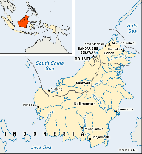
The Kapuas River is the primary waterway of western Indonesian Borneo, located in the province of West Kalimantan.
What is Kapuas River?
The Kapuas River is the primary waterway of western Indonesian Borneo, located in the province of West Kalimantan.
Rising in the Kapuas Hulu Mountains in the center of the island, the river flows for 710 miles (1,143 km) in a west-southwest direction. It eventually empties into the South China Sea through a large, marshy delta situated west-southwest of the city of Pontianak. The Kapuas is notable for being navigable across the majority of its length.1
What kind of wildlife lives in the Kapuas River basin?
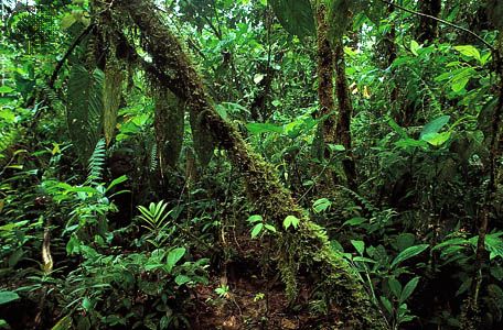
The Kapuas River basin is located within the island of Borneo, a region characterized by dense rainforests and extremely varied faunal populations. While specific wildlife surveys unique to the Kapuas River basin are not detailed in the provided text, the broader ecosystem of Borneo—which the river traverses—supports a diverse array of species.1
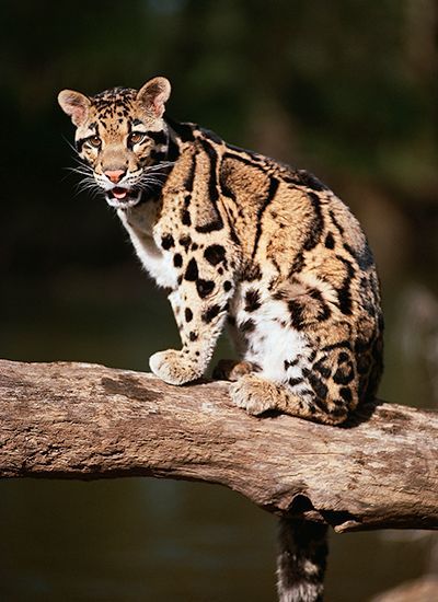
Endemic mammals found on the island include the clouded leopard and the proboscis monkey. Other notable animals inhabiting the island’s forests include orangutans, gibbons, and elephants. Additionally, the region is home to a vast number of fish, insects, and birds. It is important to note that the Sumatran rhinoceros is now extinct on the island.1
The basin’s environment is defined by its equatorial climate, which sustains these rich biological communities.1
How does the river support the economy of West Kalimantan?
The Kapuas River serves as the primary artery for internal transportation in West Kalimantan, as the province has limited road infrastructure connecting its inland regions to the coast and the capital city of Pontianak4. Because the river is navigable along most of its 710-mile length, it is essential for moving goods and people throughout the region.14
Beyond its role in transport, the river basin supports the local economy by facilitating access to the province’s agricultural and industrial output. The region relies on shifting agriculture for staples like rice, corn, and cassava, while also producing rubber and copra. In urban centers like Pontianak, the river supports industries such as food processing, rubber processing, and the manufacturing of wooden and rattan goods. Historically, the river also established Pontianak as a vital trading station and the primary gold city of Borneo.45
What are the main characteristics of the island of Borneo?
Borneo is the third-largest island in the world, located in the southwestern Pacific Ocean within the Malay Archipelago. It is politically divided among Indonesia (known as Kalimantan), Malaysia (Sabah and Sarawak), and the sultanate of Brunei.6
Key characteristics of the island include:
- Geography and Terrain: Lying astride the Equator, the island is largely mountainous with a central spine of ranges, including the Crocker and Muller mountains. Mount Kinabalu is the island’s highest peak. Extensive, often swampy lowlands exist near the coasts.2
- Climate: The climate is equatorial, characterized by high heat and humidity. It features a wet monsoonal season (landas) from October to March and a drier period (tedoh) for the remainder of the year.2
- Ecosystems: Much of the island is covered in dense rainforest, which supports immense biodiversity, including endemic species like the clouded leopard and proboscis monkey.2
- Hydrology: Navigable rivers, such as the Kapuas and Mahakam, serve as vital lifelines for trade and commerce.2
Sources
- Kapuas River — Encyclopædia Britannica
- Borneo - Land — Encyclopædia Britannica
- East Kalimantan — Encyclopædia Britannica
- West Kalimantan — Encyclopædia Britannica
- Pontianak — Encyclopædia Britannica
- Borneo — Encyclopædia Britannica
- Borneo - History of Borneo — Encyclopædia Britannica
- Tropical rainforest - Biota — Encyclopædia Britannica
Published on · 2 min read