Mount Saint Elias
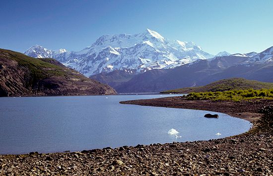
Mount Saint Elias is the second-highest peak in the St. Elias Mountains, reaching an elevation of 18,008 feet (5,489 meters). It is located on the border…
What is Mount Saint Elias?
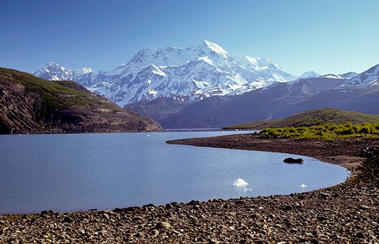
Mount Saint Elias is the second-highest peak in the St. Elias Mountains, reaching an elevation of 18,008 feet (5,489 meters). It is located on the border between Canada (Yukon territory) and the United States (Alaska), situated approximately 70 miles (110 km) northwest of Yakutat, Alaska, and rising north of the Malaspina Glacier.123
The mountain was first sighted by the European explorer Vitus Bering on July 16, 1741, marking the first official European discovery of northwestern America. The first successful ascent of the peak was completed on July 31, 1897, by a party led by the duke of Abruzzi.14
What is the significance of the Malaspina Glacier near the mountain?
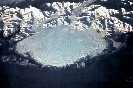
The Malaspina Glacier is significant primarily for its scale and unique geological classification. As the most extensive individual ice field in Alaska, it covers approximately 1,500 square miles (3,900 square km) and reaches thicknesses exceeding 1,000 feet (300 meters).5
Its key features include:
- Piedmont Classification: It is the world’s largest piedmont glacier, characterized by a massive lobe of ice that spreads out over level terrain after exiting a mountain valley.5
- Geographic Context: Flowing 50 miles (80 km) along the southern base of Mount St. Elias, it serves as a major component of the St. Elias Mountains glacier system.5
- Protected Status: It is located within the Wrangell–St. Elias National Park and Preserve, which is part of a World Heritage site recognized for its immense ecological and glacial importance.5
Who was Vitus Bering and why is he important to Alaskan history?
Vitus Bering (1681–1741) was a Danish navigator who served in the Russian navy under Peter the Great. He is historically significant for leading expeditions that established a Russian foothold in North America, effectively opening the region to European exploration and commerce.6
His importance to Alaskan history includes:
- Geographic Discovery: During his 1728 expedition, he determined that Siberia and North America were not connected by land, confirming the existence of the Bering Strait.67
- First Contact: On his second voyage in 1741, he reached the Gulf of Alaska and sighted Mount St. Elias, leading to the first official European landing on the Alaskan coast.67
- Economic Impact: Although Bering died during the return journey, his crew’s reports of abundant sea otter populations sparked a lucrative fur trade that connected the North American Pacific coast with markets in Asia and Europe for the next century.67
How does the height of Mount Saint Elias compare to Denali?
Denali (formerly known as Mount McKinley) is the highest point in North America, standing at 20,310 feet (6,190 meters) above sea level. In comparison, Mount Saint Elias is the fourth-highest point on the continent, with an elevation of 18,008 feet (5,489 meters).829
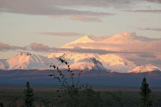
This makes Denali approximately 2,302 feet (701 meters) taller than Mount Saint Elias. While both are prominent features of the Alaskan landscape, they belong to different mountain systems: Denali is the centerpiece of the Alaska Range, whereas Mount Saint Elias is a major peak within the St. Elias Mountains on the border between Alaska and Canada.8102
Sources
- Mount Saint Elias — Encyclopædia Britannica
- Saint Elias, Mount — Merriam-Webster
- mountaineering - History — Encyclopædia Britannica
- St. Elias Mountains — Encyclopædia Britannica
- Malaspina Glacier — Encyclopædia Britannica
- Vitus Bering — Encyclopædia Britannica
- Alaska - Explorations — Encyclopædia Britannica
- North America: Top Questions — Encyclopædia Britannica
- Alaskan mountains - Physiography of the southern ranges — Encyclopædia Britannica
- Mount McKinley — Encyclopædia Britannica
Published on · 2 min read