Rat Islands
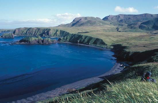
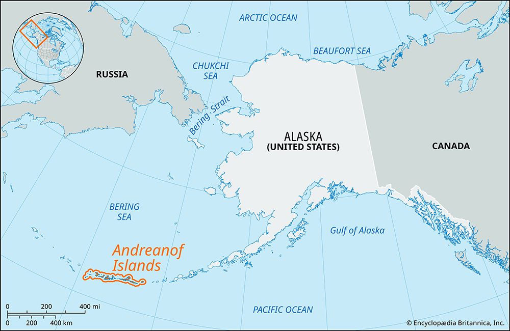
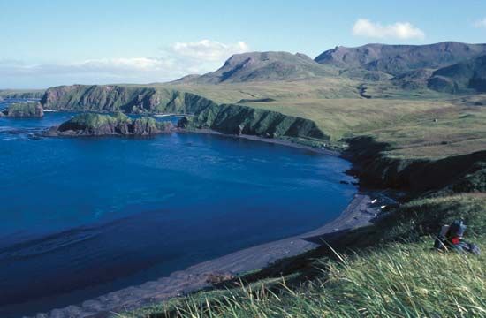
The Rat Islands are an uninhabited group of islands located in the southwestern portion of the Aleutian Islands in Alaska, U.S. Situated between the Near…
What is Rat Islands?
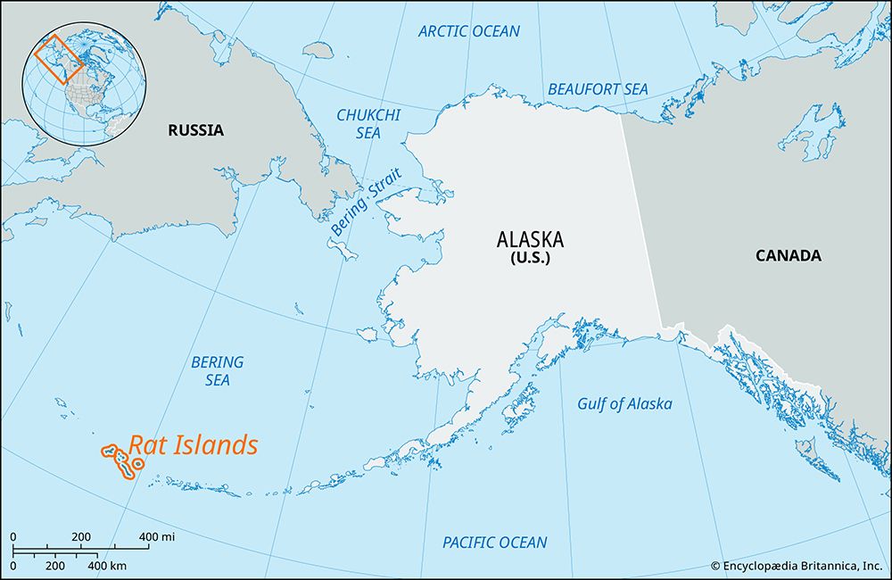
The Rat Islands are an uninhabited group of islands located in the southwestern portion of the Aleutian Islands in Alaska, U.S. Situated between the Near Islands and the Andreanof Islands, the group spans approximately 110 miles and is part of the Alaska Maritime National Wildlife Refuge.12
The three largest islands in the chain are Amchitka, Kiska, and Semisopochnoi. The region is characterized by significant historical and geological activity:1
- Military History: Kiska Island was occupied by Japanese forces during World War II.1
- Nuclear Testing: Between 1965 and 1971, the U.S. government conducted underground nuclear tests on Amchitka Island.1
- Geology: The area is seismically active, and Semisopochnoi Volcano has experienced multiple eruptions since the 18th century.1
What role did the Aleutian Islands play during World War II?
During World War II, the Aleutian Islands served as a strategic northern flank in the Pacific theater. Although U.S. military planners did not intend to use the islands as a primary invasion route toward Japan, they prioritized expelling Japanese forces to prevent attacks on Alaskan bases and to secure the region.45
Key developments in the Aleutian campaign included:
- Japanese Occupation: Japan initially planned to establish air bases in the Aleutians to protect their perimeter. They occupied Attu and Kiska, prompting a U.S. response to reclaim the territory.645
- Allied Counter-Strategy: The U.S. established airfields on Adak in August 1942 and Amchitka in January 1943. These bases allowed for air attacks and a naval blockade that effectively cut off Japanese reinforcements.45
- Recapture: In May 1943, U.S. forces invaded Attu, resulting in heavy Japanese casualties. Following this, the Japanese evacuated Kiska, which was occupied by U.S. and Canadian forces in August 1943.45
Ultimately, these operations successfully removed Japanese forces from North American territory and provided bases for Allied bombing missions against the Kuril Islands4.5
How do underground nuclear tests affect island ecosystems?
Underground nuclear testing significantly impacts island and regional ecosystems primarily through the contamination of groundwater and the surrounding environment. While underground detonations avoid the immediate atmospheric fallout associated with surface or air bursts, they present long-term environmental risks.89
Key impacts include:
- Groundwater Contamination: Many underground tests were conducted within aquifers or below water tables. This practice often leads to the contamination of groundwater, rendering it largely unusable and posing a persistent threat to the local environment.9
- Residual Radiation: All materials exposed to the intense energy of a nuclear blast can become radioactive. Even when tests are contained underground, the resulting radioactive materials remain buried, creating a legacy of contamination that can affect the stability and safety of the local ecosystem.109
- Environmental Persistence: Unlike atmospheric tests, which dispersed radioactive debris over vast distances, underground testing concentrates radioactive materials in a localized area. This creates long-term hazards that require extensive monitoring and cleanup efforts, as seen in the ongoing management of former test sites.89
What makes the Aleutian Islands seismically active?
The Aleutian Islands are highly seismically active because they are part of the Ring of Fire, a major chain of volcanoes and tectonic activity encircling the Pacific Ocean.13
The primary driver of this activity is the subduction process occurring along the Aleutian Trench. In this region, the Pacific Plate is forced beneath the North American Plate. This process is not continuous; as the plates move, they accumulate enormous stress at their boundaries. When this accumulated stress is released, it generates significant seismic events, including large-magnitude earthquakes.1415
Furthermore, the islands represent a partially submerged volcanic arc that serves as a continuation of the Aleutian Range. The subduction of the oceanic crust creates molten mantle rock, which fuels the volcanic activity characteristic of the archipelago. This combination of active subduction and volcanic formation makes the region one of the most geologically dynamic areas in the world.1413
Sources
- Rat Islands — Encyclopædia Britannica
- Rat Islands — Merriam-Webster
- American Samoa - Plant and animal life — Encyclopædia Britannica
- World War II - The Solomons, Papua, Madagascar, the Aleutians, and Burma, July 1942–May 1943 — Encyclopædia Britannica
- Andreanof Islands — Encyclopædia Britannica
- Pacific War - The expansion of the Japanese perimeter — Encyclopædia Britannica
- Pacific War - The Aleutians, Rabaul, and the Gilberts — Encyclopædia Britannica
- Marshall Islands atomic bomb tests — Encyclopædia Britannica
- Bikini — Encyclopædia Britannica
- radiation - Accumulation in critical organs — Encyclopædia Britannica
- nuclear weapon - The effects of nuclear weapons — Encyclopædia Britannica
- Nevada Test Site — Encyclopædia Britannica
- Pacific mountain system - Geology — Encyclopædia Britannica
- Aleutian Islands — Encyclopædia Britannica
- Alaska earthquake of 1964 — Encyclopædia Britannica
- Aleutian Basin — Encyclopædia Britannica
- Aleutian Trench — Encyclopædia Britannica
Published on · 3 min read