Takla Makan Desert
The Taklamakan Desert served as a formidable geographical barrier that shaped the path of the ancient Silk Road. Because the desert was extremely hazardous…
What role did the Taklamakan Desert play in the ancient Silk Road trade routes?
The Taklamakan Desert served as a formidable geographical barrier that shaped the path of the ancient Silk Road. Because the desert was extremely hazardous to traverse, the primary trade routes were forced to skirt its northern and western fringes.12
At the city of Kashgar, a historic gateway for trade between Asia and Europe, the Silk Road divided to bypass the desert on both sides before converging again at Yuanquan. These routes were vital for the exchange of goods, such as jade from Khotan, and served as a conduit for the spread of Buddhism into East Asia during the first millennium CE.321
The desert’s surrounding oasis towns became essential hubs for travelers and merchants, supporting a flourishing civilization that was later buried by the sands. By the 15th and 16th centuries, the rise of sea routes led to the decline of these overland paths, leaving the region as a remote area until its archaeological rediscovery in the late 19th century.1
Where is the Taklamakan Desert located in China, and what are its geographical features?
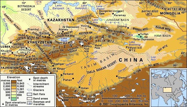
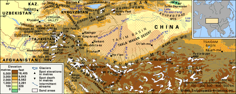
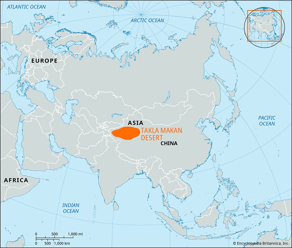
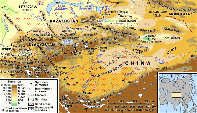
The Takla Makan Desert is located in the central part of the Tarim Basin within the Uygur Autonomous Region of Xinjiang in western China. It is a vast, arid region spanning approximately 123,550 to 132,000 square miles.27
Geographical Features
- Surrounding Mountains: The desert is enclosed by major mountain ranges that block moist air, creating an extremely dry climate: the Tien Shan to the north, the Pamirs to the west, and the Kunlun Mountains to the south.789
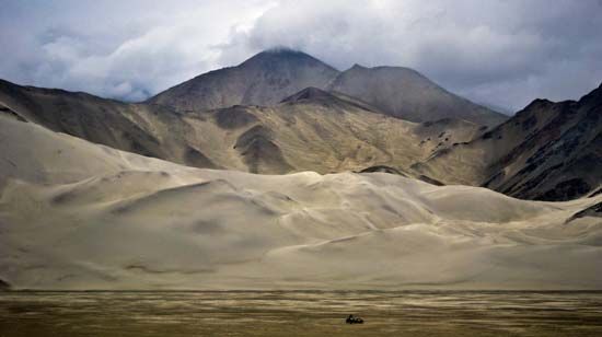
- Topography: The surface is characterized by thick alluvial deposits covered by wind-borne sand up to 1,000 feet deep. It features diverse eolian (wind-formed) structures, including massive sand-dune chains and pyramidal dunes that can reach heights of 650 to 1,000 feet.10
- Drainage: The desert is an internal-drainage basin. Most rivers flowing from the surrounding mountains dry up in the sands, with only a few, such as the Hotan River, occasionally crossing the interior to reach the Tarim River to reach the Tarim River.911
- Elevation: The terrain generally slopes from south to north, with elevations ranging from roughly 2,600 to 4,900 feet above sea level.29
What is the climate like in the Taklamakan Desert, and how does it affect life in the region?
The Takla Makan Desert features a moderately warm and markedly continental climate characterized by extreme aridity and significant temperature fluctuations. Annual precipitation is exceptionally low, ranging from approximately 1.5 inches (38 mm) in the west to as little as 0.4 inches (10 mm) in the east.14
Temperature and Weather
The region experiences a high annual temperature range of up to 70 °F (39 °C). Summers are hot, with temperatures reaching 100 °F (38 °C) on the eastern edge, while winters are cold, with average January temperatures between 14 and 16 °F (−10 to −9 °C) and lows often dropping below −4 °F (−20 °C). In the spring, the desert is frequently subjected to hurricane-force dust storms that can fill the atmosphere with dust up to 13,000 feet (4,000 meters) high.14
Impact on Life
The harsh climate severely limits human and biological activity:
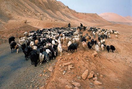
- Human Settlement: There is no fixed population within the desert. While the Chinese government has encouraged agricultural settlement on the desert’s margins since 1950, these efforts often face challenges such as low soil fertility and desertification caused by overgrazing.2
- Flora and Fauna: Vegetation is extremely sparse, found primarily in depressions where groundwater is accessible or along river valleys and deltas. Animal life is similarly restricted to these peripheral areas, featuring species such as gazelles, wolves, foxes, and various rodents.15
- Economic Activity: Despite the difficult environment, the region has become significant for its petroleum deposits, which are exploited despite the hazardous conditions for transportation and labor.2
What archaeological discoveries have been made in the Taklamakan Desert, and what do they tell us about ancient civilizations?
Archaeological exploration of the Takla Makan Desert began in earnest during the late 19th century, revealing that the region was once home to flourishing civilizations along the fringes of the Silk Road.1
Key Discoveries and Significance
- Forgotten Civilizations: In the 1890s, Swedish explorer Sven Anders Hedin discovered artifacts belonging to a previously unknown Buddhist civilization that thrived in the area during the first millennium CE.1
- Buried Cities and Art: The archaeologist Sir Aurel Stein conducted extensive excavations starting in 1900, uncovering towns that had been buried by shifting sands. His work retrieved significant quantities of monumental Buddhist art, providing evidence of the region’s historical role as a cultural and religious crossroads.1
- Cultural Exchange: These findings demonstrate that the desert’s oasis towns were vital hubs for the transmission of Buddhism into East Asia and served as essential conduits for foreign trade between China, Central Asia, and the West.1
These discoveries highlight how the harsh, arid environment preserved remnants of ancient societies that were otherwise lost to history as trade routes shifted toward the sea by the 16th century.1
Sources
- Takla Makan Desert - Study and exploration — Encyclopædia Britannica
- Takla Makan Desert — Encyclopædia Britannica
- Kunlun Mountains - People and economy — Encyclopædia Britannica
- Xinjiang - Transportation — Encyclopædia Britannica
- road - The Silk Road — Encyclopædia Britannica
- Gobi - Study and exploration — Encyclopædia Britannica
- Tarim Basin — Encyclopædia Britannica
- Taklimakan — Merriam-Webster
- Takla Makan Desert - Physiography — Encyclopædia Britannica
- Kunlun Mountains — Encyclopædia Britannica
- Takla Makan Desert - Physical features — Encyclopædia Britannica
- Takla Makan Desert - Drainage — Encyclopædia Britannica
- China - The Tarim Basin — Encyclopædia Britannica
- Kunlun Mountains - Climate of the Kunlun Mountains — Encyclopædia Britannica
- Takla Makan Desert - Plant and animal life — Encyclopædia Britannica
- Takla Makan Desert - Climate — Encyclopædia Britannica
- Takla Makan Desert - People and economy — Encyclopædia Britannica
- Xinjiang - Plant and animal life — Encyclopædia Britannica
- oasis — Encyclopædia Britannica
- Sahara - People of the Sahara — Encyclopædia Britannica
- Asia - Temperature — Encyclopædia Britannica
Published on · 4 min read