Yablonitsky Pass
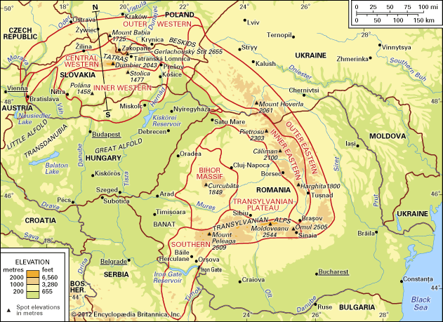
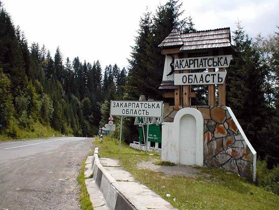
The Yablonitsky Pass is a mountain pass located in the outer eastern Carpathians of western Ukraine. It serves as a vital transportation link, connecting the…
What is Yablonitsky Pass?
The Yablonitsky Pass is a mountain pass located in the outer eastern Carpathians of western Ukraine. It serves as a vital transportation link, connecting the country’s isolated western regions to the rest of the nation and to northeastern Romania.1
The pass reaches an elevation of 3,054 feet (931 meters) and is traversed by both a road and a railway line. Geographically, the southern portion of the pass is defined by the valley of the Tisza River, while the northern section features the headwaters of the Prut River. The surrounding mountains in the area rise to heights exceeding 6,600 feet (2,000 meters).1
Please note that the Yablonitsky Pass should not be confused with the Yablonovy Range, which is a mountain range located in far eastern Russia.2
What are the Carpathian Mountains known for?
The Carpathian Mountains are a major mountain system in Central and Eastern Europe, known for their diverse physical geography, rich biodiversity, and cultural significance.
Physical Features and Biodiversity
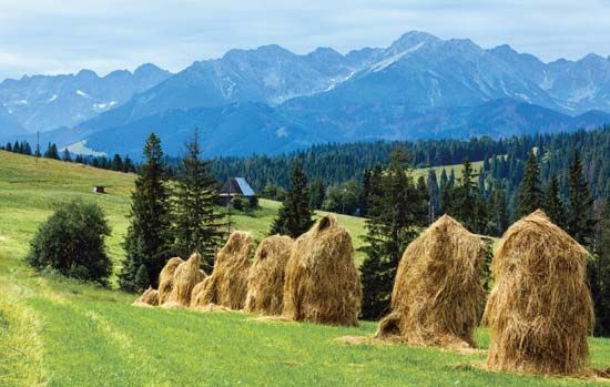
The range is divided into the Western, Eastern, and Southern Carpathians, each with distinct geological structures. The Tatras in the Western Carpathians are noted for their high-mountain glacial relief, featuring cirque lakes and waterfalls. The region supports varied ecosystems, including primeval beech forests designated as a UNESCO World Heritage site. Wildlife in the better-preserved eastern forests includes bears, wolves, lynx, and chamois.34
Tourism and Economy
The mountains are a popular destination for recreation, particularly for winter sports and health tourism. The region is famous for its abundant mineral springs, with well-known spas located in Poland, Slovakia, and Romania.5
Cultural Diversity
The Carpathians are characterized by a complex mix of nationalities, including Poles, Slovaks, Hungarians, Ukrainians, Romanians, and Serbs. This diversity has historically influenced the region’s architecture, customs, and economic practices, such as traditional pastoral methods.6
How do mountain passes influence trade and travel?
Mountain passes serve as critical geographical conduits that bridge otherwise isolated regions, fundamentally shaping the history of trade, travel, and military strategy. By providing a navigable route through rugged or mountainous terrain, these gaps—often formed by river valleys or geological erosion—transform impassable barriers into essential communication and transportation links.101112
Economic and Strategic Impact
Historically, passes have functioned as vital arteries for commerce. For example, the Khyber Pass served as a segment of the Silk Road, facilitating the movement of goods and people between Central and South Asia. Similarly, in the Alps, settlements grew around these focal points, evolving from simple footpaths into modern hubs for tourism and transit.1112
Evolution of Infrastructure
The nature of travel through these passes has changed significantly over time:
- Early Routes: Initially, passes were simple tracks used by caravans and travelers, often subject to seasonal closures due to weather.101112
- Modern Engineering: The introduction of paved highways and complex railway systems, such as the Khyber Pass Railway, revolutionized regional connectivity.1112
- Tunnels: The construction of road and rail tunnels has largely mitigated the challenges of steep terrain, allowing for year-round transit and significantly increasing the volume of trade and tourism.12
While these developments have ended the isolation of mountain communities, they have also introduced environmental challenges, such as the degradation of fragile ecosystems due to increased traffic.12
What is the significance of the Tisza River?
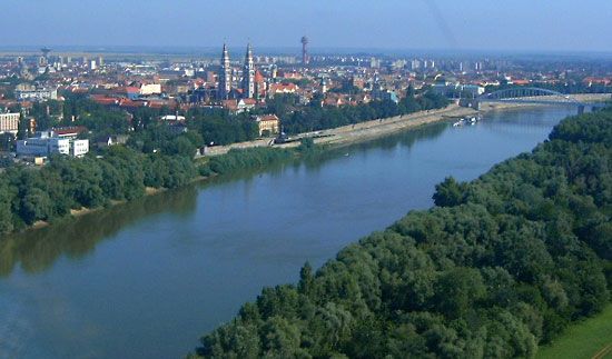
The Tisza River is a major tributary of the Danube River and serves as a vital geographical and economic feature of Central and Eastern Europe. Rising in the Carpathian Mountains, it flows for approximately 600 miles (966 km) through Ukraine, Hungary, and Serbia before joining the Danube.13
Economic and Agricultural Significance
The Tisza is essential to the agricultural productivity of the region. Because the central and eastern areas of the Great Alfold plain are relatively dry, the river provides necessary water for large-scale irrigation systems. The Tiszalök Dam, constructed in 1954, is a key piece of infrastructure that supports these irrigation efforts and generates hydroelectric power. Additionally, the river is navigable for river boats up to Szolnok, facilitating regional transport and trade.1413
Flood Management
The river is characterized by significant seasonal fluctuations in water levels due to the lack of natural lakes in the Carpathians to regulate runoff. This historically led to devastating floods, such as the 1879 destruction of Szeged, Hungary. Consequently, the river has been heavily regulated with approximately 2,400 miles (3,860 km) of flood-control levees.1314
Sources
- Yablonitsky Pass — Encyclopædia Britannica
- Yablonovy Range — Encyclopædia Britannica
- Carpathian Mountains - Physiography of the Carpathian Mountains — Encyclopædia Britannica
- Carpathian Mountains - Tourism — Encyclopædia Britannica
- Carpathian Mountains - Transportation — Encyclopædia Britannica
- Carpathian Mountains - Plant and animal life — Encyclopædia Britannica
- Carpathian Mountains - The people — Encyclopædia Britannica
- Carpathian Mountains - Study and exploration — Encyclopædia Britannica
- Appalachian Mountains - Recreation and tourism — Encyclopædia Britannica
- passes — Merriam-Webster
- Khyber Pass — Encyclopædia Britannica
- Alps - Transportation — Encyclopædia Britannica
- Tisza River — Encyclopædia Britannica
- Danube River - Physiography — Encyclopædia Britannica
- Hungary - Drainage and soils — Encyclopædia Britannica
- Mureş River — Encyclopædia Britannica
Published on · 3 min read