Youghiogheny River
The Youghiogheny River is a 135-mile-long (217 km) waterway that rises at Backbone Mountain in Preston County, West Virginia. It flows north and northwest…
What is Youghiogheny River?
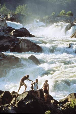
The Youghiogheny River is a 135-mile-long (217 km) waterway that rises at Backbone Mountain in Preston County, West Virginia. It flows north and northwest through Maryland and Pennsylvania, eventually joining the Monongahela River at McKeesport, Pennsylvania.12
The river’s name originates from an Algonquian word meaning “contrary stream,” reflecting its unique status as the only river in western Maryland that does not flow south into the Potomac River. Near Confluence, Pennsylvania, the river is joined by the Casselman River; a dam completed in 1948 created a reservoir there that inundated the former borough of Somerfield, Pennsylvania.1
What is the Monongahela River?
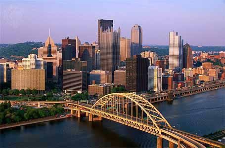
The Monongahela River is a 128-mile (206 km) waterway formed by the confluence of the Tygart and West Fork rivers in Marion County, West Virginia. It flows in a northerly direction through West Virginia and Pennsylvania, passing cities such as Morgantown, Brownsville, and Charleroi. At Pittsburgh, it joins the Allegheny River to form the Ohio River.345
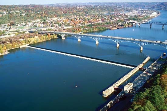
The river is a vital commercial artery, made navigable by a system of locks that support heavy barge traffic carrying coal, coke, iron, and steel. Additionally, its upper reaches provide hydroelectric power to several municipalities. The river is also geologically significant; it serves as the namesake for the Monongahela Series, a division of Pennsylvanian rocks that contains the Pittsburgh Coal, considered the most economically valuable coal bed in the world.36
How do dams affect river ecosystems?
Dams significantly alter river ecosystems by transforming natural flow regimes and physical landscapes. While human-made dams are often constructed for flood control, power generation, and water storage, they frequently cause adverse environmental impacts, including the destruction of fish habitats and the displacement of local flora and fauna.8910
Impact on Aquatic Life and Migration
A primary concern is the obstruction of migratory fish, such as salmon, which must travel upstream to spawn. Dams can block these routes, leading to dramatic population declines. Although technologies like fish passes—including fish ladders and locks—are used to help fish navigate these structures, they are not always successful in sustaining populations.119
Sedimentation and Erosion
Dams trap the sediment load of rivers within reservoirs, which reduces the reservoir’s storage capacity over time. This process also starves downstream areas of silt. Consequently, water released from dams often has a renewed capacity to erode riverbanks, leading to land degradation downstream rather than the natural buildup of banks.81012
Landscape and Social Consequences
Large-scale projects, such as the Three Gorges Dam, can inundate vast areas, destroying scenic landscapes and forcing the relocation of human populations. In contrast, natural “ecosystem engineers” like beavers build dams that create ponds and wetlands, which often support biodiversity by providing essential habitats for various aquatic species and waterfowl.891213
What are some other rivers in the Appalachian region?
The Appalachian region is home to an intricate network of rivers that have played a vital role in the area’s history, ecology, and industrial development. Beyond the Monongahela, several other significant rivers define the landscape:
- Ohio River: Formed by the confluence of the Allegheny and Monongahela rivers at Pittsburgh, this major artery flows southwest to the Mississippi River, serving as a critical commercial route for coal, steel, and oil.14
- New River: Rising in North Carolina, this ancient river flows north through Virginia and West Virginia. It is known for its dramatic gorges and is a key tributary that joins the Gauley River to form the Kanawha River.1516
- Potomac River: Originating in the mountains of West Virginia, the Potomac flows southeast to the Chesapeake Bay. It is historically significant and serves as a boundary between several states, including Maryland, Virginia, and West Virginia.4
- Tennessee River: A dominant force in the southern Appalachians, this river system was transformed by the Tennessee Valley Authority into a series of reservoirs that provide power and flood control.15
- Kanawha River: Formed by the junction of the New and Gauley rivers, it flows through West Virginia and eventually empties into the Ohio River.1516
Sources
- Youghiogheny River — Encyclopædia Britannica
- Youghiogheny — Merriam-Webster
- Monongahela River — Encyclopædia Britannica
- Ohio River — Encyclopædia Britannica
- Monongahela — Merriam-Webster
- Allegheny River — Encyclopædia Britannica
- Monongahela Series — Encyclopædia Britannica
- dam - Fish passes — Encyclopædia Britannica
- reservoir — Encyclopædia Britannica
- dam - Rise of environmental and economic concerns — Encyclopædia Britannica
- Yangtze River - Human impact on the environment — Encyclopædia Britannica
- Why do beavers build dams? — Encyclopædia Britannica
- river - Environments of deposition — Encyclopædia Britannica
- Appalachian Mountains - Drainage — Encyclopædia Britannica
- Potomac River — Encyclopædia Britannica
- New River — Encyclopædia Britannica
- Appalachian Mountains - Geology of the Appalachian Mountains — Encyclopædia Britannica
Published on · 3 min read