Central Russian Upland
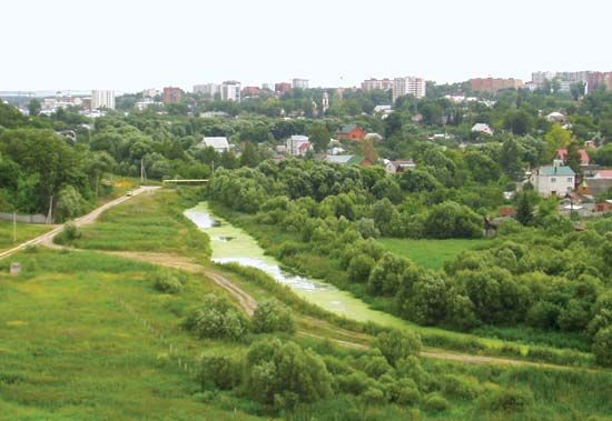
The Central Russian Upland is a significant elevated region located within the Russian Plain in the central portion of European Russia.
What is Central Russian Upland?
The Central Russian Upland is a significant elevated region located within the Russian Plain in the central portion of European Russia.1
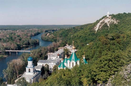
Spanning approximately 600 miles (1,000 km) from north to south and 300 miles (480 km) in width, the upland reaches a maximum elevation of 950 feet (290 m). It serves as a vital watershed, directing rivers toward both the Black Sea and the Caspian Sea.1
Geologically, the area is characterized by deep deposits of sands, limestones, and clays. Its central section features the Voronezh Anticline—a stable, ancient geologic base of the Russian Platform situated near the cities of Voronezh, Oryol, and Kursk. The region stretches between the Oka River in the north and the Donets River and Donets Ridge in the south.1
What is the Russian Plain and how does it shape the country’s geography?
The Russian Plain, also known as the East European Plain, is a vast lowland region covering nearly 1,500,000 square miles (4,000,000 square km) in eastern Europe. It extends from Russia’s western border to the Ural Mountains and from the Arctic Ocean south to the Caucasus Mountains and the Caspian Sea.52
Geographic Influence
The plain fundamentally shapes Russia’s geography through its relief and drainage systems:
- Topography: While largely flat—with about half the area lying below 650 feet (200 meters)—the terrain is varied. Northern sections feature glacial deposits, including morainic ridges like the Valdai Hills and Smolensk Upland. South of Moscow, the landscape alternates between rolling plateaus, such as the Central Russian Upland, and extensive plains.2
- Hydrology: The plain acts as a critical drainage basin for major rivers, including the Volga, Don, and Dnieper. These rivers have historically served as essential transport arteries, with the Volga system alone carrying a significant portion of the country’s waterway traffic.62
- Climate: The plain’s lack of significant mountain barriers allows for distinct climatic patterns. Precipitation generally declines from the northwest to the southeast, and the region experiences pronounced seasonal temperature ranges that increase toward the interior.78
How do watersheds determine where rivers flow in Russia?
In Russia, watersheds are the primary geographic features that dictate the direction and destination of river flow. These elevated regions, such as uplands and hills, act as natural divides that separate drainage basins, forcing water to flow toward specific seas or oceans based on the local topography.212
Key Watersheds and Drainage Basins
Russia’s river systems are organized into five major drainage basins: the Arctic, Pacific, Baltic, Black Sea, and Caspian. Watersheds determine how these basins are partitioned:2
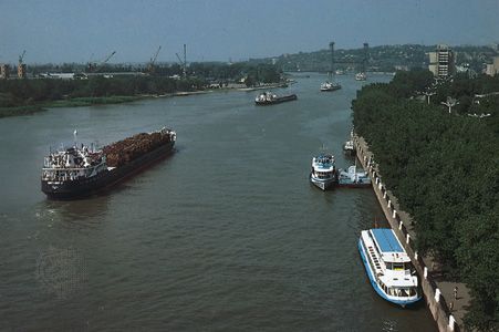
- Central Russian Upland: This significant upland area serves as a critical watershed, directing rivers toward both the Black Sea and the Caspian Sea. For example, the Don River rises in this upland and flows south toward the Sea of Azov, which is connected to the Black Sea.1213
- Valdai Hills: Located northwest of Moscow, these hills act as a watershed between the basins of the Volga River and the Western Dvina](https://www.britannica.com/place/Volga-River) and the Western Dvina. The Volga, which rises here, flows southeast to the Caspian Sea.2114
- Severnye Uvaly: This range of hills functions as a watershed between the left-bank tributaries of the Volga and the northern rivers, such as the Sukhona, Vychegda, and Pechora, which ultimately drain into the Arctic Ocean.15
- Ural Mountains: These mountains serve as a major divide. Rivers on the western slope generally drain into the Arctic or the Caspian Sea (via the Kama River), while those on the eastern slope primarily belong to the Ob River system, which flows north to the Arctic.16
By separating these basins, watersheds ensure that despite the vast, relatively flat nature of the Russian Plain, water is consistently channeled into distinct, massive river networks that have historically served as essential transport arteries.2
What are the main differences between an upland and a mountain range?
The terms “upland” and “mountain range” describe distinct landforms, though they are often related in geographic discussions.
Upland
An upland is a general term for an area of high ground. It is a broad, descriptive category that encompasses various elevated features, including hills, plateaus, and tablelands. Uplands are defined primarily by their elevation relative to surrounding lowlands, but the term does not imply a specific geological structure or a requirement for extreme height.1718
Mountain Range
A mountain is a landform that rises prominently above its surroundings, typically characterized by steep slopes, a confined summit area, and significant local relief. Unlike the more general “upland,” mountains are usually larger and more rugged. They are rarely found in isolation; instead, they typically occur in elongated mountain ranges or chains formed by tectonic processes, such as the collision of continents or volcanic activity.192021
Key Differences
- Scale and Relief: Mountains generally exhibit greater height and steeper, more dramatic relief than the broader, often gentler terrain found in many upland areas.1920
- Geological Definition: Mountain ranges are specific tectonic landforms built by processes like crustal folding, faulting, or volcanic uplift. While an upland may be formed by these same processes, the term itself is a general classification of high ground rather than a specific geological structure.2217
- Complexity: Mountain ranges often feature complex systems of peaks, ridges, and valleys, whereas an upland may simply refer to a plateau or a rolling highland area.2018
Sources
- Central Russian Upland — Encyclopædia Britannica
- Russia - Rivers — Encyclopædia Britannica
- Ural Mountains - Climate of the Ural Mountains — Encyclopædia Britannica
- Russia - Agriculture — Encyclopædia Britannica
- Russian Plain — Encyclopædia Britannica
- Russia - The Russian Plain — Encyclopædia Britannica
- Russia - Precipitation — Encyclopædia Britannica
- Russia - Temperature — Encyclopædia Britannica
- West Siberian Plain — Encyclopædia Britannica
- Russia - The West Siberian Plain — Encyclopædia Britannica
- European Plain - Physiography — Encyclopædia Britannica
- Ural Mountains - Drainage — Encyclopædia Britannica
- Volga River - Physiography — Encyclopædia Britannica
- Don River — Encyclopædia Britannica
- Severnye Uvaly — Encyclopædia Britannica
- Valdai Hills — Encyclopædia Britannica
- upland — Merriam-Webster
- list of mountains — Encyclopædia Britannica
- mountain - Geomorphic characteristics — Encyclopædia Britannica
- tectonic landform — Encyclopædia Britannica
- list of mountain ranges - North America — Encyclopædia Britannica
- paleogeography - Mountain ranges — Encyclopædia Britannica
- Highland climate — Encyclopædia Britannica
- uplands — Merriam-Webster
Published on · 4 min read