Gash River
The Gash River, also known as the Mareb (or Mereb) on its upper course, is a river that rises in the highlands of southern Eritrea near Asmara. Spanning…
What is Gash River?
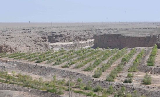
The Gash River, also known as the Mareb (or Mereb) on its upper course, is a river that rises in the highlands of southern Eritrea near Asmara. Spanning approximately 300 miles (480 km), the river flows southward before turning west, where it forms part of the border between Eritrea and Ethiopia.12
Continuing into northeastern Sudan, the river eventually dissipates into the desert, though during flood seasons, it reaches the Atbara River. The Gash is a vital water source used for irrigation in the regions surrounding Teseney, Eritrea, and Kassala, Sudan.12
What is the importance of the Atbara River to the Nile?
The Atbara River is a critical tributary of the Nile, serving as its final major affluent before the river reaches the Mediterranean Sea. Its importance to the Nile system is defined by several key factors:34
- Significant Discharge: During the flood season (July to October), the Atbara accounts for more than 20 percent of the Nile’s total discharge. It is a major contributor to the annual floodwaters that historically sustained the Nile valley.35
- Sediment Transport: The river carries a heavy load of silt from the Ethiopian Plateau. This nutrient-rich sediment has been essential in forming and maintaining the fertility of the Nile delta.4
- Hydrological Regime: Unlike the White Nile, which provides a steady, year-round flow, the Atbara is a seasonal stream that rises and falls rapidly in response to summer monsoon rains in Ethiopia. While it shrinks to a series of pools during the dry season, its surge is vital to the Nile’s overall water volume.543
- Agricultural Support: The river supports essential irrigation infrastructure, such as the Khashm al-Qirbah Dam, which facilitates commercial agriculture in eastern Sudan.36
How do seasonal floods affect agriculture in Sudan?
Seasonal floods have historically been a defining factor in Sudanese agriculture, though their role has evolved significantly through modern infrastructure.
The Role of Natural Flooding
Historically, agriculture in Sudan relied on the natural inundation of riverbanks. The Blue Nile is particularly significant, as its annual floods deposit deep-cracking, fertile clay across the Al-Jazirah plain, creating a highly productive agricultural region. Similarly, seasonal rivers like the Gash River create inland deltas, such as the one at Kassala, where alluvial soils support fruit gardens and local cultivation.617
Transition to Controlled Irrigation
Because natural flooding is unpredictable and varies from year to year, Sudan has shifted toward perennial irrigation to ensure stability. Major projects, such as the Gezira Scheme and the Khashm al-Qirbah Dam, allow for controlled water distribution, reducing reliance on the timing of seasonal floods. Modern mechanical pumps have largely replaced traditional, labor-intensive methods like the shaduf or sakia, enabling more consistent crop production.18
Challenges
While irrigation schemes support commercial crops like cotton, the country also relies on mechanized rain-fed farming. This sector faces significant environmental risks, including soil erosion and desertification, often exacerbated by unsustainable land-use practices.8
What are the major geographical features of Eritrea?
Eritrea features a highly diverse landscape, characterized by three primary geographical zones that run roughly north-to-south.10
Central Highlands
The central highlands form the backbone of the country, representing the northern extension of the Ethiopian Plateau. This region sits at an average elevation of about 6,500 feet (2,000 meters) and includes the country’s highest point, Mount Soira, at 9,885 feet (3,013 meters). The terrain is deeply dissected by gorges and river channels, creating flat-topped tablelands known as ambas.10
Coastal and Rift Regions
To the east, the plateau drops sharply into a coastal plain along the Red Sea. This area is part of the East African Rift System and includes the barren Danakil Plain. This region contains the Kobar Sink, which lies more than 300 feet (90 meters) below sea level. Off the coast, the Dahlak Archipelago consists of over 100 coral-fringed islands.10
Western Lowlands
The western flank of the highlands transitions into an undulating plain that slopes toward the border with Sudan. This region, lying at an average elevation of 1,500 feet (460 meters), is primarily characterized by savanna vegetation.10
Sources
- Gash River — Encyclopædia Britannica
- Eritrea - Drainage — Encyclopædia Britannica
- Atbara River — Encyclopædia Britannica
- Nile River - Climate and hydrology — Encyclopædia Britannica
- Nile River - Physiography of Nile River — Encyclopædia Britannica
- Sudan - Mechanized agriculture — Encyclopædia Britannica
- Sudan - Drainage and soils — Encyclopædia Britannica
- Nile River - Irrigation — Encyclopædia Britannica
- Kassala — Encyclopædia Britannica
- Eritrea - Relief — Encyclopædia Britannica
- Eritrea - Climate — Encyclopædia Britannica
- Eritrea - Land — Encyclopædia Britannica
Published on · 3 min read