Gyre
In oceanography and climatology, a gyre is a vast circular system of ocean currents that spirals around a central point. These systems are primarily driven…
What is gyre?
In oceanography and climatology, a gyre is a vast circular system of ocean currents that spirals around a central point. These systems are primarily driven by atmospheric circulation and the Coriolis effect, which is caused by the rotation of the Earth.123
There are two main types of gyres:
- Subtropical gyres: These large systems ring subtropical high-pressure systems.1
- Subpolar gyres: These systems enclose areas of low atmospheric pressure over the oceans.1
Due to the Coriolis effect, these currents generally move in a clockwise direction in the Northern Hemisphere and a counterclockwise direction in the Southern Hemisphere. These circulation patterns play a critical role in the marine ecosystem by transporting nutrients, larvae, and various organisms across vast distances.23
How does the Coriolis effect influence ocean currents?
The Coriolis effect is a critical factor in shaping ocean currents because the Earth acts as a rotating frame of reference. As water moves across the surface, this inertial force causes an apparent deflection of its path: to the right in the Northern Hemisphere and to the left in the Southern Hemisphere.24
This deflection influences ocean circulation in several key ways:
- Directional Flow: The Coriolis force acts perpendicular to the motion of water. This results in large-scale currents moving in a clockwise (anticyclonic) direction in the Northern Hemisphere and a counterclockwise (cyclonic) direction in the Southern Hemisphere.25
- Ekman Transport: In the upper layers of the ocean, wind-driven surface water is deflected by the Coriolis force. While surface water moves at an angle to the wind, the average movement of the entire Ekman layer is directed at 90° to the wind direction.6
- Geostrophic Balance: Away from surface boundary layers, currents often reach a geostrophic balance, where the Coriolis force exactly offsets the horizontal pressure gradient force, causing water to flow parallel to pressure contours rather than directly from high to low pressure.5
What is the Great Pacific Garbage Patch?
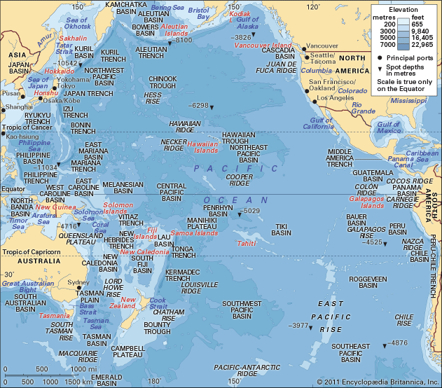
The Great Pacific Garbage Patch is a massive zone in the Pacific Ocean located between Hawaii and California that contains a high concentration of plastic waste.7
Formed by the North Pacific subtropical gyre, this clockwise-rotating current system draws in and traps solid debris from the coasts of the United States and Japan.place/United-States) and Japan. While the patch contains larger items like discarded fishing gear, it is more accurately described as a “soup” of microplastics created by the photodegradation of larger plastic objects over time.78
The patch gained public attention after yachtsman Charles Moore traversed the area in 1997 and reported a vast sea of plastic refuse. Research indicates that the debris is denser than previously expected and poses a severe threat to marine life, as animals can become entangled in the waste or ingest toxic, pollutant-laden plastic particles.798
How do ocean currents impact global climate patterns?
Ocean currents are fundamental to regulating Earth’s climate by acting as a massive heat-distribution system. They transport warm water from the tropics toward the poles and return cold water toward the tropics, significantly moderating regional temperatures.1011
Heat Transport and Regional Climate
The most prominent example is the Gulf Stream, which, along with the North Atlantic Current, carries heat to northwestern Europe. This process keeps the region significantly warmer and more temperate than it would otherwise be at such high latitudes. Similarly, thermohaline circulation—driven by density differences—moves vast volumes of water globally, influencing climate patterns in coastal areas like Iceland.1012
Large-Scale Climate Oscillations
Ocean currents also interact with the atmosphere to drive periodic, large-scale climate phenomena such as the El Niño-Southern Oscillation (ENSO).
- El Niño: Weakened trade winds reduce upwelling of cold, nutrient-rich water in the Pacific, leading to warmer surface temperatures that can disrupt global weather, causing unseasonable warmth or altered precipitation patterns thousands of miles away.1314
- La Niña: Stronger trade winds enhance upwelling, bringing cooler water to the surface and often resulting in cooler, wetter conditions in various regions.1314
Sources
- gyre — Encyclopædia Britannica
- ocean current - Coriolis effect — Encyclopædia Britannica
- Marine ecosystem - Ocean currents — Encyclopædia Britannica
- Ekman layer — Encyclopædia Britannica
- Coriolis force — Encyclopædia Britannica
- ocean current - Geostrophic currents — Encyclopædia Britannica
- Great Pacific Garbage Patch — Encyclopædia Britannica
- Talking Ocean Trash: Ghost Gear Keeps on Fishing — Encyclopædia Britannica
- Single-use plastics — Encyclopædia Britannica
- How Do Ocean Currents Affect the Biosphere? — Encyclopædia Britannica
- What Is the Difference Between El Niño and La Niña? — Encyclopædia Britannica
- thermohaline circulation — Encyclopædia Britannica
- Atmosphere - Effect of oceans on air movement — Encyclopædia Britannica
- Climate - Climate and the oceans — Encyclopædia Britannica
Published on · 3 min read