Harischandra Range
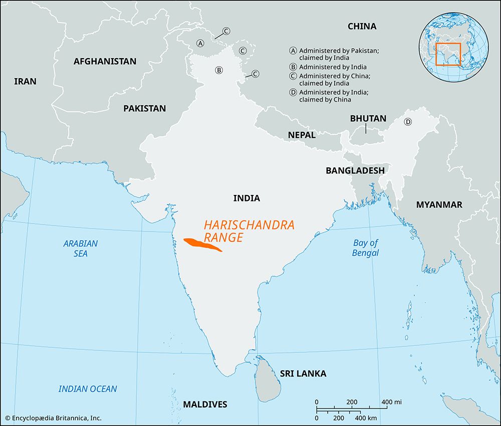
The Harischandra Range is an eastward-extending spur of the Western Ghats located in west-central India. Situated in the northwestern Deccan plateau between…
What is Harischandra Range?
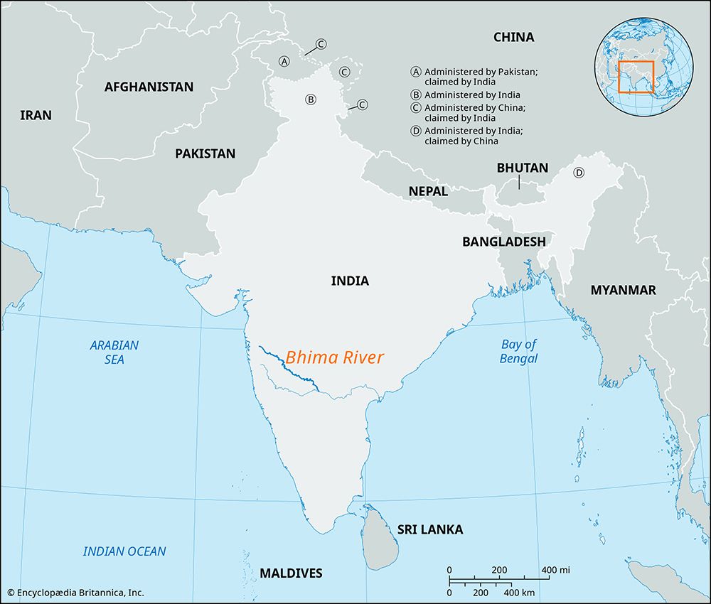
The Harischandra Range is an eastward-extending spur of the Western Ghats located in west-central India. Situated in the northwestern Deccan plateau between the Godavari and Bhima rivers, the range is primarily located within the state of Maharashtra.1
The range is characterized by its flat-topped, basaltic lava composition, with slopes that have weathered into terraces. Its highest peak, Harischandragarh, gives the range its name. While the elevation averages around 2,000 feet (600 metres), it rises higher in the west where it merges with the Western Ghats before gradually decreasing toward the southeast. The mountain slopes support hardwood forests, including teak, along with dense undergrowth of bamboo, cane, ferns, and climbing vines. Ahmadnagar serves as the primary city in the region.1
What are the Western Ghats?
The Western Ghats are a north-south mountain range in western India that forms the crest of the western edge of the Deccan plateau. Running parallel to the Arabian Sea, the range extends from the Tapti River in the north to Cape Comorin in the south, passing through several states including Maharashtra, Karnataka, and Kerala.23
These mountains serve as peninsular India’s principal watershed, trapping moisture from the monsoon winds and significantly influencing the region’s climate. The range is a UNESCO World Heritage site and a recognized biodiversity hot spot, housing over 30 percent of India’s plant, fish, bird, and mammal species, including significant populations of tigers and Asian elephants.23
Geographically, the range features steep seaward slopes and gentler landward slopes. While elevations vary, the highest point is Anai Peak at 8,842 feet (2,695 meters).23
How does basaltic lava shape mountain landscapes?
Basaltic lava plays a significant role in shaping mountain landscapes and plateaus through extensive volcanic activity and subsequent erosion. When voluminous amounts of fluid basaltic lava erupt from fissures, they can bury preexisting terrain to form thick, expansive lava plateaus (also known as flood basalts or traps).45
The physical characteristics of these landscapes are defined by several processes:
- Topographic Formation: Because basaltic lava is fluid, it can travel long distances from its source, creating surfaces that are typically very flat. However, these plateaus are often modified by sharp, deeply incised canyons and valleys carved by water.4
- Differential Erosion: Over time, the differential erosion of these layered lava flows results in distinct landforms, such as steppelike slopes, uniform crest lines, and a characteristic tabletop appearance in many hills.6
- Structural Variations: In specific environments, such as subglacial eruptions, basaltic lava can form steep-sided “table mountains” composed of pillow lavas.5
- Compositional Influence: The chemical properties of basalt, such as its silica content and viscosity, dictate how it flows and accumulates, influencing whether it builds gently sloping shield volcanoes or vast, flat-topped plateaus.57
What is the significance of the Deccan Plateau in India?
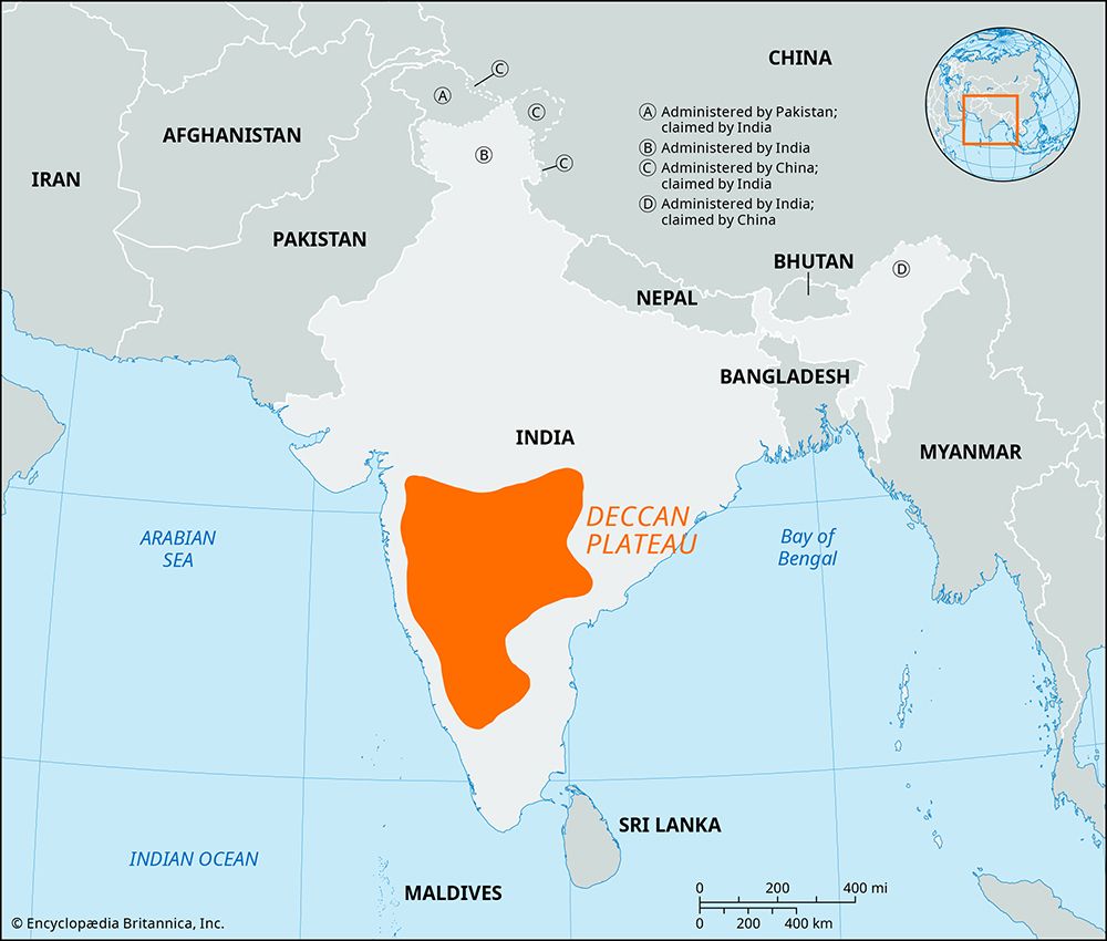
The Deccan Plateau is a vast, triangular tableland in southern India that holds immense geological, historical, and economic significance.
Geological Foundation
As a remnant of the ancient continent of Gondwana, the Deccan is one of the oldest and most geologically stable regions in India. It is famously characterized by the Deccan Traps, a massive series of basaltic lava flows that erupted 60–65 million years ago as the Indian plate passed over a hot spot in the Earth’s mantle.910
Historical and Strategic Importance
The name Deccan derives from the Sanskrit daksina (“south”), and the region has served as a critical crossroads for power throughout Indian history. Its mineral wealth and strategic position made it a frequent target for major powers, including the Mauryan and Gupta dynasties, the Delhi sultanate, and the Mughal Empire. The plateau was the site of significant political shifts, such as the Battle of Talikota, and eventually became a focal point for colonial competition before being integrated into independent India.11
Geography and Economy
The plateau is bounded by the Ghats and serves as a vital watershed. Its major rivers—the Godavari, Krishna, and Kaveri—flow eastward, supporting agriculture in a region where low rainfall historically made farming challenging.11
Sources
- Harischandra Range — Encyclopædia Britannica
- Ghats — Encyclopædia Britannica
- Western Ghats — Encyclopædia Britannica
- plateau - Formative processes — Encyclopædia Britannica
- volcano - Determinants of size and shape — Encyclopædia Britannica
- Maharashtra - Relief, drainage, and soils — Encyclopædia Britannica
- mountain - Geomorphic characteristics — Encyclopædia Britannica
- basalt — Encyclopædia Britannica
- India - The Deccan of India — Encyclopædia Britannica
- Deccan — Encyclopædia Britannica
- plateau - Geographic distribution — Encyclopædia Britannica
- Bhander Plateau — Encyclopædia Britannica
Published on · 3 min read