Holston River
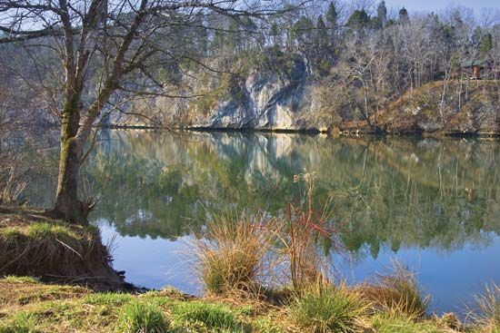
The Holston River is a 115-mile (185-km) waterway located in eastern Tennessee, U.S. It is formed by the junction of its North and South forks just west of…
What is Holston River?
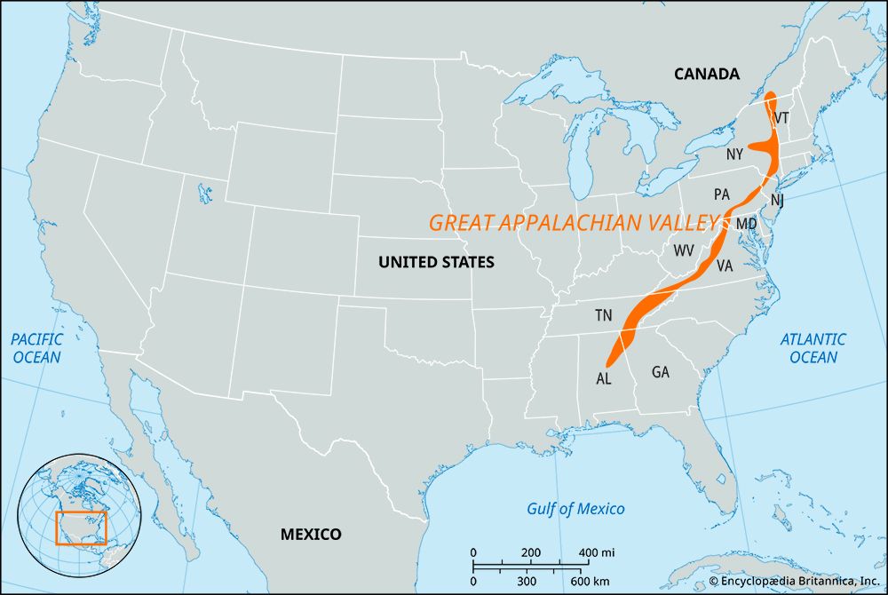
The Holston River is a 115-mile (185-km) waterway located in eastern Tennessee, U.S. It is formed by the junction of its North and South forks just west of Kingsport.1
The river flows southwest through the Great Appalachian Valley and joins the French Broad River near Knoxville to form the Tennessee River1. Named after Stephen Holston, who settled on its banks in 1746, the river is significant for its role in regional infrastructure; it features two major Tennessee Valley Authority (TVA) installations: the Cherokee Dam on the Holston and the South Holston Dam on the South Fork.21
What is the role of the Tennessee Valley Authority in managing rivers?
The Tennessee Valley Authority (TVA) was established in 1933 as a public corporation to manage the Tennessee River system through a comprehensive approach to natural-resource planning. Its primary roles in river management include:
- Flood Control: The TVA manages its system of dams as a unified unit. This strategy has been highly effective, preventing major flood damage along the river since the system’s completion.3
- Navigation Improvements: To facilitate commerce, the agency installed navigation locks in its main dams, deepened river channels, and supported the development of port facilities. These efforts significantly increased river traffic.3
- Power Generation: The agency utilizes hydroelectric stations at its dams to produce electricity, which helped spur industrial growth in the region.3
- Public Health and Conservation: The TVA implemented mosquito eradication programs to eliminate malaria and promoted improved forestry and land conservation practices throughout the drainage basin.3
How do dams and reservoirs help with flood control?
Dams and reservoirs serve as critical components of flood control by managing the natural variability of river flows. Their primary function in this context is to impound excess water during periods of high flow, such as heavy rainfall or snowmelt, which prevents downstream flooding.4
The process works through several key mechanisms:
- Storage and Lag Effect: By collecting water in a reservoir, dams reduce the peak discharge rate of a river. This “lag effect” spreads the volume of a flood over a longer period, preventing the water level from rising to dangerous heights downstream.5
- Controlled Release: Once the threat of flooding has passed, the stored water is released gradually during periods of lower flow, balancing the river’s discharge over time.4
- Spillways: Spillways are essential auxiliary structures that allow for the automatic, safe discharge of surplus water, ensuring that the reservoir level does not exceed safe limits and protecting the dam structure from overtopping.5
- Integrated Systems: In complex river systems like the Mississippi River, reservoirs work alongside levees, floodways, and spillways to manage large-scale flood events.6
What are some other major rivers in the Appalachian region?
The Appalachian region is home to an extensive network of rivers that play vital roles in the geography and history of the eastern United States. Beyond the Tennessee River, several other major rivers are central to the region’s drainage:
- Ohio River: Formed by the confluence of the Allegheny and Monongahela rivers in Pittsburgh, this major artery flows southwest to join the Mississippi River. It serves as a critical commercial waterway and receives water from numerous Appalachian tributaries.2
- New River: Rising in the Blue Ridge Mountains of North Carolina, this river flows northward before turning west across the Appalachian Valley. As it crosses the Alleghenies, it becomes the Kanawha River, eventually emptying into the Mississippi basin.9
- Cumberland River: This river runs parallel to parts of the Tennessee River and is historically significant for its role during the American Civil War.10
- Chattahoochee River: Originating in northeastern Georgia, this river is a notable exception to the general drainage patterns of the region, flowing southwestward into the Gulf of Mexico.9
Sources
- Holston River — Encyclopædia Britannica
- Tennessee River — Encyclopædia Britannica
- Tennessee Valley Authority — Encyclopædia Britannica
- reservoir — Encyclopædia Britannica
- dam - Spillways — Encyclopædia Britannica
- dam - Rise of environmental and economic concerns — Encyclopædia Britannica
- dam - Construction techniques — Encyclopædia Britannica
- Mississippi River - Flood control — Encyclopædia Britannica
- Appalachian Mountains - Drainage — Encyclopædia Britannica
- Appalachian Mountains - Physiography — Encyclopædia Britannica
- Ohio River — Encyclopædia Britannica
Published on · 3 min read