Indian Platform
The Indian Platform is a Precambrian continental shield that served as one of the four foundational blocks around which the Asian continent coalesced.
What is Indian Platform?
The Indian Platform is a Precambrian continental shield that served as one of the four foundational blocks around which the Asian continent coalesced.1
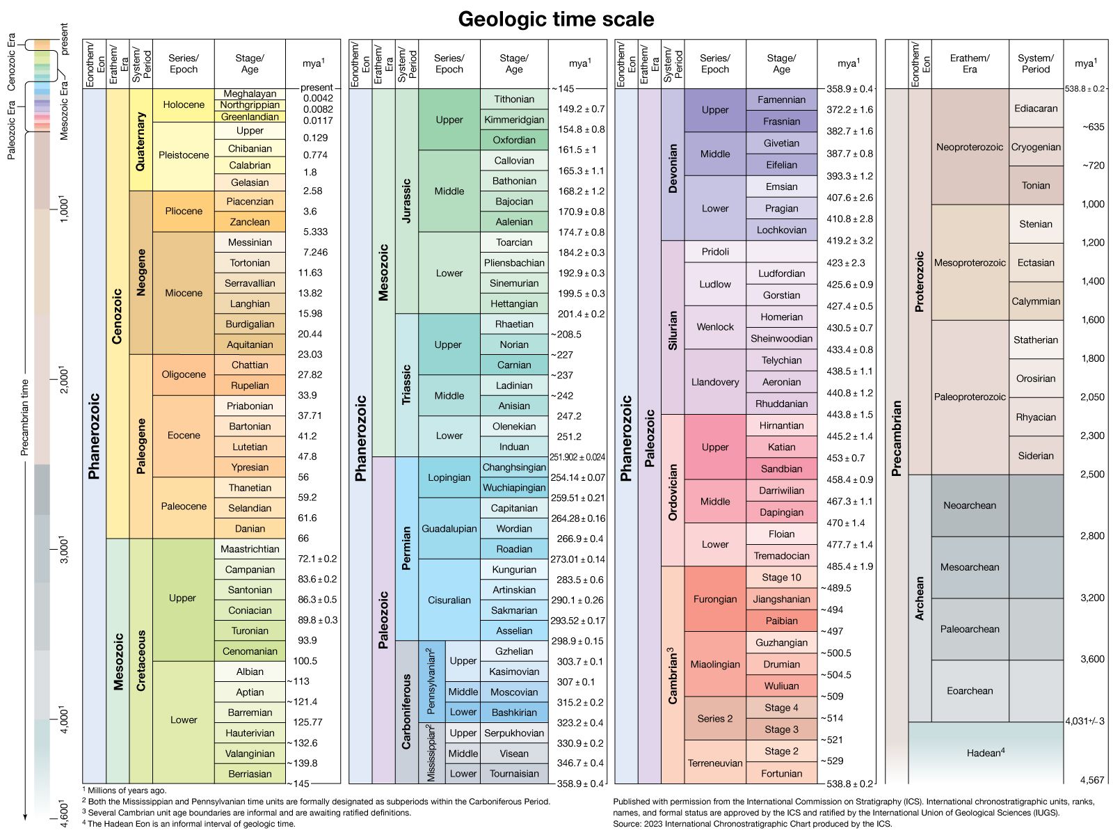
Its basement was consolidated during the Proterozoic era (between 2.5 billion and 542 million years ago) and consists of five distinct areas of geosynclinal folding: the Dharwar, Aravalli, Eastern Ghat, Satpura, and Delhi foldings. Following this consolidation, the platform underwent six major tectonic-stratigraphic sequences, which produced the rock groups of the Cuddapah, Vindhyan, Gondwana, Mesozoic, Paleogene, and Neogene periods.1
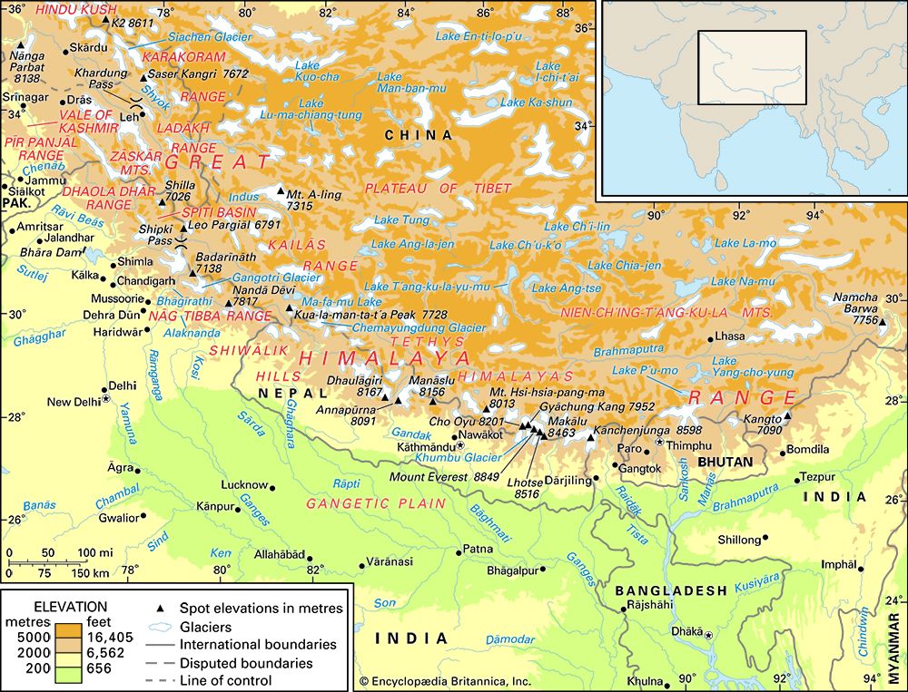
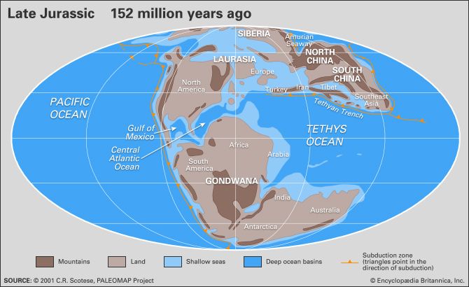
Geologically, this platform is part of the larger Indian-Australian Plate. Millions of years ago, this landmass broke away from the ancient supercontinent of Gondwana and drifted northward, eventually colliding with the Eurasian Plate to form the Himalayas.23
What is the difference between a continental shield and a tectonic plate?
A continental shield and a tectonic plate represent different geological concepts regarding the structure and dynamics of the Earth.
Continental Shield
A continental shield is a large, stable area of low relief within a continent’s crust, composed of ancient Precambrian crystalline rocks. These shields act as the “nuclei” or cores of continents, having formed between 2 and 4 billion years ago. They are characterized by their stability and age, serving as the foundational blocks to which younger rocks have been added over geological time through a process known as accretion.45
Tectonic Plate
A tectonic plate refers to a massive, rigid segment of the Earth’s lithosphere—the planet’s outer shell, which is about 100 km thick. Unlike the stable shield, these plates are dynamic; they move relative to one another at rates of several centimeters per year. Continents are essentially embedded within these plates and drift passively as the plates interact at their boundaries through convergence, divergence, or sliding past one another.6
In short, a shield is a specific, ancient structural component of a continent, while a tectonic plate is a much larger, mobile unit of the Earth’s outer shell that carries continents and ocean basins across the globe.56
How did the breakup of the supercontinent Gondwana affect the formation of India?
The breakup of the supercontinent Gondwana was the primary driver of India’s geological formation and its current geographic position.
Following the fragmentation of Gondwana, which began in stages during the Jurassic Period, India separated from Antarctica and Australia approximately 140 million years ago, opening the central Indian Ocean. Later, during the Late Cretaceous Period, India broke away from Madagascar and began its northward drift as part of the Indian-Australian Plate.91011
The most significant consequence of this movement occurred approximately 50 million years ago when India collided with the Eurasian Plate. This collision resulted in:911
- Mountain Building: The northern edge of the Indian plate was thrust beneath Eurasia, scraping off crustal rock to form the Himalayas.211
- Crustal Subsidence: The immense weight of the new mountains and their eroded sediments forced the Indian plate downward, creating a zone of subsidence that eventually became the Indo-Gangetic Plain.11
What role do the Indo-Gangetic Plain’s sediments play in understanding the region’s history?
The sediments of the Indo-Gangetic Plain serve as a vital geological record of the region’s history, primarily documenting the intense tectonic activity associated with the rise of the Himalayas.
As the Indian plate collided with Eurasia, the resulting uplift triggered massive erosion. Rivers such as the Indus, Ganges, and Brahmaputra transported vast quantities of debris from the rising mountains, depositing them into a subsiding basin. The weight of these alluvial deposits created further depressions, allowing for sediment accumulation that in some areas exceeds 25,000 feet (7,600 meters) in depth.13
These sediments provide a chronological map of the region’s evolution:
- Tectonic History: The layers of alluvium reflect the tempo of mountain building, with older deposits often found within thrust-faulted structures known as nappes.3
- Agricultural Foundation: The deposition of khadar (new alluvium) and bhangar (old alluvium) has created the fertile soils that have sustained the region’s dense populations for millennia.3
- Hydrological Record: The sandy aquifers within these sediments hold significant groundwater reserves, which are essential to the region’s modern productivity.3
Sources
- Indian Platform — Encyclopædia Britannica
- India - Relief — Encyclopædia Britannica
- Himalayas - Geologic history — Encyclopædia Britannica
- continent — Encyclopædia Britannica
- continental shield — Encyclopædia Britannica
- plate tectonics — Encyclopædia Britannica
- plate tectonics - Convergent margins — Encyclopædia Britannica
- plate tectonics - Continental rifting — Encyclopædia Britannica
- Gondwana — Encyclopædia Britannica
- mountain - The Himalayan chain — Encyclopædia Britannica
- Pangea — Encyclopædia Britannica
- Climate change - Amplification of the Indian Ocean monsoon — Encyclopædia Britannica
- Indo-Gangetic Plain — Encyclopædia Britannica
- alluvial deposit — Encyclopædia Britannica
- India - Alluvial soils — Encyclopædia Britannica
Published on · 3 min read