Patuca River
The Patuca River is a major waterway located in northeastern Honduras. It is formed southeast of Juticalpa through the confluence of the Guayape and…
What is Patuca River?
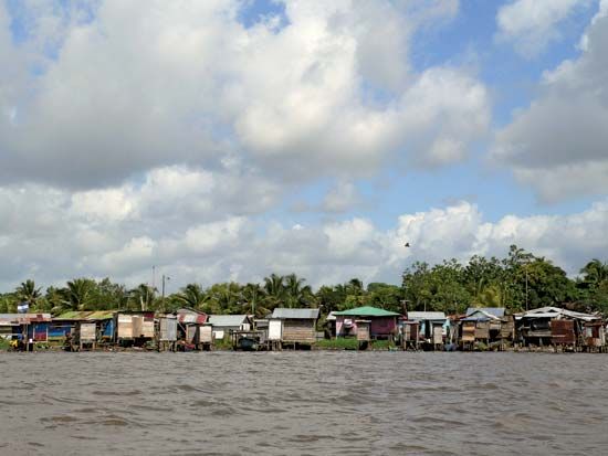
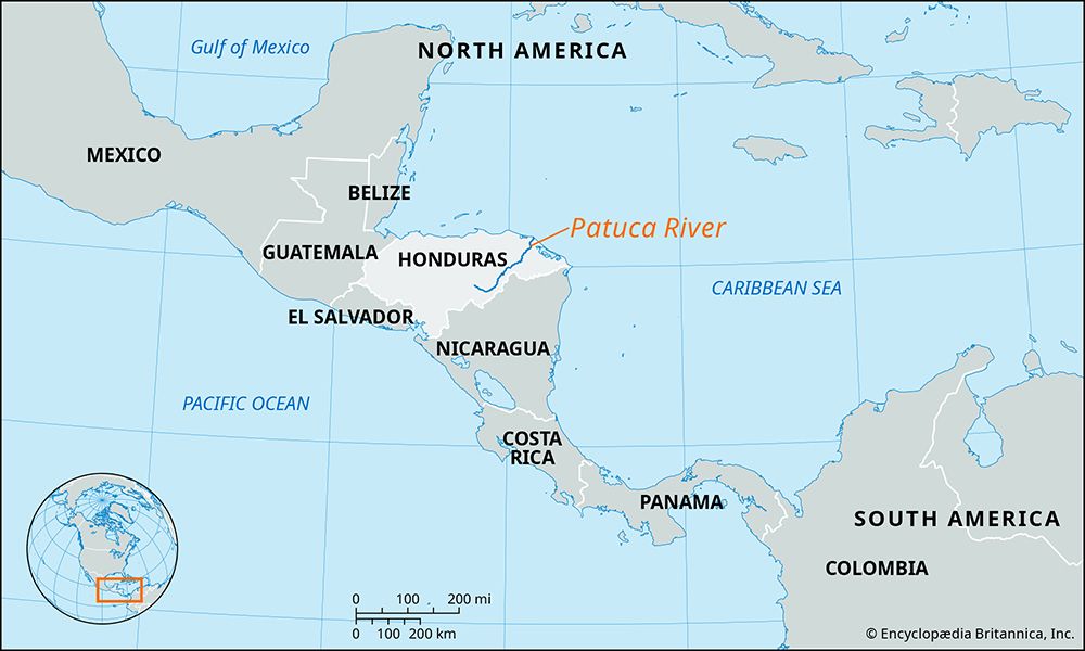
The Patuca River is a major waterway located in northeastern Honduras. It is formed southeast of Juticalpa through the confluence of the Guayape and Guayambre rivers. From there, it flows northeast for approximately 200 miles (320 km), traversing the highlands and the Mosquito Coast before emptying into the Caribbean Sea at Patuca Point.1
The river’s path is characterized by several sets of rapids, including the notable Portal del Infierno, or “gate of hell.” In its lower, navigable reaches, the river serves as a vital artery for transportation and communication for isolated local communities. Additionally, it is used to transport timber harvested from the surrounding tropical rain forests.1
What is the Mosquito Coast known for?
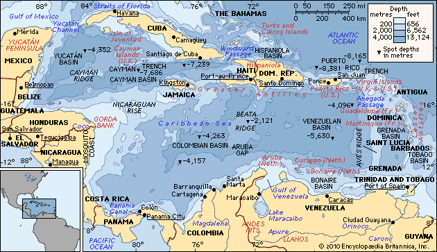
The Mosquito Coast, also known as the Miskito Coast or La Mosquitia, is a lowland region stretching approximately 225 miles along the Caribbean Sea in eastern Nicaragua and Honduras.23
The region is primarily known for the following:
- Indigenous Heritage: It is named for the Miskito people, who constitute the majority of the population. Their culture has been shaped by long-standing European contact and intermarriage with Africans.24
- Colonial History: Although visited by Columbus in 1502, the area became a focal point for 17th-century buccaneers. The English subsequently established a protectorate over the Miskito, leading to long-standing territorial disputes between Spain, Nicaragua, Great Britain, and the United States, which were eventually addressed by the Clayton-Bulwer Treaty of 1850.2
- Modern Centers: The principal city is Bluefields, with other notable centers including Puerto Cabezas and San Juan del Norte.2
How do tropical rain forests impact river ecosystems?
Tropical rain forests play a critical role in regulating river ecosystems by acting as natural filters and stabilizers within the hydrologic cycle. Their impact is primarily observed through the following mechanisms:
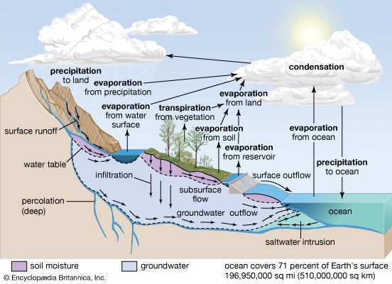
- Water Regulation and Quality: Forests function as sponges and filters, ensuring that water entering river systems is relatively pure, high in oxygen, and low in temperature. By intercepting precipitation and regulating soil infiltration, they promote gradual, reliable streamflow, which helps mitigate the risk of floods compared to unforested land.5
- Erosion Control: The maintenance of continuous forest cover is essential for protecting watersheds. Tree roots and litter layers stabilize soil, preventing excessive sediment from entering rivers. When forest canopies are removed, the resulting increase in turbidity and sediment from logging roads can significantly degrade water quality.5
- Nutrient Cycling: In tropical rain forests, high rainfall leads to the leaching of nutrients from the soil into streams and rivers. While this process contributes to the nutrient content of the water, the forest structure itself—including dense vegetation and epiphytes—moderates the microclimate and regulates the amount of water that reaches the forest floor.6
- Riparian Interaction: Tropical rain forests often interface with riparian wetlands, which interact laterally with river channels. These areas are vital for managing the periodic overflow of rivers and supporting diverse plant life adapted to flooding.7
What are some other major rivers in Central America?
Central America features several significant river systems that drain its mountainous terrain into the Caribbean Sea and the Pacific Ocean. Notable rivers include:
- Coco River: Stretching 485 miles (780 km), this is a major river in the region, forming much of the international boundary between Honduras and Nicaragua before emptying into the Caribbean.89
- Usumacinta River: Flowing through southeastern Mexico and northwestern Guatemala, this river system is approximately 600 miles (1,000 km) long and serves as a vital waterway for the region’s lowlands.10
- Lempa River: A principal river system in El Salvador, it flows from Guatemala through the interior plains and highlands of El Salvador before reaching the Pacific.11
- San Juan River: Located in the south, this 124-mile (200-km) river serves as a distributary for Lake Nicaragua, flowing into the Caribbean.8
- Other Notable Rivers: Nicaragua also features the Río Grande de Matagalpa, the Prinzapolka, and the Escondido rivers. In Costa Rica, the Reventazón River drains into the Caribbean, while the Grande de Tárcoles flows into the Pacific.812
Sources
- Patuca River — Encyclopædia Britannica
- Mosquito Coast — Encyclopædia Britannica
- Mosquito Coast — Merriam-Webster
- Miskito — Encyclopædia Britannica
- forestry - Watershed management and erosion control — Encyclopædia Britannica
- Tropical rainforest - Environment — Encyclopædia Britannica
- Wetland - Riparian wetlands — Encyclopædia Britannica
- El Salvador - Rivers and lakes — Encyclopædia Britannica
- Usumacinta River — Encyclopædia Britannica
- Nicaragua - Drainage — Encyclopædia Britannica
- South America - Rivers of South America — Encyclopædia Britannica
- Coco River — Encyclopædia Britannica
- Costa Rica - Relief — Encyclopædia Britannica
Published on · 3 min read