Ria
A ria is a funnel-shaped estuary formed by the submergence of the lower portion of a river valley. These features typically occur along rugged coastlines…
What is ria?
A ria is a funnel-shaped estuary formed by the submergence of the lower portion of a river valley. These features typically occur along rugged coastlines where the land is perpendicular to a mountain chain.1
Many rias were created following the last glacial period, as rising sea levels—caused by the melting of continental glaciers—flooded existing river valleys. Because of their widening, funnel-like shape and increasing depth toward the sea, rias often experience exaggerated tidal effects. They are frequently characterized by an irregular appearance and multiple branching tributaries, serving as the primary drainage systems for the surrounding landscape.1
Please note that “RIA” is also a common abbreviation for radioimmunoassay, a laboratory technique used to measure the concentration of antigens or antibodies in a sample.2
How do rising sea levels affect coastlines?
Rising sea levels significantly alter coastlines through physical inundation, increased erosion, and the contamination of freshwater resources. As global temperatures rise, the combination of thermal expansion and the melting of polar ice sheets and mountain glaciers causes sea levels to climb, threatening approximately 40 percent of the world’s population living in vulnerable coastal areas.341
Key Impacts on Coastlines
- Inundation and Flooding: Rising waters lead to more frequent and intense coastal flooding. High-tide flooding, in particular, has increased by 300 to over 900 percent since 1975, inundating low-lying communities and infrastructure.34
- Saltwater Intrusion: As sea levels rise, salt water encroaches into groundwater supplies and aquifers. This contamination ruins wells, threatens drinking water, and harms agriculture by causing freshwater salinization, which can lead to soil degradation and the loss of arable land.35
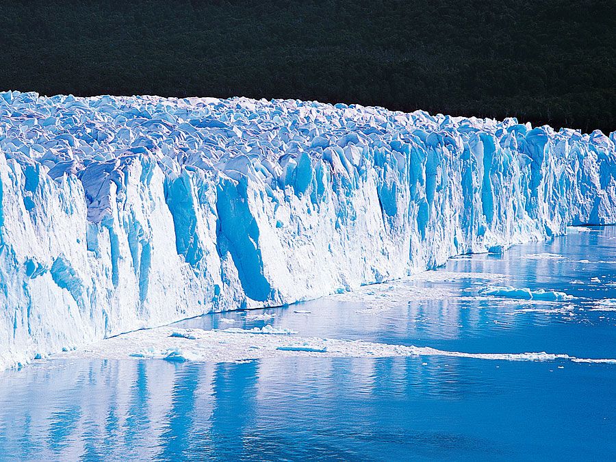
- Erosion and Ecosystem Disruption: Higher sea levels distribute wave energy across a wider shore zone, accelerating erosion. This process disrupts coastal ecosystems, often replacing productive farmland with brackish marshes and threatening the survival of local plant and animal life.346
What is the difference between a ria and a fjord?
While both rias and fjords are coastal inlets formed by the submergence of valleys, they differ fundamentally in their geological origins and physical characteristics.
Key Differences
- Formation: A ria is a river valley that has been submerged by rising sea levels, typically following the melting of continental glaciers. In contrast, a fjord is formed by the marine inundation of a U-shaped valley carved by a glacier.18
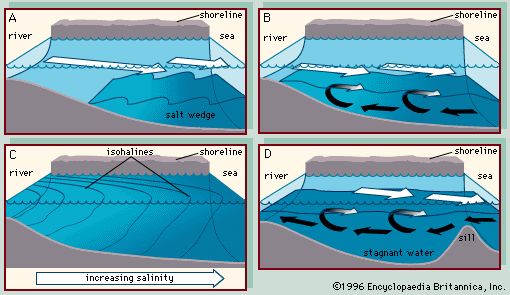
- Shape and Depth: Rias are generally funnel-shaped, widening and deepening toward the sea. Fjords are typically long, narrow, and exceptionally deep, often featuring a shallow ridge or “sill” at their mouth composed of glacial deposits. This sill can trap stagnant water in the basin.189
- Topography: Rias often feature irregular, branching tributaries and serve as major drainage systems for the surrounding land. Fjords are characterized by steep, vertical cliffs and deep water close to the shore, a result of the intense erosive power of ancient glaciers.18
How do tides behave in funnel-shaped estuaries?
In funnel-shaped estuaries with large tidal ranges, the incoming tide can be confined to a narrow channel, leading to the formation of a tidal bore. This phenomenon manifests as a well-defined “wall of water” or a series of waves that rushes upstream, often traveling significantly faster than normal tidal currents.12
The behavior of tides in these constricted environments is characterized by several distinct features:
- Abrupt Flow Reversal: As the bore passes, the water flow changes direction abruptly. Before its arrival, the water may be still or flowing seaward, but behind the bore, the current shifts to flow upriver.12
- Wave Dynamics: The bore is preceded by a wave front that collects the still water in front of it and sets it in motion. The water surface behind this wave is higher than the water level in front of it.12
- Momentum: Due to the momentum of the incoming water, the upstream flow often continues for approximately 30 minutes after the time of high water.12
- Intensity: These events occur during spring tides and are most pronounced where the channel geometry forces the tide into a confined space, such as in the Severn or the Qiantang River Qiantang River.13
Sources
- ria — Encyclopædia Britannica
- RIA — Merriam-Webster
- saltwater intrusion — Encyclopædia Britannica
- sea level rise: Top Questions — Encyclopædia Britannica
- Global warming - Ice melt and sea level rise — Encyclopædia Britannica
- salinity — Encyclopædia Britannica
- coastal landforms - Tides — Encyclopædia Britannica
- fjord — Encyclopædia Britannica
- fjord — Merriam-Webster
- estuary - Fjords — Encyclopædia Britannica
- Oslo Fjord — Encyclopædia Britannica
- estuary - Partially mixed estuaries — Encyclopædia Britannica
- tidal bore — Encyclopædia Britannica
- river - Origin and classification — Encyclopædia Britannica
Published on · 3 min read