Sierra Nevada
The Sierra Nevada range in California is home to several iconic national parks and protected areas, many of which were established to preserve the region's…
What are some of the major national parks and protected areas within the Sierra Nevada?
The Sierra Nevada range in California is home to several iconic national parks and protected areas, many of which were established to preserve the region’s unique giant sequoia groves and dramatic glacial landscapes.1234
Major National Parks
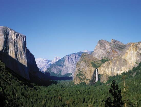
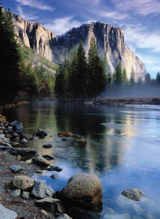
- Yosemite National Park: Famous for its U-shaped valleys, granite domes like El Capitan, and massive waterfalls, this park is a UNESCO World Heritage site.4
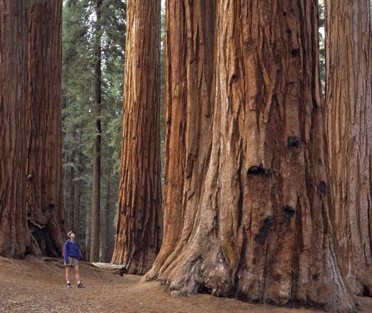
- Sequoia National Park: Established in 1890, it protects the world’s largest trees by volume, including the General Sherman Tree2.
- Kings Canyon National Park: Adjacent to Sequoia, this park features deep glacial canyons and the extensive Redwood Mountain Grove.3
Protected Areas and National Monuments
- Giant Sequoia National Monument: Located within Sequoia National Forest, this monument protects numerous groves of giant sequoias.12
- Devils Postpile National Monument: Situated near the eastern edge of Sierra National Forest, it is known for its unique basalt columns.54
These areas are connected by extensive trail systems, including the Pacific Crest National Scenic Trail, which traverses much of the Sierra Nevada.12534
How were the Sierra Nevada mountains formed, and what is their geological history?
The geological history of the Sierra Nevada is a complex process involving ancient mountain-building events and more recent tectonic uplift.
Early Formation: The Nevadan Orogeny
The foundation of the range began approximately 156 million years ago during the Nevadan orogeny. This event was driven by the subduction of oceanic crust beneath the North American continent. This process led to the formation of vast batholiths—massive bodies of igneous rock like granite that solidified deep underground—which now form the core of the Sierra Nevada.
Uplift and Asymmetry
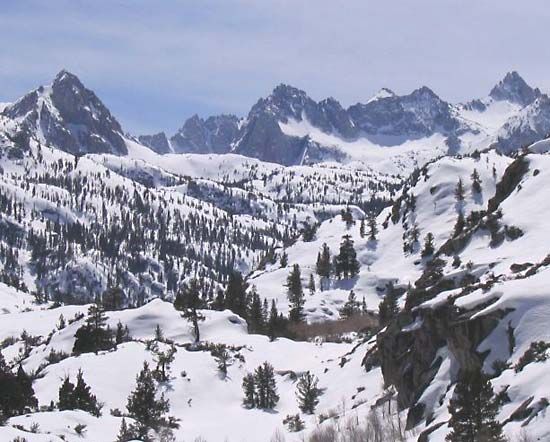
The modern range is characterized as an upfaulted, tilted block of the Earth’s crust. A major fault zone along the eastern edge caused the massive block to tilt westward, creating the range’s distinct asymmetry: a steep, abrupt eastern escarpment and a gentler western slope. While this uplift began millions of years ago, a significant portion of the elevation gain occurred within the last two million years.
Glacial Sculpting
During the Pleistocene Epoch, repeated glacial cycles profoundly altered the landscape. Glaciers carved deep, U-shaped valleys and created features such as cirques and glacial lakes, which define much of the current high-altitude scenery.
What is the geographical location and extent of the Sierra Nevada mountain range?
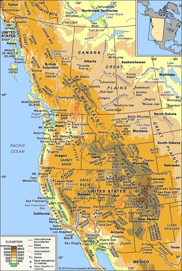
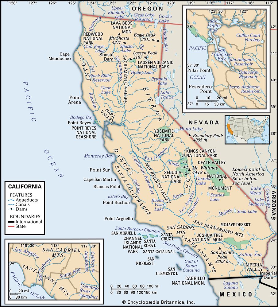
The Sierra Nevada is a major mountain range in western North America, situated along the eastern edge of California. Its geographical extent is defined by its position between the Central Valley to the west and the Basin and Range Province to the east.512
The range stretches approximately 430 miles (700 km) from the vicinity of Lassen Peak in the north to the fringes of Los Angeles in the south. Its width varies significantly, measuring about 80 miles wide near Lake Tahoe and narrowing to roughly 50 miles in the south.125
Geologically, the range is characterized by a dramatic asymmetry: it features a sheer, abrupt eastern escarpment that rises sharply from the Trans-Sierra desert, while the western slope descends in gradually declining foothills toward the Central Valley. The range reaches its highest point at Mount Whitney, which stands at 14,494 feet (4,418 meters) above sea level.12
What are some of the most notable peaks and natural features in the Sierra Nevada?
The Sierra Nevada is renowned for its dramatic topography, shaped by millions of years of tectonic activity and glacial erosion. Some of its most notable features include:
Notable Peaks
- Mount Whitney: At 14,494 feet (4,418 meters), it is the highest peak in the contiguous United States. Its summit is a unique, gently sloping tablelike surface.1314
- Mount Lyell: Located in the southeastern area of Yosemite National Park, it is the park’s highest summit at 13,114 feet (3,997 meters).6
- El Capitan: A massive granite buttress in Yosemite Valley that rises 3,600 feet above the valley floor.6
- Half Dome: An iconic granite dome in Yosemite reaching 8,836 feet (2,693 meters).6
Natural Features
- Lake Tahoe: The largest and deepest alpine lake in the world, known for its stunning clarity and surrounding mountain scenery.8
- Yosemite Valley: A world-famous U-shaped valley carved by glaciers, featuring sheer rock walls and numerous waterfalls, including the towering Yosemite Falls.68
- Devils Postpile National Monument: A site known for its unique columnar basalt formations.67
Sources
- Sequoia National Forest and Giant Sequoia National Monument — Encyclopædia Britannica
- Sequoia National Park — Encyclopædia Britannica
- Sierra National Forest — Encyclopædia Britannica
- Kings Canyon National Park — Encyclopædia Britannica
- Sierra Nevada — Encyclopædia Britannica
- Yosemite National Park — Encyclopædia Britannica
- Sierra Nevada - The people and economy — Encyclopædia Britannica
- Sierra Nevada - Drainage and glaciation — Encyclopædia Britannica
- Sierra Nevada - Geology — Encyclopædia Britannica
- Nevadan orogeny — Encyclopædia Britannica
- batholith — Encyclopædia Britannica
- California - Relief — Encyclopædia Britannica
- Sierra Nevada - Physiography — Encyclopædia Britannica
- Mount Whitney — Encyclopædia Britannica
- Tioga Pass — Encyclopædia Britannica
- Donner Pass — Encyclopædia Britannica
Published on · 4 min read