Grand Canyon
The Grand Canyon ecosystem hosts a diverse array of flora and fauna, shaped by the region's varying elevations and climates.
What flora and fauna can be found in the Grand Canyon ecosystem?
The Grand Canyon ecosystem hosts a diverse array of flora and fauna, shaped by the region’s varying elevations and climates.
Fauna
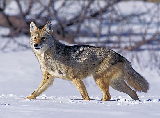
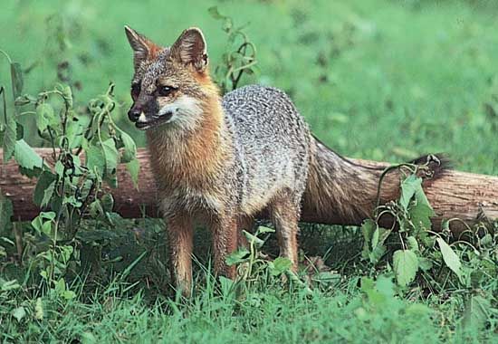
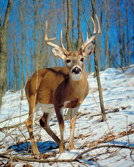
Animal life is abundant throughout the canyon. Common mammals include coyotes, foxes, deer, bobcats, badgers, rabbits, squirrels, chipmunks, and kangaroo rats. Bird species are also prominent, featuring raptors like bald eagles, peregrine falcons, and the rare California condor. Aquatic life includes trout and the endangered humpback chub.1
Flora
Plant distribution varies significantly by location:
- Canyon Bottom: Features water-dependent species like willows and cottonwoods, alongside drought-resistant yuccas, agaves, cactus, and the invasive tamarisk.
- South Rim: Characterized by ponderosa pine forests, piñon pine, juniper, scrub oak, and sagebrush.
- North Rim: Home to wetter forest communities including Douglas fir, blue spruce, and aspen1.
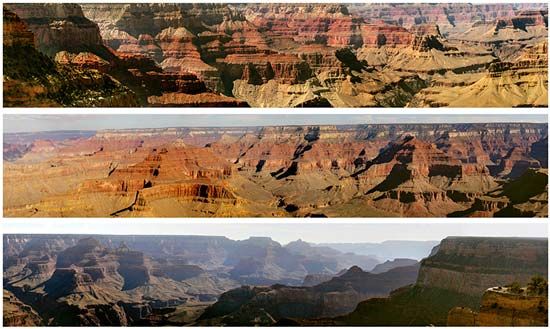
How do the different rock layers in the Grand Canyon reveal Earth’s history?
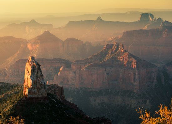
The Grand Canyon provides an unparalleled record of Earth’s geologic history through its exposed rock strata, which function as a chronological archive of the planet’s past.23
The Geologic Sequence
The canyon’s walls reveal a complex timeline, though the record is punctuated by significant time gaps caused by erosion or periods of non-deposition. The sequence includes:3
- Inner Gorge: At the base lie Archean granite and schist, dating back more than 2.5 billion years.3
- Proterozoic Layers: Overlying the ancient basement are limestones, sandstones, and shales from the Precambrian time, which are more than 540 million years old.34
- Paleozoic Strata: These layers, representing a 300-million-year depositional period, form the bulk of the canyon walls.3
- Missing Eras: A notable gap exists where Mesozoic Era rocks—which should logically overlie the Paleozoic strata—have been entirely removed by erosion.3
- Recent Activity: The most recent additions include volcanic cones and lava flows, some of which are less than 1,000 years old.3
Through stratigraphy, geologists interpret these layers to reconstruct Earth’s history, using principles like the law of superposition to determine the relative age of deposits.5
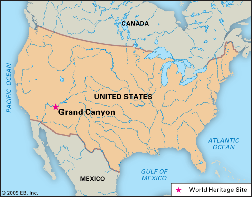
How has the Colorado River shaped the Grand Canyon over time?
The Colorado River is the primary force behind the formation of the Grand Canyon, having begun its carving process approximately six million years ago.63
Mechanisms of Formation
The river’s ability to cut through the Colorado Plateau is driven by several factors:
- Erosive Power: The river’s rapid flow, combined with a heavy load of mud, sand, and gravel, acts as a powerful cutting tool. Before the construction of the Glen Canyon Dam, the river transported an average of 500,000 tons of sediment daily.63
- Tectonic Uplift: The uplift of the Colorado Plateau steepened the river’s path, providing the necessary energy for the water to entrench itself deep into the earth, eventually reaching depths of over a mile.63
- Widening Forces: While the river cuts downward, the canyon’s vast width is the result of secondary forces, including rain, wind, temperature fluctuations, and chemical erosion. These elements wear away softer rock layers, while the region’s semiarid climate prevents the walls from eroding away entirely, preserving the canyon’s dramatic, stair-step topography.63
What are the climate conditions in the Grand Canyon, and how do they vary throughout the year?
The Grand Canyon is characterized by a semiarid climate, which is essential for preserving the canyon’s unique stair-step topography and preventing the rapid erosion of its walls. Climate conditions vary significantly based on elevation and location within the canyon.13
Temperature and Precipitation
- Canyon Bottom: The floor of the canyon experiences extreme heat during the summer, with temperatures reaching highs of 120 °F (49 °C).3
- Canyon Rims: The rims experience cooler temperatures and higher precipitation. The South Rim receives approximately 15 inches (380 mm) of annual precipitation, while the North Rim is wetter, receiving about 26 inches (660 mm) annually.3
Seasonal Variations
The region is subject to a summer monsoon season, which introduces a period of increased instability. During this time, intense thunderstorms can occur, leading to the risk of flash floods. These sudden, powerful floods can rapidly collect in narrow canyons and creeks, posing significant hazards to visitors due to the movement of debris, mud, and rocks. Outside of these monsoon events, the area generally remains dry, supporting desert-adapted vegetation such as cacti, agaves, and yuccas.23
Sources
- Grand Canyon - Biological past and present — Encyclopædia Britannica
- Grand Canyon: Top Questions — Encyclopædia Britannica
- Grand Canyon - Geologic history — Encyclopædia Britannica
- Grand Canyon Series — Encyclopædia Britannica
- stratigraphy — Encyclopædia Britannica
- How was the Grand Canyon formed? — Encyclopædia Britannica
Published on · 4 min read