Gundlakamma River
The Gundlakamma River is a waterway located in the east-central region of Andhra Pradesh state in southern India.
What is Gundlakamma River?
The Gundlakamma River is a waterway located in the east-central region of Andhra Pradesh state in southern India.1
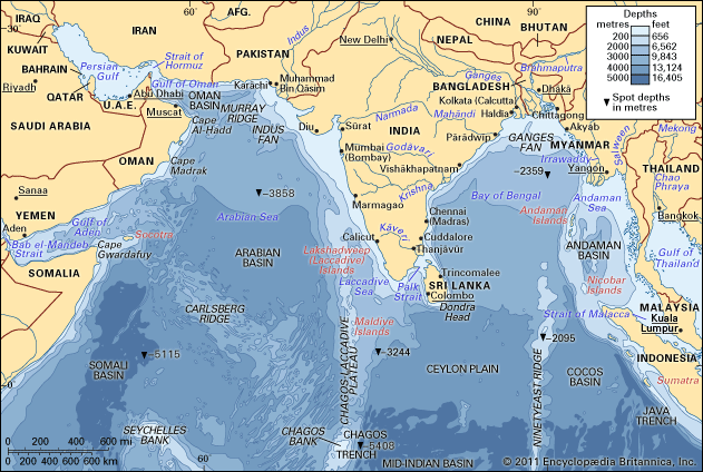
The river originates in the Nallamalla Range of the Eastern Ghats. Upon exiting the mountains, it traverses the plains in a northeasterly direction, passing the town of Markapur. The river flows for a total course of 140 miles (225 km) before emptying into the Bay of Bengal along the Coromandel Coast, specifically at a point 12 miles (19 km) east of Ongole.1
What are the Eastern Ghats?
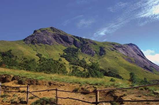
The Eastern Ghats are a series of discontinuous and dissimilar hill masses that form the eastern edge of the Deccan plateau in peninsular India. These mountains trend generally northeast-southwest along the Bay of Bengal, separated from the coast by a strip of level land.2
The range is relatively narrow, with an average elevation of about 2,000 feet (600 meters), though some peaks reach 4,000 feet (1,200 meters) or higher. The highest point is Arma Konda, located in Andhra Pradesh, which reaches 5,512 feet (1,680 meters). The chain is interrupted by a 100-mile-wide gap through which the Krishna and Godavari rivers flow toward the coast. Toward the southwest, the range continues as a series of low hills, including the Javadi and Shevaroy hills, before eventually merging with the Western Ghats. The slopes of these mountains are characterized by sparse forests that contain valuable timber.2
How do rivers in India support agriculture?
Rivers are fundamental to Indian agriculture, serving as a primary source of surface water for irrigation and supporting the livelihoods of roughly half the population.56
Irrigation Systems
The development of large-scale canal systems, initiated during the 19th century and expanded significantly after independence, allows for the distribution of river water to vast agricultural tracts.67
- Canal Networks: Major projects, such as those on the Ganges and Indus rivers, utilize gravity canals and barrages to irrigate cash crops like sugarcane, cotton, and oilseeds.87
- Dams and Barrages: Structures like the Harike Barrage channel water into extensive systems like the Indira Gandhi Canal, transforming arid regions into productive farmland.8
- Deltaic Agriculture: In the fertile deltas of rivers like the Godavari and Krishna, navigable canal systems have created some of the country’s most productive rice-growing areas.9
Regional Variations
Water availability is highly seasonal, largely dependent on the monsoon.610
- Northern India: The Indo-Gangetic Plain benefits from the relatively stable flow of Himalayan rivers and vast groundwater reserves, supporting intensive cultivation.611
- Peninsular India: In the south, agriculture relies more heavily on seasonal rainfall and smaller reservoirs, as hard rock formations often limit groundwater access.611
While these systems have enabled the Green Revolution, improper management—such as excessive irrigation without adequate drainage—can lead to soil waterlogging and salt buildup, posing long-term risks to land fertility.86
What is the geography of the Coromandel Coast?
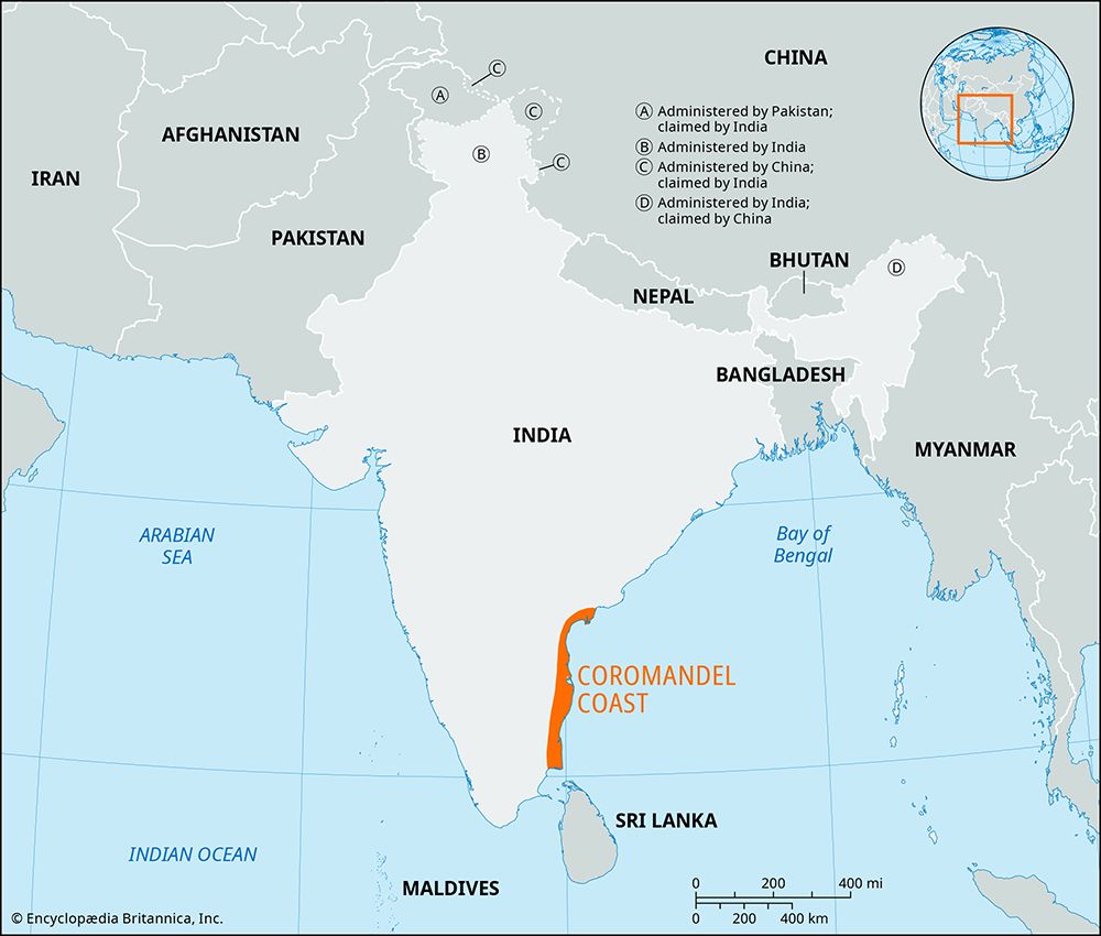
The Coromandel Coast is a broad coastal plain located in the eastern part of the Indian state of Tamil Nadu. Covering approximately 8,800 square miles (22,800 square km), the region is bounded by the Utkal Plains to the north, the Bay of Bengal to the east, the Kaveri delta to the south, and the Eastern Ghats to the west.13
The geography of the coast is characterized by an average elevation of 264 feet (80 meters) and a relatively straight shoreline featuring sandbars and an offshore chain of coral islands. The interior is backed by the Eastern Ghats, a chain of low, flat-topped hills. While the region experiences little forest cover, it contains marshes, swamps, scrub woodlands, and thorny thickets. Several rivers, including the Palar, Ponnaiyar, and Cheyyar, flow through the area but remain dry for most of the year.13
Sources
- Gundlakamma River — Encyclopædia Britannica
- Ghats — Encyclopædia Britannica
- Eastern Ghats — Merriam-Webster
- Western Ghats — Encyclopædia Britannica
- water infrastructure in India - Major sources of water — Encyclopædia Britannica
- Indus River - Irrigation of the Indus River — Encyclopædia Britannica
- India - Agriculture — Encyclopædia Britannica
- Ganges River - Irrigation — Encyclopædia Britannica
- South Asia: Top Questions — Encyclopædia Britannica
- Indian monsoon - Monsoon withdrawal — Encyclopædia Britannica
- economy of India - Agriculture — Encyclopædia Britannica
- Godavari River — Encyclopædia Britannica
- Coromandel Coast — Encyclopædia Britannica
- Coromandel — Merriam-Webster
- Coromandel Peninsula — Encyclopædia Britannica
Published on · 3 min read