Kuma-Manych Depression
The Kuma-Manych Depression is a geologic feature located in western Russia. It serves as the dividing line between the Russian Plain to the north and the…
What is the Kuma-Manych Depression and where is it located in Russia?
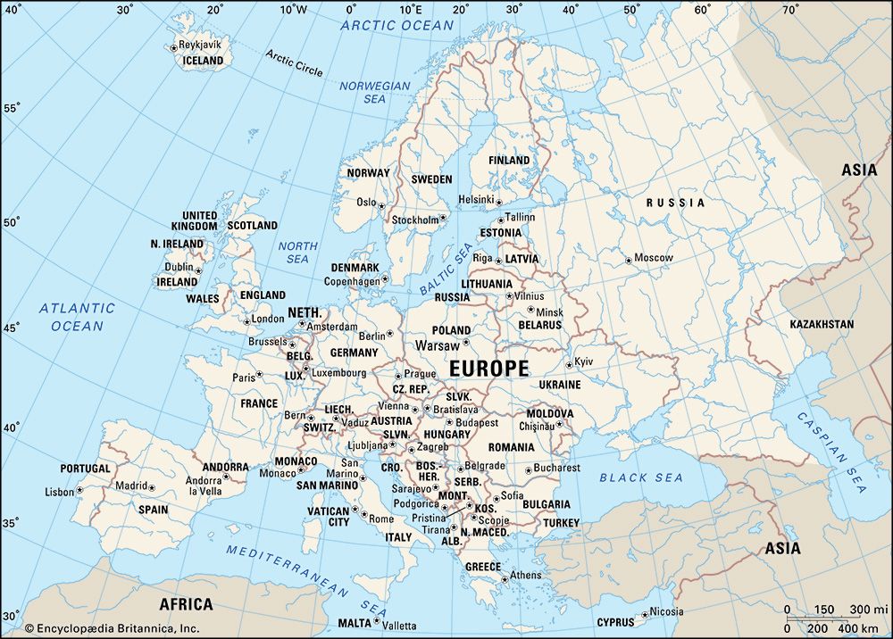
The Kuma-Manych Depression is a geologic feature located in western Russia. It serves as the dividing line between the Russian Plain to the north and the North Caucasus foreland to the south, and it is widely considered the natural boundary between Europe and Asia.1
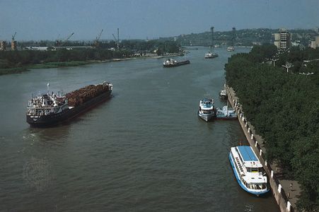
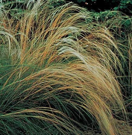
Stretching northwest to southeast from the Don River valley to the Caspian lowlands, the depression typically measures 12–19 miles (20–30 km) in width, though it narrows significantly in its center. The landscape is defined by numerous salt lakes, including the Manych-Gudilo, and is characterized by semiarid vegetation such as feather grass. While the region is naturally drained by the Zapadny Manych, Vostochny Manych, and Kuma rivers, water flow has been augmented by the construction of the Kuma-Manych Canal to support local crop irrigation.1
What role did the Kuma-Manych Depression play in ancient water connections between seas?
The Kuma-Manych Depression, historically referred to as the Manych Trench, served as a vital structural link between the Caspian Sea and the Black Sea.
Geologically, this connection existed until the beginning of the late Miocene Epoch, approximately 13.8 million years ago. Following a period of tectonic uplift, the Caspian Sea became an enclosed basin. However, this oceanic connection was temporarily reestablished during the early Pleistocene Epoch, roughly 2.6 million years ago. During this time, it is also hypothesized that a northern link may have existed across the Russian Plain connecting to the Barents Sea of the Arctic Ocean. These ancient water pathways were fundamental to the shifting geography and marine connectivity of the region long before the modern landscape was formed.1
What is the significance of the Kuma-Manych Depression in defining the boundary between Europe and Asia?
The Kuma-Manych Depression is significant as a primary geographic marker used to delineate the boundary between Europe and Asia. While the division of the Eurasia landmass is a historical and cultural construct rather than a strictly physical one, geographers have reached a consensus on a specific borderline to provide clarity.1
Following this convention, the boundary runs south from the Arctic Ocean along the Ural Mountains and the Emba River to the Caspian Sea. West of the Caspian, the line follows the Kuma-Manych Depression toward the Sea of Azov and the Black Sea. By utilizing this depression, the boundary effectively places the Caucasus region within Asia, while territories to the north and west are categorized as part of Europe.1
How does the Kuma-Manych Depression relate to the Caspian Sea and the Black Sea?
The Kuma-Manych Depression is a geologic feature in western Russia that serves as a structural link between the Caspian Sea and the Black Sea.
Historically, this area—often called the Manych Trench—acted as a waterway connecting the two basins until the late Miocene Epoch, approximately 13.8 million years ago. Following tectonic uplift, the Caspian became an enclosed basin, though this oceanic connection was temporarily reestablished during the early Pleistocene Epoch about 2.6 million years ago.](https://www.britannica.com/science/Pleistocene-Epoch) about 2.6 million years ago.2
In the modern era, the depression functions as a geographic boundary rather than a marine corridor. It runs northwest-southeast from the Don River valley to the Caspian lowlands, separating the Russian Plain to the north from the North Caucasus foreland to the south. While the natural flow of the region is intermittent, the construction of the Kuma-Manych Canal in the mid-20th century has helped manage water distribution for irrigation.1
Sources
- Kuma-Manych Depression — Encyclopædia Britannica
- Caspian Sea - Geology of the Caspian Sea — Encyclopædia Britannica
- Black Sea - Study and exploration — Encyclopædia Britannica
- Eurasia — Encyclopædia Britannica
Published on · 3 min read