Laurentian Mountains
It is inaccurate to suggest that the Laurentian Mountains played a foundational role in the formation of the Canadian Shield. Rather, the Laurentian…
What role did the Laurentian Mountains play in the formation of the Canadian Shield?
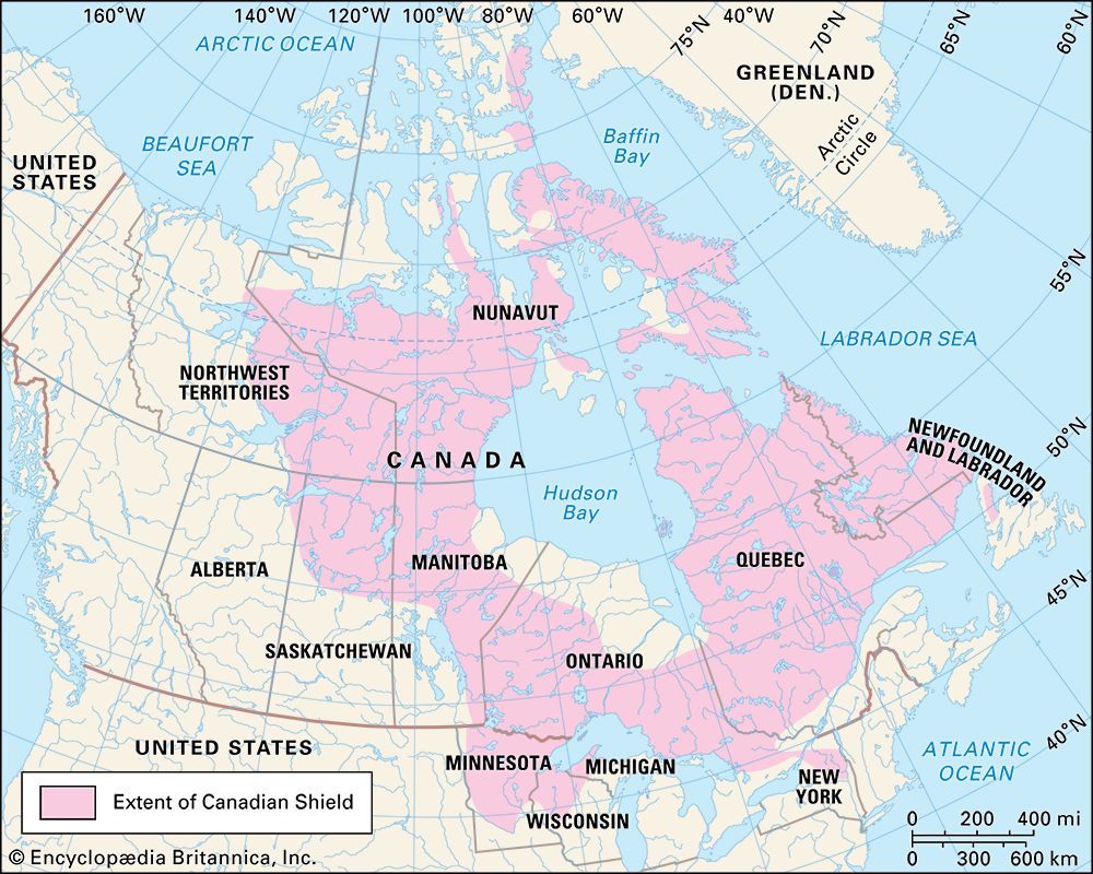
It is inaccurate to suggest that the Laurentian Mountains played a foundational role in the formation of the Canadian Shield. Rather, the Laurentian Mountains are a component of the shield—specifically the portion located in Quebec—rather than a cause of its creation.12
The Canadian Shield itself is a vast craton formed through the fusion of at least four discrete continents between 2.0 and 1.8 billion years ago. The shield’s complex structure is the result of long-term geological processes, including orogeny (mountain building), uplift, and extensive erosion caused by glacial activity.34
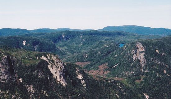
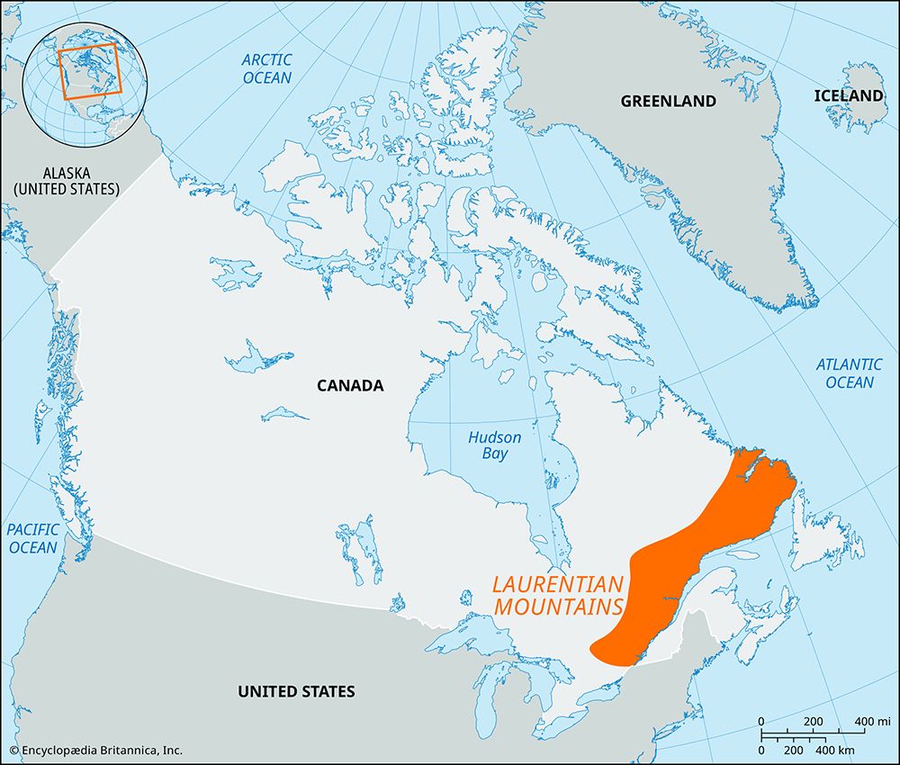
The Laurentian Mountains are one of the oldest mountain regions on Earth, composed of Precambrian rocks. Over time, this range has been scoured and worn down into a rocky peneplain, representing a small, weathered segment of the larger, ancient continental core that defines the shield.1
How do the Laurentian Mountains affect water systems and watersheds in Canada?
The Laurentian Mountains play a significant role in shaping the hydrology of the Canadian Shield and the surrounding regions of Quebec. Characterized by a landscape of innumerable lakes and swift rivers, this mountainous region acts as a vital source area for several major water systems.16
The topography of the Laurentians influences the drainage patterns of the province, feeding into key tributaries that flow into the St. Lawrence River. Notable rivers originating from or flowing through this region include the Ottawa, Saguenay, Saint-Maurice, and Manicouagan rivers. These waterways are essential for the region’s hydroelectric installations, which leverage the swift currents and elevation changes inherent to the mountainous terrain.16
Furthermore, the Laurentians help define the broader drainage architecture of eastern Canada. As part of the Canadian Shield, the region contributes to the vast freshwater network that eventually discharges into the Gulf of St. Lawrence and the Atlantic Ocean, connecting the interior of the continent to the sea.678
What is the geological history of the Laurentian Mountains?
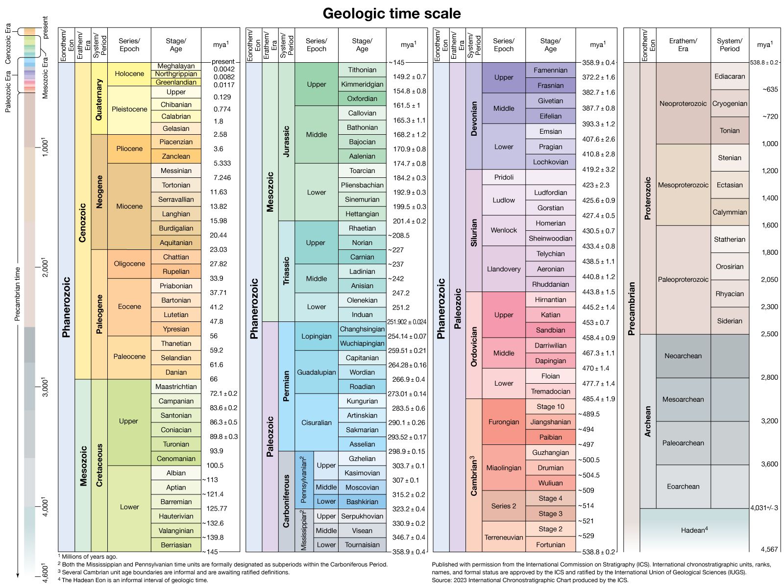
The Laurentian Mountains are among the oldest mountain regions on Earth, composed primarily of Precambrian rocks that are more than 540 million years old. As a prominent segment of the Canadian Shield, their geological history is deeply tied to the ancient formation of the North American continent.1
The region’s current topography is the result of immense geological time and erosional forces. While the area was once part of more significant mountain-building events, it has been gradually scoured and worn down over hundreds of millions of years. This process transformed the range into a rocky peneplain—a vast, relatively uniform erosional plain—with crests typically reaching about 3,000 feet (900 metres).1
In addition to ancient weathering, the landscape was significantly reshaped during the Quaternary Period by glacial activity. The movement of massive ice sheets, such as the Laurentide Ice Sheet, scoured the bedrock and altered drainage patterns, leaving behind the innumerable lakes and swift rivers that define the modern Laurentian landscape.112
How do the Laurentian Mountains contribute to Canada’s geography and climate?
The Laurentian Mountains are a significant geographical feature of the Canadian Shield in Quebec, bounded by the Ottawa, St. Lawrence, and Saguenay rivers. As a vast, ancient rocky peneplain, the range serves as a critical watershed, characterized by its numerous lakes and swift rivers that support essential hydroelectric installations, forestry, and tourism.1
Regarding climate, the provided search results do not indicate that the Laurentian Mountains act as a major climatic barrier in the same way that the high-altitude, north-south-oriented ranges like the Rockies do. Instead, the climate of the region—including areas like Montreal and the surrounding provinces—is primarily influenced by large-scale continental air masses and moisture sources such as the Great Lakes, Hudson Bay, and the Gulf of Mexico. While the mountains contribute to the local landscape, the broader regional climate is defined by these shifting air masses and the interaction between cold northern currents and humid southern air.15916
Sources
- Laurentian Mountains — Encyclopædia Britannica
- Canadian Shield: Top Questions — Encyclopædia Britannica
- North America - The Canadian Shield — Encyclopædia Britannica
- Laurentian Mountains — Merriam-Webster
- Canadian Shield — Merriam-Webster
- Quebec - Relief, drainage, and soils — Encyclopædia Britannica
- Ontario - Drainage — Encyclopædia Britannica
- St. Lawrence River - Geology — Encyclopædia Britannica
- Canada - The Great Lakes–St. Lawrence lowlands — Encyclopædia Britannica
- North America - Drainage — Encyclopædia Britannica
- Laurentian Trough — Encyclopædia Britannica
- North America - 600 to 250 million years ago — Encyclopædia Britannica
- Quaternary - Landforms — Encyclopædia Britannica
- North America - 1.3 billion to 950 million years ago — Encyclopædia Britannica
- Quebec - Climate of Quebec — Encyclopædia Britannica
- Atmosphere - Mountain barriers — Encyclopædia Britannica
- Canada - Rainfall — Encyclopædia Britannica
Published on · 3 min read