Nashville Dome
The Nashville Dome is a geologic feature in central Tennessee, characterized as a southward extension of the Cincinnati Arch.
What is Nashville Dome?
The Nashville Dome is a geologic feature in central Tennessee, characterized as a southward extension of the Cincinnati Arch.1
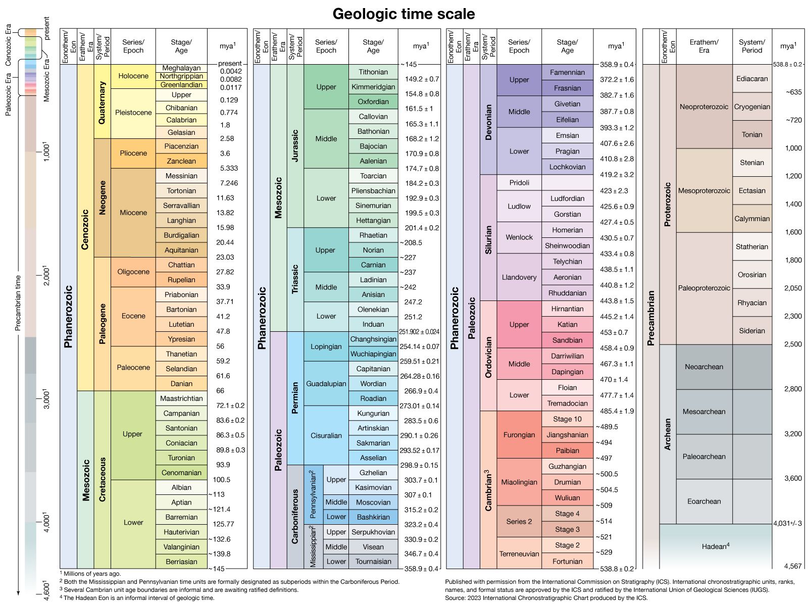
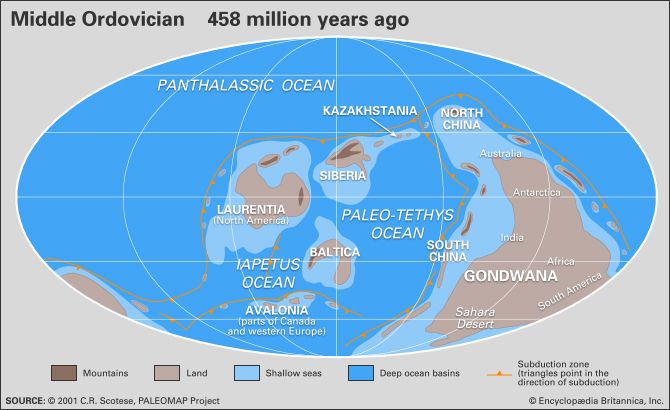
The structure consists of ancient rock layers, with its core composed of Ordovician strata dating back approximately 490 to 445 million years, surrounded by younger Carboniferous strata. Throughout its history, the dome experienced periods of submergence and elevation, the latter of which exposed the central portions to significant erosion.1
Two major tectonic uplifts shaped the dome:
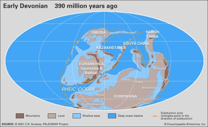
- Late Devonian Period: Occurring about 385 to 360 million years ago, this event led to the removal of roughly 150 meters (500 feet) of deposits through erosion.1
- Carboniferous Period: A second major tectonic event triggered further extensive erosion.1
What is the Cincinnati Arch and how does it relate to the Nashville Dome?
The Cincinnati Arch is a geologic anticlinal (archlike) structure that was highly influential during the Paleozoic Era. It functioned as a persistent, low-lying land area that remained elevated while surrounding regions were often covered by seas.3
The relationship between the two features is structural: the Nashville Dome serves as the southward extension of the Cincinnati Arch. While they are part of the same continuous geologic system, they are separated by a structural saddle.31
Key characteristics of their connection include:
- Geography: The axis of the Cincinnati Arch extends from Ohio southward into Tennessee, where it culminates in the Nashville Dome.3
- Composition: Both features exhibit Ordovician rocks at their crests, while younger strata are found in the flanking basins.31
- Tectonic History: Both structures underwent multiple phases of uplift and subsequent erosion throughout the Paleozoic, particularly during the Devonian and Carboniferous periods.31
How do geologists determine the age of rock strata?
Geologists determine the age of rock strata using two primary methods: relative dating and absolute dating.
Relative Dating
Relative dating establishes the sequence of events without providing a specific numerical age.
- Law of Superposition: This fundamental principle of stratigraphy states that in an undisturbed sequence of sedimentary rock, the oldest layers are at the bottom and the youngest are at the top.67
- Fossil Correlation: Geologists use index fossils—distinctive, widespread, and short-lived organisms—to correlate rock layers across different geographic locations and define boundaries in the geologic time scale.87
Absolute Dating
Absolute dating, or geochronology, provides a numerical age by measuring the radioactive decay of isotopes within minerals.910
- Isotopic Measurement: By analyzing the ratio of “parent” radioactive atoms to “daughter” atoms in a sample, scientists can calculate how much time has passed since the rock or mineral formed.911
- Precision: Techniques such as uranium-lead dating are highly precise and allow geologists to calibrate the fossil record and date rocks that predate life-forms.9710
What are the primary differences between tectonic uplift and erosion?
Tectonic uplift and erosion are opposing geological forces that work together to shape the Earth’s surface. Their primary differences lie in their function, origin, and impact on elevation.
Tectonic Uplift
Tectonic processes act as the “builders” of the Earth’s crust. Derived from the Greek word tekton, these processes involve the movement of rock material—such as crustal blocks, layers, or molten lava—upward or downward.12
- Function: Uplift creates major structural features like mountains, plateaus, and rift valleys by increasing the elevation of the surface.12
- Mechanisms: This is driven by internal forces, including volcanism, horizontal crustal shortening (folding and faulting), and the thermal expansion of the Earth’s crust.1213
Erosion
Erosion acts as the “sculptor” of the landscape. It is the process of removing surface material—primarily soil and rock debris—and transporting it away from its original site.14
- Function: Erosion works to reduce differences in elevation and destroy elevated terrains.1215
- Mechanisms: It is driven by external natural agencies, including water, wind, and glacial processes.14
In essence, while tectonic processes build high elevations, erosion works to destroy them. The final profile of a landform is the result of the competition between these two forces.1215
Sources
- Nashville Dome — Encyclopædia Britannica
- Nashville — Encyclopædia Britannica
- Cincinnati Arch — Encyclopædia Britannica
- Interior Lowlands — Encyclopædia Britannica
- North America - Structural plan — Encyclopædia Britannica
- dating: Top Questions — Encyclopædia Britannica
- index fossil — Encyclopædia Britannica
- law of superposition — Encyclopædia Britannica
- geochronology — Encyclopædia Britannica
- dating - Principles of isotopic dating — Encyclopædia Britannica
- dating - Distinctions between relative-age and absolute-age measurements — Encyclopædia Britannica
- tectonic landform — Encyclopædia Britannica
- erosion — Encyclopædia Britannica
- mountain - Tectonic processes that produce high elevations — Encyclopædia Britannica
- mountain - Tectonic processes that create and destroy mountain belts and their components — Encyclopædia Britannica
Published on · 3 min read