Interior Lowlands
The Interior Lowlands of North America are geologically defined as a stable, ancient region that has remained largely undisturbed by mountain-building…
How were the Interior Lowlands formed geologically?
The Interior Lowlands of North America are geologically defined as a stable, ancient region that has remained largely undisturbed by mountain-building processes throughout recent geologic time. Their formation and current appearance are the result of two primary factors:1
- Tectonic Stability: The region is built upon a craton—a massive, stable interior of the continent that coalesced approximately 1.85 billion years ago. This platform consists of ancient crystalline rock covered by a veneer of virtually flat-lying sedimentary rock. Because this area is enclosed by younger, peripheral orogenic belts, it has avoided the intense deformation seen in surrounding mountain ranges.23
- Glacial Modification: During the Pleistocene Epoch, the landscape was significantly reshaped by massive ice sheets, such as the Laurentide Ice Sheet. These glaciers acted as powerful agents of erosion and deposition, stripping material from some areas and leaving behind thick deposits of till and sediment in others. This process created the flat-to-gently-rolling terrain that characterizes the region today.4
What are the major landforms and features found within the Interior Lowlands?
The Interior Lowlands are a vast, geologically stable region of North America characterized by low relief and a foundation of ancient sedimentary rock. Their landscape has been significantly shaped by repeated glacial advances and the subsequent action of rivers.8910
Major Landforms and Features
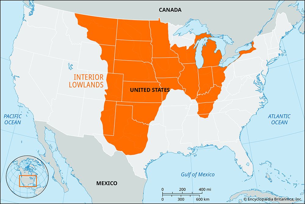
- Central Lowland: The heart of the region, this area spans from New York to Texas and north into Saskatchewan. Its terrain varies from flat lake plains—formed by glacial meltwater—to rolling hills created by glacial moraines and wind-deposited loess.810
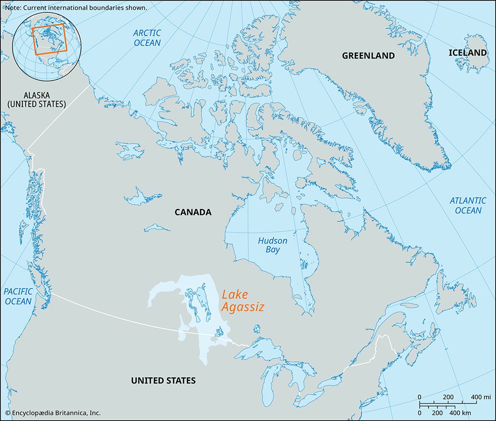
- Glacial Features: The landscape is marked by extensive end moraines, which can rise hundreds of feet above the plains. Other features include kettle lakes, abandoned drainage channels, and vast, flat plains that were once the beds of glacial lakes, such as Lake Agassiz.1011
- Upland Fringes: The region includes several related uplands that border the central plains, such as the Superior Upland, the Ozark Plateau, the Interior Low Plateaus, and the Appalachian Plateau10.9
- River Systems: Major rivers like the Mississippi, Missouri, and Ohio have played a critical role in shaping the topography, carving valleys and depositing sediment that contributes to the region’s fertile soils.108
- Northern Plains: In Canada, the interior plains feature rolling landscapes and large lakes, including Great Bear, Great Slave, and Winnipeg, as well as the swampy Mackenzie Lowlands.11
How have the Interior Lowlands influenced the historical settlement patterns and economic development of North America?
The Interior Lowlands have served as the geographic and economic heartland of North America, profoundly shaping settlement patterns and industrial growth through their unique physical characteristics.
Agricultural Foundation and Settlement
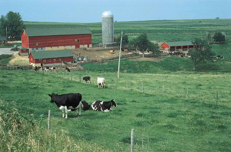
The extraordinary fertility of the region, particularly the loess soils of the Midwest and the black clay of the Red River valley, provided the primary impetus for large-scale settlement. Unlike the rugged, resource-poor plateaus, these plains allowed for intensive commercial agriculture, which fostered a dense network of villages, towns, and cities. In the Canadian Prairies, the regular grid-based subdivision of land—facilitated by the region’s flat topography—further organized settlement patterns.10148
Waterways and Economic Development
Natural waterways were the essential arteries for exploration, trade, and the movement of goods. The Mississippi-Ohio and Great Lakes-St. Lawrence systems drew navigation into the continental interior, allowing inland cities to function as major ports. This connectivity enabled the transformation of raw materials into manufactured goods, supporting the rise of industrial centers from Buffalo to Chicago.15916
Mineral Wealth and Industrial Power
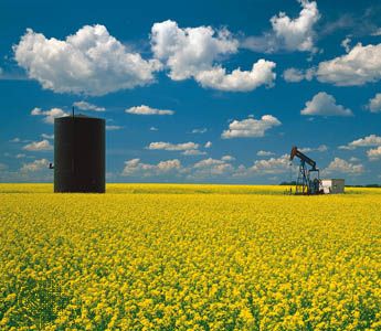
The region’s economic development was further accelerated by its vast mineral resources. The Mesabi Range provided iron ore that, when combined with Appalachian coal, fueled the heavy industry that established North America as a global industrial power. Additionally, the extraction of petroleum and natural gas in the Midcontinent fields and Alberta has been a critical driver of modern urban growth and economic prosperity.101614
What are some of the major rivers and water systems that flow through the Interior Lowlands?
The Interior Lowlands are defined by vast, interconnected river systems and large bodies of water that have historically shaped the continent’s geography and development.
Major River Systems
- Mississippi-Missouri-Ohio System: This massive network serves as the heart of the continent’s drainage. The Mississippi River acts as a central funnel, collecting water from the Missouri River and other western tributaries, as well as the Ohio River and its eastern branches, such as the Tennessee and Cumberland rivers.1819
- Great Lakes–St. Lawrence System: This system represents one of the world’s largest freshwater capacities. It includes the five Great Lakes—Superior, Michigan, Huron, Erie, and Ontario—which drain eastward into the Atlantic Ocean via the St. Lawrence River.182021
- Mackenzie River System: Draining the northwestern portion of the lowlands, the Mackenzie River is Canada’s largest basin. It includes major tributaries like the Peace, Liard, and Athabasca rivers, as well as large lakes such as Great Slave and Great Bear.1822
- Nelson River System: This system carries water from the Saskatchewan and Red River of the North through Lake Winnipeg into Hudson Bay.18
Sources
- Interior Lowlands — Encyclopædia Britannica
- North America - 2.0 to 1.8 billion years ago — Encyclopædia Britannica
- Canadian Shield: Top Questions — Encyclopædia Britannica
- Pleistocene Epoch - Glaciation — Encyclopædia Britannica
- Europe - Pleistocene glaciation — Encyclopædia Britannica
- North America - Structural plan — Encyclopædia Britannica
- Lowlands — Encyclopædia Britannica
- North America - The lowlands of North America — Encyclopædia Britannica
- Canada - The interior plains — Encyclopædia Britannica
- United States - The Interior Lowlands and their upland fringes — Encyclopædia Britannica
- Scotland - Drainage — Encyclopædia Britannica
- Great Plains — Encyclopædia Britannica
- United States - The Pacific systems — Encyclopædia Britannica
- North America - Waterways — Encyclopædia Britannica
- North America - Coastal sites — Encyclopædia Britannica
- river - Significance in early human settlements — Encyclopædia Britannica
- Canada - Settlement patterns — Encyclopædia Britannica
- North America - Drainage — Encyclopædia Britannica
- Mackenzie River — Encyclopædia Britannica
- Mississippi River - Physiography — Encyclopædia Britannica
- British Columbia - Drainage — Encyclopædia Britannica
- Ohio - Relief — Encyclopædia Britannica
- Great Lakes - Physiography of Great Lakes — Encyclopædia Britannica
- Great Lakes — Encyclopædia Britannica
Published on · 4 min read