Pilcomayo River
The Pilcomayo River is the primary western tributary of the Paraguay River in south-central South America. Rising in the eastern Andes Mountains of Bolivia…
What is Pilcomayo River?
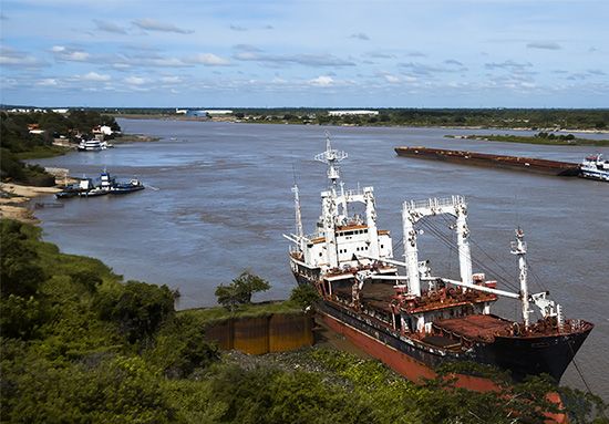
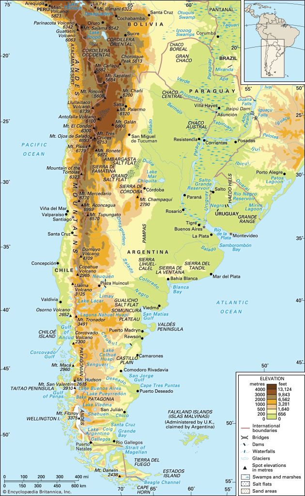
The Pilcomayo River is the primary western tributary of the Paraguay River in south-central South America. Rising in the eastern Andes Mountains of Bolivia, the river flows southeast for approximately 1,550 miles (2,500 km) through the Gran Chaco plains.1
The river serves as an international border between the Formosa province of Argentina and Paraguay. Its lower course is characterized by shifting channels and is navigable only by small craft. The name is believed to derive from the Quechua language, meaning “River of the Birds”.1
Environmental concerns are significant, as the river has suffered from severe pollution caused by waste from the mining industry. Protecting such vital waterways is an essential ethical responsibility to ensure the health of ecosystems and the communities that depend on them.1
What is the Gran Chaco region like?
The Gran Chaco is a vast, low-lying alluvial plain in interior south-central South America, covering approximately 280,000 square miles across Argentina, Paraguay, and Bolivia. Its name, of Quechua origin, means “Hunting Land”.3
Landscape and Climate
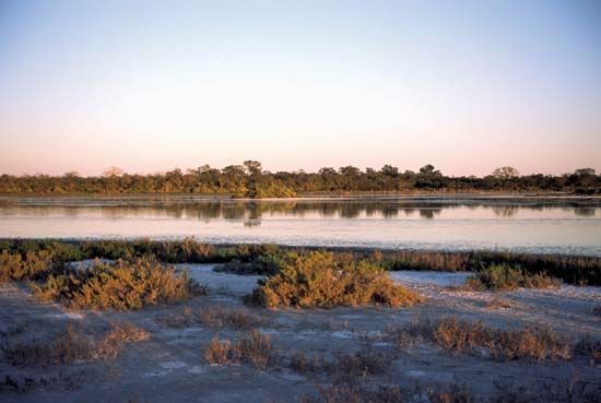
The region is an arid subtropical area characterized by low forests and savannas. The landscape transitions from lush, parklike vegetation in the east to dry, thorny forests in the west. The climate is generally subtropical, though it varies from tropical in the north to warm-temperate in the south. It experiences extreme temperature contrasts, with summer highs reaching up to 116 °F (47 °C). Rainfall is highest in the east and decreases significantly toward the west, leading to an arid environment exacerbated by high evaporation rates.345
Drainage and Wildlife
The region is traversed by only two permanent rivers, the Pilcomayo and the Bermejo the Bermejo. Poor drainage and impermeable subsoils often lead to extensive flooding during the rainy summer months. The Chaco supports diverse wildlife, including jaguars, tapirs, peccaries, and various reptiles and fish.367
How do mining activities affect river ecosystems?
Mining activities significantly degrade river ecosystems primarily through the discharge of untreated industrial chemical wastes. A notable example is the residue from coal-mining operations, which contains sulfur that reacts with water to form sulfuric acid. This process increases the acidity of the river to levels that can be corrosive enough to destroy living organisms.9
Beyond acidification, mining and other industrial processes introduce a variety of toxic substances—such as arsenic, barium, cyanide, lead, and phenols—into waterways. These pollutants can persist in the environment for years, even after their discharge is prohibited. Once in the water, these chemicals can accumulate in the fatty tissues of fish and move up the food chain, posing severe health risks to humans, including the potential to induce cancer.9
It is a fundamental ethical imperative to prevent the contamination of our natural waterways, as the health of both aquatic ecosystems and human populations depends on the preservation of clean water.
What are the main characteristics of the Andes Mountains?
The Andes Mountains form an unbroken, 5,500-mile (8,900-kilometer) rampart stretching from the southern tip of South America to the Caribbean coast. As the highest mountain system in the Western Hemisphere, they are defined by several key characteristics:
Physiography and Geology
The Andes are not a single line of peaks but a complex succession of parallel and transverse ranges, or cordilleras, separated by high plateaus and depressions. The system was created by the subduction of the oceanic Nazca Plate beneath the continental South American Plate, a process that continues today and makes the region part of the volcanically active Ring of Fire.1011
Climate and Life
The region features extreme environmental diversity, with conditions varying significantly by altitude and latitude.
- Altitudinal Bands: Life is organized into distinct zones, ranging from tropical valleys below 8,000 feet to the puna grasslands and the permanent snow line at higher elevations.1213
- Microclimates: Factors such as proximity to the sea, the cold Peru Current, and topographic barriers create a wide array of localized habitats.13
Notable Features
- Altiplano: One of the world’s largest interior basins, this high plateau spans parts of Bolivia and Peru and contains Lake Titicaca.1111
- High Peaks: The system includes the highest peaks in the Western Hemisphere, such as Mount Aconcagua (22,831 feet).11
Sources
- Pilcomayo River — Encyclopædia Britannica
- Pilcomayo — Merriam-Webster
- Gran Chaco — Encyclopædia Britannica
- Gran Chaco - Climate — Encyclopædia Britannica
- Argentina - The Gran Chaco — Encyclopædia Britannica
- Gran Chaco - Plant life — Encyclopædia Britannica
- Gran Chaco - Early settlement — Encyclopædia Britannica
- Gran Chaco - Drainage — Encyclopædia Britannica
- river - Environmental problems attendant on river use — Encyclopædia Britannica
- Andes Mountains: Top Questions — Encyclopædia Britannica
- Andes Mountains - Physiography of the Central Andes — Encyclopædia Britannica
- Andes Mountains - Plant and animal life — Encyclopædia Britannica
- Andes Mountains - Geology — Encyclopædia Britannica
- Andes Mountains - Climate — Encyclopædia Britannica
- Andean Geosyncline — Encyclopædia Britannica
- Andes Mountains — Encyclopædia Britannica
Published on · 3 min read