Solomon Sea
The Solomon Sea is a body of water located in the western portion of the South Pacific Ocean. It covers an area of approximately 280,000 square miles…
Where is the Solomon Sea located, and what are its geographical boundaries?
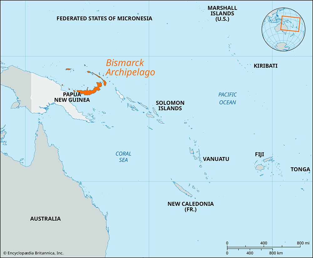
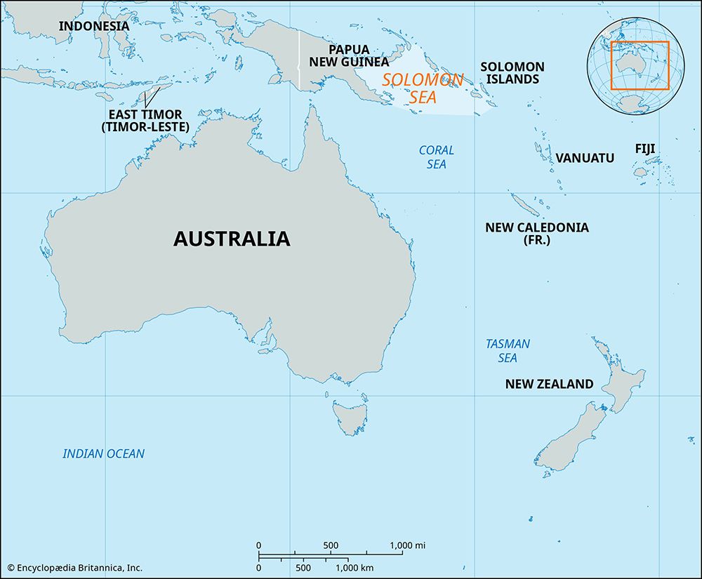
The Solomon Sea is a body of water located in the western portion of the South Pacific Ocean. It covers an area of approximately 280,000 square miles (720,000 square km) and is defined by the following geographical boundaries:1
- West: New Guinea1
- North: New Britain1
- East: The Solomon Islands1
The sea opens to the Coral Sea to the south, the Bismarck Sea to the northwest, and the open ocean to the northeast. Its seafloor is characterized by two primary basins, the New Britain Basin and the Solomon Basin, with depths reaching up to 29,988 feet (9,140 metres) in the Planet Deep.1
What are the main islands and archipelagos that surround the Solomon Sea?
The Solomon Sea is surrounded by several significant islands and archipelagos that define its borders and internal geography:
- New Guinea: Located to the west, this large island serves as the primary western boundary of the sea.1
- New Britain: Situated to the north, this island is the largest of the Bismarck Archipelago and forms the northern limit of the Solomon Sea.14
- Solomon Islands: These islands lie to the east, forming the eastern boundary of the sea. This group consists of a double chain of volcanic islands and coral atolls, including major islands such as Guadalcanal, New Georgia, Choiseul, Santa Isabel, and Malaita.153
- Louisiade Archipelago: Located within the sea, this group of islands is a notable feature of the region.1
- D’Entrecasteaux Islands: Situated in the southwestern portion of the Solomon Sea, this volcanic group lies across the Ward Hunt Strait from the eastern tip of New Guinea and includes islands such as Normanby, Fergusson, and Goodenough.6
What role did the Solomon Sea play during World War II?
During World War II, the Solomon Sea served as a critical theater for major naval and aerial encounters between U.S. and Japanese forces. As the Japanese sought to expand their reach into the South Pacific, the sea became the primary battleground for control over the Solomon Islands and the approaches to New Guinea1.19
Key aspects of the conflict in this region included:
- Naval Campaigns: The sea hosted several decisive naval engagements, including the Battle of the Eastern Solomons, the Battle of Cape Esperance, and the Battle of the Santa Cruz Islands. These battles were characterized by intense carrier-based air warfare and surface ship combat as both sides fought to control supply lines to Guadalcanal.1011
- Strategic Logistics: The Japanese utilized the “Tokyo Express”—a series of nightly destroyer runs—to ferry troops and supplies across the sea to reinforce their positions. Conversely, Allied forces worked to interdict these lines and secure airfields, such as Henderson Field, to project power across the region.10911
- Allied Success: The successful defense of Guadalcanal and the subsequent campaign in the Solomons effectively halted the Japanese southward advance, securing vital communication lines with Australia and New Zealand.11
What is the average depth of the Solomon Sea, and how does it compare to other seas in the Pacific?
The Solomon Sea is characterized by significant depth variations across its two primary basins. The northern New Britain Basin generally exceeds 13,000 feet (4,000 meters) in depth, while the southern Solomon Basin reaches depths of 23,000 feet (7,000 meters). The sea also contains extreme depths, most notably the New Britain Trench, which plunges to a maximum of 29,988 feet (9,140 meters) at the Planet Deep.1
When compared to other regional waters, the Solomon Sea exhibits comparable deep-sea features. For instance, the Coral Sea, which lies to the south, contains the South Solomon Trench with depths of 24,002 feet (7,316 meters) and the New Hebrides Trench, which reaches 25,134 feet (7,661 meters). While the Solomon Sea’s maximum depth at the Planet Deep is greater than these specific trenches in the Coral Sea, both regions are defined by complex, deep-ocean topography typical of the western Pacific Ocean1.2
Sources
- Solomon Sea — Encyclopædia Britannica
- Coral Sea — Encyclopædia Britannica
- Solomon Islands — Encyclopædia Britannica
- D’Entrecasteaux Islands — Encyclopædia Britannica
- Solomon Islands - Land — Encyclopædia Britannica
- Pacific Ocean - Islands — Encyclopædia Britannica
- list of islands - Australia — Encyclopædia Britannica
- New Britain — Encyclopædia Britannica
- Battle of Guadalcanal - The Battles of the Eastern Solomons, Cape Esperance, and Santa Cruz — Encyclopædia Britannica
- Solomon Islands - World War II — Encyclopædia Britannica
- history of Solomon Islands - The Solomons during World War II — Encyclopædia Britannica
- World War II - The Southwest and South Pacific, June–October 1943 — Encyclopædia Britannica
- World War II - The Solomons, Papua, Madagascar, the Aleutians, and Burma, July 1942–May 1943 — Encyclopædia Britannica
Published on · 3 min read