Erramala Range
The Erramala Range is a series of hills located in the western part of Andhra Pradesh state in southern India.
What is Erramala Range?
The Erramala Range is a series of hills located in the western part of Andhra Pradesh state in southern India.1
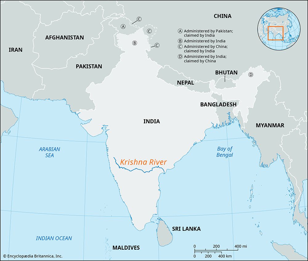
Spanning the eastern edge of the Deccan plateau, these hills are positioned between the Krishna River basin to the north and the Penneru River basin to the south. The range is geologically composed of quartzites and slates dating back to the Cambrian Period, interspersed with younger lavas. Over time, the tributaries of the Kunderu River have carved the landscape into a series of longitudinal hills and valleys.1
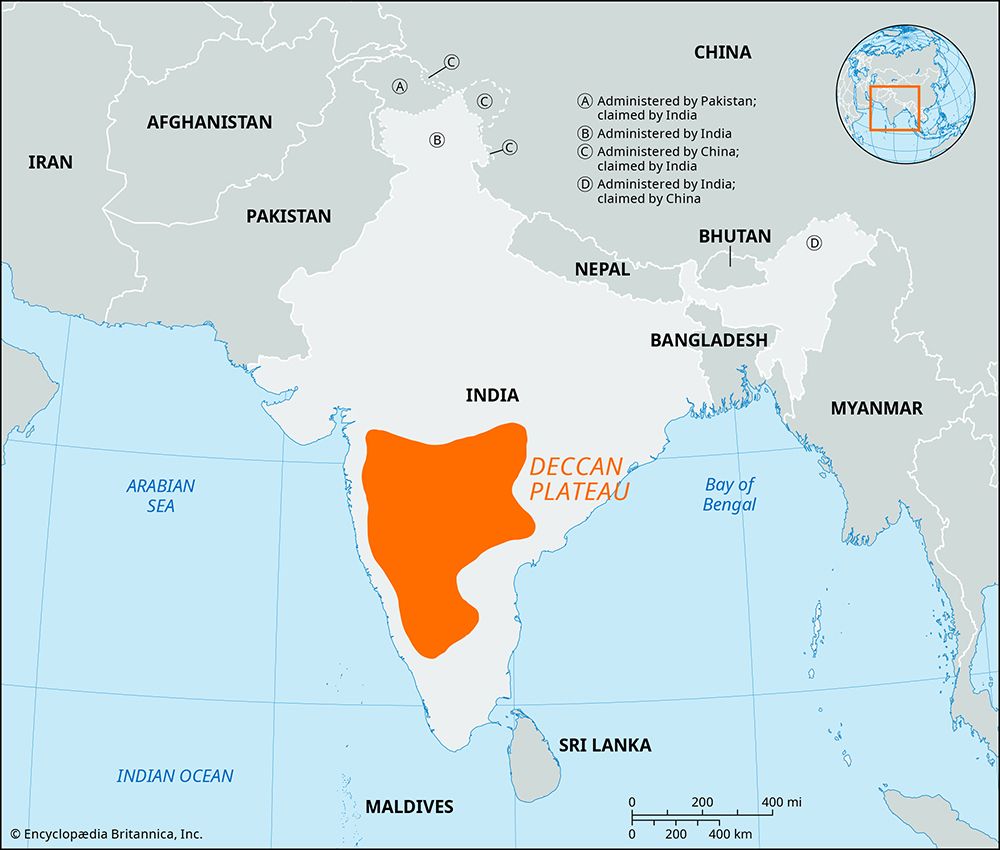
What is the Deccan Plateau?
The Deccan Plateau is a large, triangular tableland that constitutes the southern peninsula of India, located south of the Narmada River. The name is derived from the Sanskrit word daksina, meaning “south”.23
Geography and Relief
The plateau is geologically ancient, having once been a segment of the supercontinent Gondwana. It is bounded by the Western Ghats and Eastern Ghats—escarpments that meet at the southern tip of the peninsula—and the Satpura Range to the north.32
Key characteristics include:
- Elevation: The plateau has an average elevation of about 2,000 feet (600 meters) and features a general eastward slope.2
- Composition: The region is composed of ancient rocks, including gneiss, granite, and schists, as well as more recent basaltic lava flows, particularly in the northwestern Deccan.34
- Drainage: Major rivers, including the Godavari, Krishna, and Kaveri, originate in the Western Ghats and flow eastward toward the Bay of Bengal4.
Historical Significance
The Deccan has a long history of human habitation and mineral wealth, which attracted various regional dynasties, including the Mauryan and Gupta empires4. Over the centuries, it was the site of numerous kingdoms and conflicts, eventually coming under the control of the Mughal Empire and later the British, before becoming part of independent India.2
How do rivers shape mountain ranges over time?
While tectonic processes—such as uplift, folding, and volcanic activity—build the primary structures of mountain ranges, rivers act as the primary agents that sculpt these features into their individual shapes over time.6
Mechanisms of Sculpting
Rivers transform geologic settings into distinct topographic forms primarily through the movement of sediment-laden water, which exerts powerful erosional forces. This process generally follows a developmental cycle:7
- Vertical Entrenchment: In the initial stages of mountain development, rivers expend most of their energy cutting downward into the bedrock. This creates narrow, deep valleys and canyons, especially in resistant rock types like quartzite or igneous rock.89
- Rejuvenation: When tectonic activity causes vertical uplift, it reinvigorates a river’s erosive power. This can lead to the formation of spectacular canyons and gorges as the river cuts through the rising terrain.9
- Lateral Widening: As rivers smooth their longitudinal profiles and approach their baselevel, they expend more energy laterally. This causes the valley floors to broaden, gradually softening the rugged profiles created by initial uplift.8
Structural Interaction
Rivers often interact with the underlying macrostructures of a mountain range. While valleys typically follow the orientation of folds and faults, rivers can also create transverse canyons that cut across resistant ridges. This occurs either through headward erosion along fault zones or through processes like antecedence (where a river maintains its course while the land rises beneath it) or superimposition (where a river cuts down from a layer of younger sediment into an underlying complex structure).9
What are the characteristics of the Cambrian Period?
The Cambrian Period was the first time division of the Paleozoic Era, spanning from approximately 538.8 million to 485.9 million years ago. It is defined by several distinct environmental and biological characteristics:11
The Cambrian Explosion
The period is most famous for the “Cambrian explosion,” a geologically rapid event where most major animal lineages appeared in the fossil record. This diversification was fueled by rising sea levels and increased oxygen content in seawater, which allowed for the development of complex life in marine environments. Early aquatic ecosystems included trilobites, mollusks, sponges, and predators like Anomalocaris. Because trilobite remains dominate many deposits, the period is sometimes called the “Age of Trilobites”.121314
Climate and Geography
- Climate: The global climate was warmer than today, with average temperatures around 22 °C (72 °F). The absence of polar ice caps is attributed to the lack of landmasses at the poles.1315
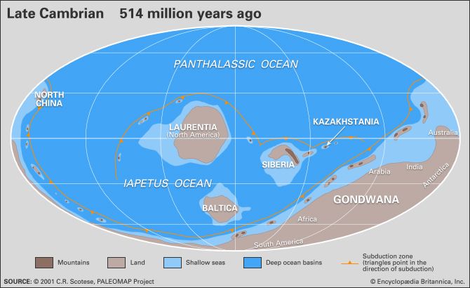
- Geography: The supercontinent Gondwana formed during this time, while other landmasses like Laurentia and Baltica began to drift apart.13
- Environment: Rising sea levels flooded continental margins, creating shallow seas that supported diverse marine life.1314
Sources
- Erramala Range — Encyclopædia Britannica
- India - The Deccan of India — Encyclopædia Britannica
- India - Inland regions — Encyclopædia Britannica
- Deccan — Encyclopædia Britannica
- Bhander Plateau — Encyclopædia Britannica
- river - Valley evolution — Encyclopædia Britannica
- river - Rivers as agents of landscape evolution — Encyclopædia Britannica
- river - Formation of canyons and gorges — Encyclopædia Britannica
- tectonic landform — Encyclopædia Britannica
- river - Valleys and canyons — Encyclopædia Britannica
- Cambrian Period: Top Questions — Encyclopædia Britannica
- Cambrian Period - Paleoclimate — Encyclopædia Britannica
- Cambrian explosion — Merriam-Webster
- A Journey Through Time Since the Precambrian - Cambrian Period: 541 million to 485.4 million years ago — Encyclopædia Britannica
- Cambrian Period - Fossil record of the Precambrian-Cambrian transition — Encyclopædia Britannica
Published on · 3 min read