Great Bahama Bank
The Great Bahama Bank is a large, shallow bank located off the coast of The Bahamas. Extending approximately 330 miles (530 km) in a broad curve, it…
What is Great Bahama Bank?
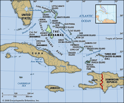
The Great Bahama Bank is a large, shallow bank located off the coast of The Bahamas. Extending approximately 330 miles (530 km) in a broad curve, it stretches southeast from Miami, across the Straits of Florida, and sits between Cuba and Andros Island.1
To the north, it is separated from the Little Bahama Bank by the Northwest Providence Channel. A defining geological feature of the area is that the edges of the bank drop off precipitously into significant ocean depths. Due to its abundant and varied marine life, the region is highly regarded as a prime fishing destination.1
How are submarine canyons formed?
The formation of submarine canyons is a complex process that has been the subject of significant scientific debate. Prevailing theories suggest that these features are created through a combination of subaerial and marine processes.3
Subaerial Erosion
Many researchers believe that subaerial erosion served as the initial catalyst for many undersea canyons. During the Pleistocene Epoch, global sea levels were significantly lower due to the expansion of continental ice sheets. During these lowstands, rivers emptied directly into the heads of canyons, carving them in a manner similar to terrestrial river valleys.34
Marine Processes
While subaerial erosion explains the initiation of some canyons, it is generally considered insufficient to account for their immense depth and extent. The primary agents responsible for their ongoing formation and maintenance are marine processes, specifically:
- Turbidity Currents: These are dense, underwater slurries of water and sediment that move downslope. They are often triggered by the slumping of unconsolidated rock material near the canyon heads.32
- Sediment Transport: As these currents flow through the canyons, they erode the seafloor and transport large volumes of sediment to the deep sea, eventually depositing them on abyssal plains or forming submarine fans.32
- Avalanche-like Movements: Sudden, gravity-driven movements of accumulated loose sedimentary material also contribute to the cutting and maintenance of these steep-walled valleys.4
What kind of marine life lives in the Bahamas?
The waters surrounding The Bahamas are home to an abundant and diverse array of marine life, making the region a renowned destination for fishing and marine biodiversity.61
The marine ecosystem is characterized by a variety of edible species, including:
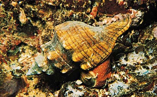
- Conch: A staple of the region’s marine life and local diet.67
- Spiny Lobster: Also known as crayfish, these are common in the surrounding waters and coral reefs.67
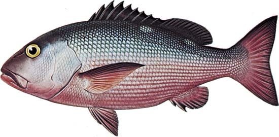
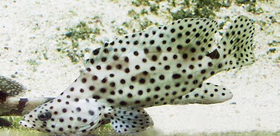
- Food Fishes: The reefs and surrounding banks support populations of various fish, including snappers and groupers.7
These shallow banks and surrounding coral reefs provide essential habitats for these species to thrive. While the area is well-known for its fish and shellfish, the broader marine environment also supports various marine mammals, such as whales and dolphins, which inhabit the world’s oceans and depend on these marine resources for survival.78
What is the difference between a shoal and a continental shelf?
A shoal and a continental shelf are distinct geological features defined by their scale, composition, and depth.
- Continental Shelf: This is a broad, relatively shallow submarine terrace of continental crust that forms the edge of a continental landmass. It typically extends from the coast to depths of 100–200 meters (330–660 feet) and ends at an abrupt drop known as the shelf break. These shelves are vast, covering about 8 percent of the ocean floor, and represent a continuation of the continent beneath the ocean margins.910
- Shoal: A shoal is a localized accumulation of sediment, such as sand or gravel, in a river channel or on a continental shelf. While they can occur on a continental shelf, they are much smaller in scale and are conventionally defined as being less than 10 meters (33 feet) below the water level at low tide. Because they are shallow, they are often considered hazards to navigation.11
Sources
- Great Bahama Bank — Encyclopædia Britannica
- Great Bahama Canyon — Encyclopædia Britannica
- submarine canyon — Encyclopædia Britannica
- submarine fan — Encyclopædia Britannica
- canyon — Encyclopædia Britannica
- The Bahamas - Plant and animal life — Encyclopædia Britannica
- Turks and Caicos Islands - Land — Encyclopædia Britannica
- What Is a Marine Mammal? — Encyclopædia Britannica
- shoal — Encyclopædia Britannica
- continental shelf — Encyclopædia Britannica
- continental shelf - Structure — Encyclopædia Britannica
- ocean - Major subdivisions of the oceans — Encyclopædia Britannica
- shoal — Merriam-Webster
Published on · 3 min read