Lake Algonquin
Lake Algonquin was a massive proglacial lake that existed in North America during the Pleistocene Epoch. As the Laurentide Ice Sheet retreated northward…
What is Lake Algonquin?
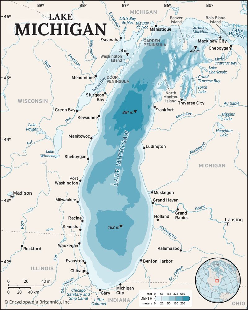
Lake Algonquin was a massive proglacial lake that existed in North America during the Pleistocene Epoch. As the Laurentide Ice Sheet retreated northward, this body of water covered much of the region now occupied by the upper Great Lakes—specifically Superior, Michigan, and Huron.12
At its peak, the lake spanned approximately 250,000 square kilometers (100,000 square miles) and reached depths of up to 460 meters (1,500 feet). Throughout its existence, Lake Algonquin drained through various channels, including the Ottawa and Mississippi rivers. As the ice sheet continued to recede and the Earth’s crust underwent postglacial rebound, the lake’s configuration changed, eventually leaving behind remnants such as Lakes Superior, Michigan, Huron, Nipigon, Simcoe, and Nipissing.12
What was the Laurentide Ice Sheet and how did it shape North America?
The Laurentide Ice Sheet was the primary glacial cover of North America during the Pleistocene Epoch, spanning approximately 2.6 million to 11,700 years ago. Centered over Hudson Bay, this massive ice sheet reached thicknesses of 2,400–3,000 meters and covered over 13 million square kilometers at its maximum extent.3
The ice sheet fundamentally reshaped the North American landscape through erosion and deposition:
- Basin Formation: Glacial movement scoured the mid-continent, deepening and widening valleys that eventually filled with water to form the Great Lakes.2
- Landform Creation: As the ice retreated, it left behind distinct features such as drumlins, eskers, and moraines. In central regions, it stripped away bedrock, while in marginal zones, it deposited thick layers of till and sediment, creating the fertile soils of the Great Plains.456
- Crustal Deformation: The immense weight of the ice depressed the Earth’s crust. Following the retreat, the land began a slow process of postglacial rebound, which continues to influence drainage patterns and lake levels today.24
- Proglacial Lakes: The ice blocked natural drainage, creating massive temporary bodies of water like Lake Agassiz, which left behind fertile silt deposits.27
How does glacial rebound affect the water levels of the Great Lakes today?
Glacial rebound, also known as isostatic adjustment, continues to significantly influence the water levels of the Great Lakes today. During the Pleistocene Epoch, the immense weight of the Laurentide Ice Sheet depressed the Earth’s crust. As the ice retreated, the land began a slow process of rising back to its original position.28
This ongoing uplift affects the lakes in several ways:
- Outlet Alteration: As the land rises, it can close off or shift the outlets through which the lakes drain. Historically, this process has forced water to find new paths, such as the shift from the Ottawa River valley to the current outflow through the St. Clair and Detroit rivers.2
- Water Level Changes: The gradual rising of the land—occurring at a rate of about 1 foot (30 centimeters) every 100 years—causes the water levels in certain parts of the basins to rise relative to the land.2
- Geological Evidence: This phenomenon is clearly evidenced by the drowned river mouths found in western Lake Erie and Lake Superior, where the land has tilted or subsided relative to the water level over time.2
What are some other prehistoric lakes that existed during the Pleistocene Epoch?
During the Pleistocene Epoch, dramatic climatic shifts and glacial activity led to the formation of numerous large lakes across the globe. These are generally categorized into two types: proglacial lakes, formed by melting ice, and pluvial lakes, which developed in arid regions due to increased precipitation and reduced evaporation.106
Proglacial Lakes
These lakes were often confined by the margins of massive ice sheets, such as the Laurentide Ice Sheet.
- Lake Agassiz: The largest of the North American ice-margin lakes, it once covered vast areas of present-day Manitoba, Ontario, Saskatchewan, North Dakota, and Minnesota.116
- Glacial Lakes in the Champlain and Hudson Valleys: These formed in eastern North America as the ice retreated.6
Pluvial Lakes
These lakes existed in closed basins, primarily in regions that are arid or semiarid today.
- Lake Bonneville: Located in the Great Basin, this massive prehistoric lake covered parts of Utah, Nevada, and Idaho. The Great Salt Lake is its primary remnant.1012
- Lake Lahontan: Another enormous pluvial lake in the western United States, primarily located in Nevada.1013
- Lake Chad: In northern Africa, this lake expanded significantly during pluvial periods, reaching a size comparable to the modern Caspian Sea.613
Sources
- Lake Algonquin — Encyclopædia Britannica
- Great Lakes - Geology — Encyclopædia Britannica
- Laurentide Ice Sheet — Encyclopædia Britannica
- Arctic - Continental ice sheets of the past — Encyclopædia Britannica
- Pleistocene Epoch - Glaciation — Encyclopædia Britannica
- Lake Agassiz — Encyclopædia Britannica
- Wisconsin Glacial Stage — Encyclopædia Britannica
- Pleistocene Epoch - Tectonic and isostatic movements — Encyclopædia Britannica
- lake - Water level fluctuations — Encyclopædia Britannica
- North America - Lakes of North America — Encyclopædia Britannica
- Pleistocene Epoch - Lacustrine environments — Encyclopædia Britannica
- Great Salt Lake — Encyclopædia Britannica
- playa - Paleolake chronologies — Encyclopædia Britannica
Published on · 3 min read