Graciosa Island
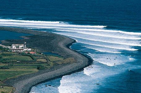
Graciosa Island is a volcanic island located in the Atlantic Ocean and serves as the northernmost island of the central group of the Azores, an autonomous…
What is Graciosa Island?
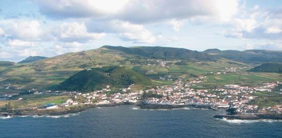
Graciosa Island is a volcanic island located in the Atlantic Ocean and serves as the northernmost island of the central group of the Azores, an autonomous region of Portugal.12
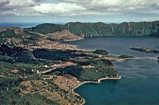
Spanning 23 square miles (60 square km), the island is characterized by its volcanic terrain, reaching a maximum elevation of 1,338 feet (408 meters) at the summit of the Enxófre Caldera. Its fertile volcanic soils support the cultivation of wine grapes, fruit, cereals, and cattle, which are primarily marketed through the settlements of Santa Cruz and Praia. Discovered in 1451, the island is believed to have been named “Graciosa” because it is less mountainous than its neighbors. Notable geographic features include the Graciosa Cave, which contains unique volcanic formations.1
What are the other islands in the Azores archipelago?
The Azores archipelago consists of nine major islands, which are organized into three distinct geographical groups:2
Eastern Group
- São Miguel
- Santa Maria
- Formigas islets
Central Group
Northwestern Group
These islands are volcanic in origin and rise from the Mid-Atlantic Ridge, creating a diverse landscape of craters, calderas, and steep, rocky shores.2
How do volcanic calderas form on islands?
A caldera is a large, bowl-shaped volcanic depression, typically exceeding one kilometer in diameter, that forms through the inward collapse of a volcanic landform.34
On islands, this process generally occurs when a significant volume of magma is rapidly expelled from an underground reservoir. As the magma chamber empties, the overlying rock loses its structural support and collapses into the resulting void. While historically some believed these depressions were created by explosions blowing away the mountain’s top, studies confirm that the collapse of the structure into the subsurface is the primary mechanism.345
The specific formation process can vary by volcano type:
- Stratovolcanoes: Large eruptions of viscous magma can empty the chamber beneath the mountain, causing the summit to collapse into a caldera.5
- Shield Volcanoes: These calderas often form when large rift eruptions or lateral intrusions drain magma from shallow chambers, leaving the ground above unsupported.4
Once formed, these depressions may remain empty, host smaller volcanic cones, or fill with water to form lakes.34
What is the significance of the Mid-Atlantic Ridge?
The Mid-Atlantic Ridge is a massive, 10,000-mile-long submarine mountain chain that serves as a fundamental piece of evidence for plate tectonics and continental drift. Located at the juncture of crustal plates, it acts as a “slow-spreading” rift zone where molten magma wells up from the mantle to create new oceanic crust.78
The ridge’s significance includes:
- Seafloor Spreading: As new material cools at the ridge, it pushes older crust outward, causing the Atlantic basin to widen by approximately 1 to 10 cm annually.78
- Geological Evolution: The ridge provides conclusive proof that the Atlantic Ocean formed as Pangea broke apart, separating the continents.8
- Volcanic and Seismic Activity: It is a site of frequent volcanic activity and earthquakes, and it hosts unique hydrothermal fields that release vent fluids.7
- Island Formation: In some areas, the ridge rises above sea level, forming islands such as the Azores and Ascension.7
Sources
- Graciosa Island — Encyclopædia Britannica
- Azores — Encyclopædia Britannica
- caldera — Encyclopædia Britannica
- volcano - Calderas — Encyclopædia Britannica
- Hawaii - Relief — Encyclopædia Britannica
- stratovolcano — Encyclopædia Britannica
- Mid-Atlantic Ridge — Encyclopædia Britannica
- Atlantic Ocean - Origin and development — Encyclopædia Britannica
Published on · 2 min read