Plain
Plains are relatively level areas of the Earth's surface characterized by gentle slopes and low relief. They are found on every continent except Antarctica…
What are the major examples of plains found around the world?
Plains are relatively level areas of the Earth’s surface characterized by gentle slopes and low relief. They are found on every continent except Antarctica and vary significantly in size and composition.1
Major examples of plains include:
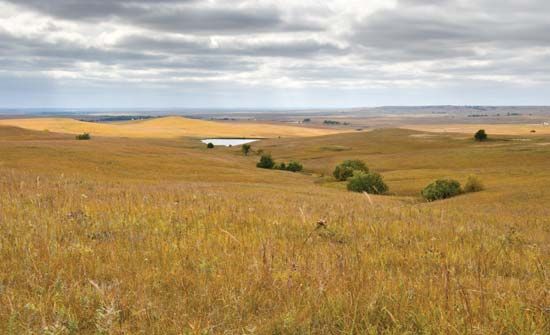
- Great Plains: A vast physiographic province in North America stretching from the Rio Grande to the Arctic Ocean, covering approximately 1,125,000 square miles.2
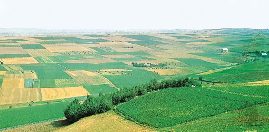
- European Plain: One of the world’s largest uninterrupted expanses, extending from the Pyrenees Mountains to the Ural Mountains in Russia.3
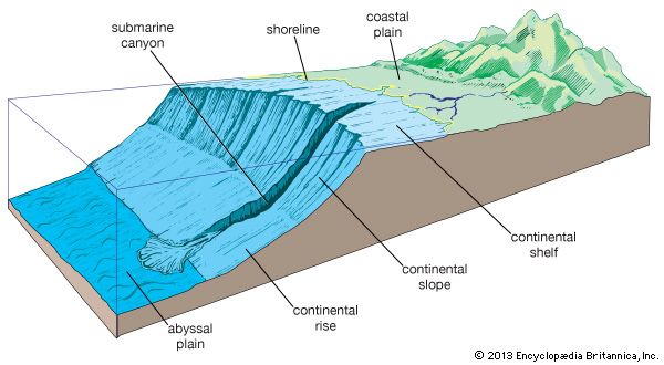
- Abyssal Plains: Flat, deep-ocean seafloor areas typically found at depths of 3,000 to 6,000 meters, most commonly located in the Atlantic Ocean.4
- Pampas: Extensive fertile plains located in South America.1
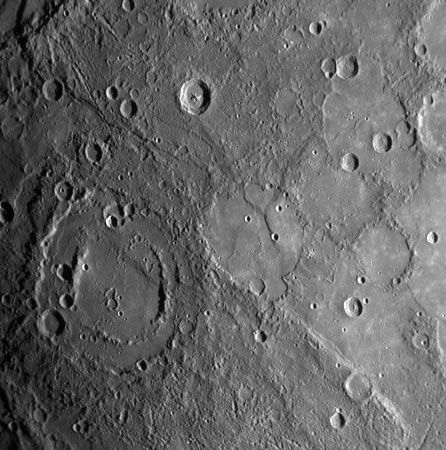
Beyond Earth, planetary scientists also identify plains on other bodies, such as the northern plains of Mars, which include regions like Amazonis Planitia and Utopia Planitia.5
How do rivers and other water bodies shape the geology of plains over time?
Rivers and other water bodies are primary agents in shaping the geology of plains through a continuous cycle of erosion and deposition. These processes transform irregular landscapes into the relatively level surfaces characteristic of plains.78
Fluvial Construction
Rivers build plains primarily through the accumulation of alluvium, which occurs in two main ways:
- Lateral Accretion: As rivers meander, they erode their outer banks while simultaneously depositing sediment on the inside of bends, creating features like point bars. Over time, these bars spread across valley bottoms, forming a flat, sediment-rich surface.8
- Vertical Accretion: During floods, rivers overflow their banks, depositing fine-grained sediment (silt and clay) across the floodplain. This process gradually raises the elevation of the land, filling in depressions and smoothing the topography.8
Lacustrine and Glacial Influences
Water bodies such as lakes also play a critical role. When streams enter standing water, they deposit sediment in deltas, and fine-grained materials settle in flat-lying beds that eventually bury pre-existing relief to form perfectly flat lake plains. Additionally, catastrophic floods—such as those from glacial lake outbursts—can carve channels and redistribute massive amounts of sediment, further modifying the regional geology.910
What role do plains play in human settlement and agriculture throughout history?
Plains have historically served as the primary sites for human settlement, industry, and commerce due to their flat surfaces, which facilitate transportation and are easily cultivated. Because they often contain highly productive soil, these regions have supported the development of major population centers throughout history.1
Agriculture and Settlement
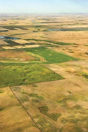
The relationship between plains and agriculture is foundational. In the Great Plains of North America, Indigenous peoples established earth-lodge villages along river valleys, utilizing the fertile soil to grow crops like corn, beans, and squash. Similarly, the Indo-Gangetic Plain has long been a center for agricultural activity. Early “hydraulic civilizations,” such as those in the Tigris-Euphrates and Nile valleys, thrived by managing the annual inundation of floodplains, which provided the agricultural surpluses necessary for the rise of cities.171819
Challenges and Evolution
While plains are hospitable, they are not immune to environmental challenges. Historically, intensive irrigation in arid regions has led to salinization, which can degrade soil fertility and threaten the stability of civilizations. Modern agricultural practices, such as the overuse of fertilizers and stubble burning, also present significant environmental issues, including water pollution and hazardous air quality. Furthermore, the conversion of wild land for farming remains a major driver of biodiversity loss, highlighting the complex balance between human reliance on these productive landscapes and the need for sustainable stewardship.191820
How are plains formed through various geological processes?
Plains are relatively level areas of the Earth’s surface characterized by gentle slopes and low relief. Their formation is primarily driven by the dominance of erosional and depositional processes over tectonic activity.1
Depositional Processes
Many plains are created when sediment—such as sand, clay, and rock debris—fills depressed crustal segments or smooths out irregular topography.
- Fluvial Deposition: Rivers are major architects of plains. Through the accumulation of alluvial deposits, rivers form floodplains and deltas by depositing silt, sand, and clay when their flow is checked or they overflow their banks.56
- Marine and Lacustrine Deposition: Abyssal plains form on the seafloor as land-derived sediment accumulates in deep depressions, burying preexisting hilly terrain. Similarly, meltwater from glaciers can pond in front of ice masses, creating vast, flat lake plains once the water drains.2425
Glacial and Eolian Processes
- Glaciation: During the Pleistocene Epoch, massive ice sheets scoured bedrock and deposited thick layers of till and glacial sediment, resulting in the flat to gently rolling landscapes seen in many modern agricultural regions.15
- Eolian Activity: Wind also shapes plains. For example, silty river sediment can be transported by wind and deposited as loess, which forms the fertile soil found in many mid-continental regions.25
Sources
- plain — Encyclopædia Britannica
- Great Plains - Soils and climate — Encyclopædia Britannica
- Great Plains — Encyclopædia Britannica
- European Plain — Encyclopædia Britannica
- Mars - Sparsely cratered plains — Encyclopædia Britannica
- abyssal plain — Encyclopædia Britannica
- river - Floodplain deposits, origins, and features — Encyclopædia Britannica
- river - Floodplains — Encyclopædia Britannica
- river - Rivers as agents of landscape evolution — Encyclopædia Britannica
- river - Terraces and geomorphic history — Encyclopædia Britannica
- alluvium — Encyclopædia Britannica
- valley - Geomorphic characteristics — Encyclopædia Britannica
- Pleistocene Epoch - Fluvial environments — Encyclopædia Britannica
- alluvial deposit — Encyclopædia Britannica
- North America - The lowlands of North America — Encyclopædia Britannica
- glacial landform - Glaciolacustrine deposits — Encyclopædia Britannica
- Native American - The Plains — Encyclopædia Britannica
- Native American - Plains Woodland and Plains Village cultures — Encyclopædia Britannica
- Wisconsin - Soils — Encyclopædia Britannica
- Intensive animal farming - Environmental impacts — Encyclopædia Britannica
- Origins of agriculture - Early agricultural societies — Encyclopædia Britannica
- river - Significance in early human settlements — Encyclopædia Britannica
- pollution in India - Modern agricultural practices — Encyclopædia Britannica
- alluvial plain — Merriam-Webster
- Pleistocene Epoch - Glaciation — Encyclopædia Britannica
Published on · 4 min read