Verkhoyansk Mountains
The Verkhoyansk Mountains are a major mountain range located in the Sakha (Yakutiya) region of far northeastern Russia. Extending for approximately 700 miles…
What is Verkhoyansk Mountains?
The Verkhoyansk Mountains are a major mountain range located in the Sakha (Yakutiya) region of far northeastern Russia. Extending for approximately 700 miles (1,100 km), the range forms a massive arc that runs parallel to and east of the lower Lena River, stretching toward the Laptev Sea.1
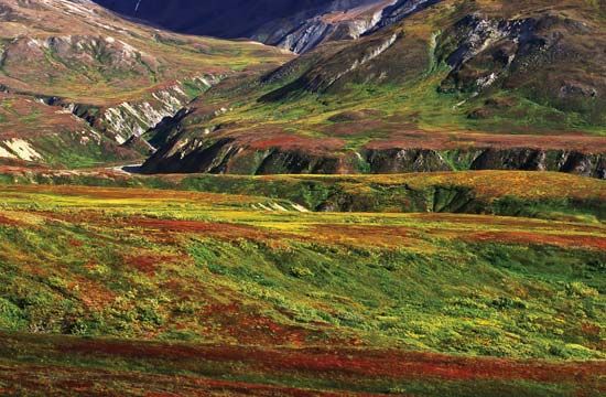
Geologically, the mountains are characterized as a significant anticlinal structure formed during a period of folding. The terrain is rugged, with elevations generally exceeding 3,300 feet (1,000 meters) and reaching a peak of 7,838 feet (2,389 meters). Due to the harsh environment, the region is virtually uninhabited and lacks any crossing routes, supporting only sparse tundra vegetation such as mosses and lichens.1
It is important to distinguish these mountains from the town of Verkhoyansk, a small mining center known for experiencing some of the lowest temperatures ever recorded outside of Antarctica.2
What is the climate like in the Sakha Republic?
The Sakha Republic experiences the most severe climate of any inhabited region on Earth, characterized by an extreme continental environment.3
Temperature Extremes
The region is defined by massive seasonal temperature fluctuations. Winters are intensely cold, with average January temperatures around −46 °F (−43.5 °C). In specific locations like Verkhoyansk, average January temperatures can drop to −58 °F (−50 °C), and the area has recorded some of the lowest temperatures ever documented outside of Antarctica. Conversely, summers are relatively warm, with an average July temperature of 66 °F (19 °C). The seasonal range is vast; for instance, in the capital city of Yakutsk, the difference between January and July means can reach 115 °F (64 °C).324
Precipitation and Permafrost
- Precipitation: The climate is notably dry, with annual precipitation ranging from only 8 to 16 inches (200–400 mm).3
- Permafrost: The entire republic is underlain by permafrost, which reaches depths of 450 feet (140 meters) in Yakutsk and can exceed 1,000 feet (300 meters) along the Arctic coast.3
How do plants survive in the tundra environment?
Plants in the tundra have evolved specialized adaptations to survive in a harsh environment characterized by low temperatures, short growing seasons, and permanently frozen ground (permafrost).678
Key Survival Strategies
- Rapid Life Cycles: Because the growing season is limited to two to four months, many plants are perennials that flower and produce seeds quickly—sometimes within four to six weeks—to complete their life cycles before winter returns.67
- Growth Forms: To protect themselves from cold, drying winds, many plants grow in compact, low-lying cushions or mats. Some species, such as cottongrass, possess hairy stalks that retain warm air, raising the temperature near the plant by several degrees.67
- Thermal Regulation: Plants often grow close to the soil surface, where air temperatures are warmer. In sunlight, flowers can become significantly warmer than the surrounding air, aiding development.6
- Asexual Reproduction: Many species rely on runners, underground stems, or bulblets to reproduce, which is often more reliable than seed production in such a challenging climate.67
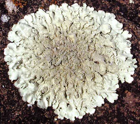
- Symbiotic Associations: Lichens—a partnership between fungi and algae—are highly resilient and can grow on bare rock or in extreme conditions where other plants cannot survive.69
What are some other major mountain ranges in Russia?
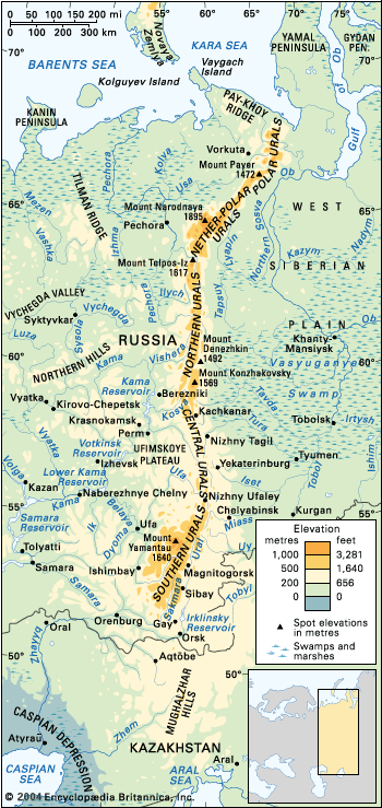
Russia is home to a vast array of complex mountain systems, particularly across its southern and eastern territories. Beyond the well-known Ural Mountains, which serve as a traditional boundary between Europe and Asia, several other major ranges define the Russian landscape:
- Caucasus: Located between the Black and Caspian seas, this system includes the Greater Caucasus, which contains Mount Elbrus—the highest peak in Russia at 18,510 feet (5,642 meters).113
- Altai Mountains: A complex system in the south bordering Kazakhstan and Mongolia, featuring rugged peaks like Belukha, which reaches 14,783 feet (4,506 meters).1415
- Sayan Mountains: Situated east of the Altai, this V-shaped system consists of the Western and Eastern Sayan ranges, which enclose the high Tyva Basin.14
- Verkhoyansk Mountains: Located in the Sakha Republic, this range extends 700 miles in a massive arc east of the Lena River.1614
- Chersky Range: A significant system in northeastern Siberia that reaches elevations of over 10,000 feet.14
- Sikhote-Alin: A prominent range in southeastern Siberia that separates the Amur-Ussuri lowlands from the Pacific coast.14
- Koryak and Sredinny Mountains: These ranges form a northeast-southwest chain along the volcanic Kamchatka Peninsula.14
Sources
- Verkhoyansk Mountains — Encyclopædia Britannica
- Verkhoyansk — Encyclopædia Britannica
- Sakha — Encyclopædia Britannica
- Russia - Temperature — Encyclopædia Britannica
- Sakha — Encyclopædia Britannica
- Tundra - Plant life — Encyclopædia Britannica
- Arctic - Vegetation — Encyclopædia Britannica
- Tundra - Soils — Encyclopædia Britannica
- Tundra - Effects of human activities and climate change — Encyclopædia Britannica
- fungus - Basic features of lichens — Encyclopædia Britannica
- Polar ecosystem - Development and structure of populations and communities — Encyclopædia Britannica
- Bryophyte - Ecology and habitats — Encyclopædia Britannica
- Ural Mountains — Encyclopædia Britannica
- Caucasus — Encyclopædia Britannica
- Russia - The mountains of the south and east — Encyclopædia Britannica
- Russia - The Russian Plain — Encyclopædia Britannica
- Altai Mountains — Encyclopædia Britannica
- Altai Mountains - Geology — Encyclopædia Britannica
Published on · 3 min read