Dinder River
The Dinder River is a 300-mile (480-km) tributary of the Blue Nile. It originates in the Ethiopian highlands west of Lake Tana and flows northwest into the…
What is Dinder River?
The Dinder River is a 300-mile (480-km) tributary of the Blue Nile. It originates in the Ethiopian highlands west of Lake Tana and flows northwest into the Sudanese plain, eventually joining the Blue Nile below Sannār, Sudan.1
During the flood season from June to September, the lower third of the river is navigable. As it traverses the Sudanese landscape, the river flows through the Dinder National Park, a protected area established in 1935 that features diverse wildlife and varied vegetation, including thornbush savanna and gallery forests along the riverbanks.12
What wildlife lives in Dinder National Park?
Dinder National Park is home to a diverse array of wildlife that thrives within its varied habitats, which range from thornbush savanna and woodland to gallery forests and swampy areas.2
Commonly found species include:
- Giraffe
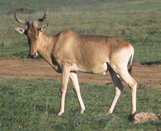
- Hartebeest
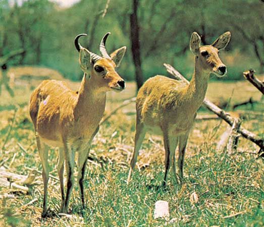
- Reedbuck
- Roan antelope
- Bushbuck
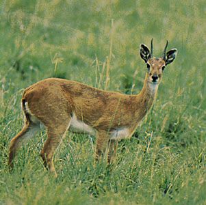
- Oribi
- Waterbuck
- Greater kudu
- Gazelle
- Dik-dik
- Buffalo
- Lion
- Ostrich
Additionally, the park occasionally hosts populations of black rhinoceros, leopard, cheetah, elephant, hyena, and jackal.2
How does the Blue Nile affect the region?
The Blue Nile is a critical hydrological force in the region, serving as the primary source of floodwater for the Nile River system, accounting for nearly 70 percent of the inflow into Lake Nasser.34
Its impact on the region includes:
- Agriculture and Irrigation: The river supports extensive agricultural development. In Sudan, the Sannar and Al-Ruṣayriṣ dams irrigate approximately 1,000,000 acres (400,000 hectares) in the Al-Jazīrah plain, a vital agricultural area located between the Blue and White Nile rivers.3
- Energy Production: The river is a major source of hydroelectric power. The Sannar Dam generates electricity, and the Grand Ethiopian Renaissance Dam in Ethiopia is a significant project for regional power generation.3
- Hydrological Regime: Unlike the more stable White Nile, the Blue Nile is characterized by a pronounced flood season from late July to October, driven by summer monsoon rains over the Ethiopian Plateau. Historically, this surge was the primary driver of the annual Nile floods, which were essential for agriculture but also posed risks of famine and disease when floods were irregular.34
- Navigation: While the river is navigable during the high-water season, its use for transport is limited by seasonal water levels and the presence of cataracts.5
What are the characteristics of the Ethiopian highlands?
The Ethiopian Highlands, often called the “Roof of Africa,” are a rugged, high-altitude region covering much of Ethiopia and central Eritrea. They are divided into the extensive Western Highlands and the more limited Eastern Highlands, separated by the vast East African Rift System.78
Key characteristics include:
- Topography: The region features dramatic relief, with the North Central massifs in the Western Highlands containing the highest peak, Mount Ras Dejen (14,872–15,157 feet). The landscape is shaped by ancient Precambrian rocks, Mesozoic sedimentary layers, and extensive Cenozoic volcanic basalt.78910
- Climate: Due to their elevation, the highlands experience a moderate, temperate climate with average annual temperatures in the low 60s F (mid-10s C), contrasting sharply with the hot, arid lowlands. Rainfall is significant, particularly in the summer, supporting diverse biomes including montane forests, grasslands, and moorlands.1112
- Biodiversity: The region hosts unique, endangered species such as the walia ibex, mountain nyala, Simien jackal, and gelada monkey.712
- Economic & Cultural Importance: The fertile soils and moderate climate make these highlands the primary agricultural and demographic core of the region. They have historically supported major civilizations, such as the kingdom of Aksum, and remain central to cultural and religious life, including the Ethiopian Orthodox Tewahedo Church.8
Sources
- Dinder River — Encyclopædia Britannica
- Dinder National Park — Encyclopædia Britannica
- Blue Nile River — Encyclopædia Britannica
- Nile River - Climate and hydrology — Encyclopædia Britannica
- Nile River - Navigation — Encyclopædia Britannica
- Nile River - Physiography of Nile River — Encyclopædia Britannica
- Exploring 7 of Earth’s Great Mountain Ranges - Ethiopian Highlands — Encyclopædia Britannica
- Ethiopia - Relief of Ethiopia — Encyclopædia Britannica
- Ethiopian Plateau — Encyclopædia Britannica
- Ethiopia - Climate — Encyclopædia Britannica
- Ethiopia - Plant and animal life — Encyclopædia Britannica
- Amhara Plateau — Encyclopædia Britannica
Published on · 3 min read