Karawanken
The Karawanken is a mountain range located in the Eastern Alps, stretching 50 miles (80 km) eastward along the border between Austria and Slovenia, beginning…
What is Karawanken?
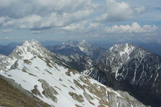
The Karawanken is a mountain range located in the Eastern Alps, stretching 50 miles (80 km) eastward along the border between Austria and Slovenia, beginning near the town of Tarvisio, Italy.1
Composed primarily of limestone, the range is situated between the Drava River to the north and the upper Sava River to the south. Its highest point is the Hochstuhl, which reaches an elevation of 7,342 feet (2,238 meters). The mountains are traversed by several road passes, including the Wurzen, Loibl, and Seeberg passes, and a 5-mile (8-km) tunnel connects the Austrian city of Villach with Jesenice, Slovenia city of Villach with Jesenice, Slovenia. The range is well-regarded for its scenic views of Lake Wörther and other nearby bodies of water.1
What are the main geological features of the Eastern Alps?
The Eastern Alps, which extend from the Brenner Pass to Trieste, are characterized by a complex geological history shaped by the convergence of the African and European continents.134
Geological Composition and Formation
The region was formed as the Italian peninsula—a promontory of the African continent—moved northward, causing the sedimentary cover of the Tethys Ocean margin to be detached and folded into massive nappes. This process resulted in a diverse landscape:3
- Sedimentary and Metamorphic Rocks: The northern and western parts of the Alps are dominated by folded, unmetamorphosed sedimentary rock, while the southern regions consist largely of metamorphic rock.3
- Limestone Features: Many ranges, such as the Karawanken and the Dolomites, are composed primarily of limestone. This has led to the development of karst systems, featuring extensive underground caves and streams, particularly in the plateau between the Eastern Alps and Slovenia.54
- Glacial Influence: During the Quaternary Period, the landscape was heavily scoured by glaciers, which carved deep valleys and shaped the rugged, high-altitude peaks.4
How do mountain tunnels like the Karawanken tunnel impact international travel?
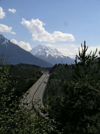
Mountain tunnels, such as the Karavanke Tunnel, have fundamentally transformed international travel by overcoming the natural barriers posed by rugged terrain like the Alps.1
Their impact on international connectivity includes:
- Year-Round Accessibility: Unlike mountain passes, which can be difficult or impassable depending on weather conditions, tunnels allow for the steady movement of people and vehicles throughout the year.1
- Enhanced Connectivity: Tunnels serve as vital links between nations. For example, the Karavanke Tunnel, which opened in 1991, provides a direct connection between Austria and Slovenia, facilitating trade and transit.67
- Increased Capacity and Efficiency: Modern “base tunnels,” such as the Gotthard Base Tunnel, allow for flatter, straighter routes that accommodate heavier freight and faster passenger trains, significantly reducing travel times between major European hubs.8
- Economic and Social Growth: By ending the isolation of mountain regions, these tunnels have been a primary driver for the expansion of international tourism and the integration of regional economies.1
While these engineering feats provide significant benefits, they also contribute to environmental challenges, such as the degradation of the Alpine environment due to increased traffic volume.1
What are some other significant mountain ranges in Europe?
Beyond the Alps, Europe features several other significant mountain ranges, many of which were formed during the same Cenozoic orogenic period.11
- Pyrenees: Stretching between the Mediterranean Sea and the Bay of Biscay, this range forms a high natural wall between France and Spain. Its highest point is Aneto Peak, reaching 11,169 feet.12
- Carpathian Mountains: Forming a wide, 900-mile crescent arc, these mountains are a geological continuation of the Alps. While they share a similar origin, they are generally lower in elevation and less compact than the Alps, with Gerlachovský Štít as their highest peak.13
- Apennine Range: Known as the physical backbone of the Italian peninsula, this range extends approximately 870 miles. It is geologically related to the Atlas Mountains in North Africa and features Mount Corno as its highest point.4
- Caucasus: Extending between the Black Sea and the Caspian Sea, the Greater Caucasus range contains some of the highest peaks in the region, including Mount Elbrus.14
- Dinaric Alps: Located in the Balkan region, these mountains are characterized by high elevations and rugged terrain, with Bobotov Kuk serving as a notable summit.11
Sources
- Karawanken — Encyclopædia Britannica
- Kärnten — Encyclopædia Britannica
- Alps - Physiography — Encyclopædia Britannica
- mountain - The western segment of the system — Encyclopædia Britannica
- Italy - Mountain ranges — Encyclopædia Britannica
- tunnels and underground excavations - Canal and railroad tunnels — Encyclopædia Britannica
- Gotthard Base Tunnel — Encyclopædia Britannica
- Slovenia - Transportation and telecommunications — Encyclopædia Britannica
- Alps - Transportation — Encyclopædia Britannica
- tunnels and underground excavations - Geologic investigation — Encyclopædia Britannica
- Apennine Range — Encyclopædia Britannica
- Pyrenees — Encyclopædia Britannica
- Carpathian Mountains — Encyclopædia Britannica
- Caucasus - Physiography — Encyclopædia Britannica
- Europe - Elevations — Encyclopædia Britannica
Published on · 3 min read