Scandinavian Ice Sheet
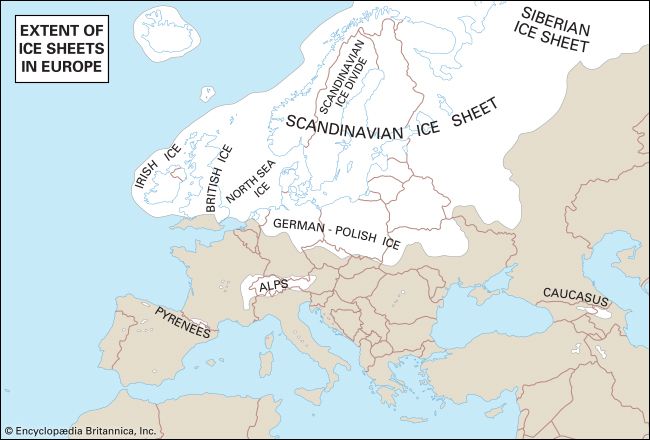
The Scandinavian Ice Sheet was one of the largest glacial masses during the Pleistocene Epoch, covering a vast portion of northern Europe.
What is Scandinavian Ice Sheet?
The Scandinavian Ice Sheet was one of the largest glacial masses during the Pleistocene Epoch, covering a vast portion of northern Europe.1
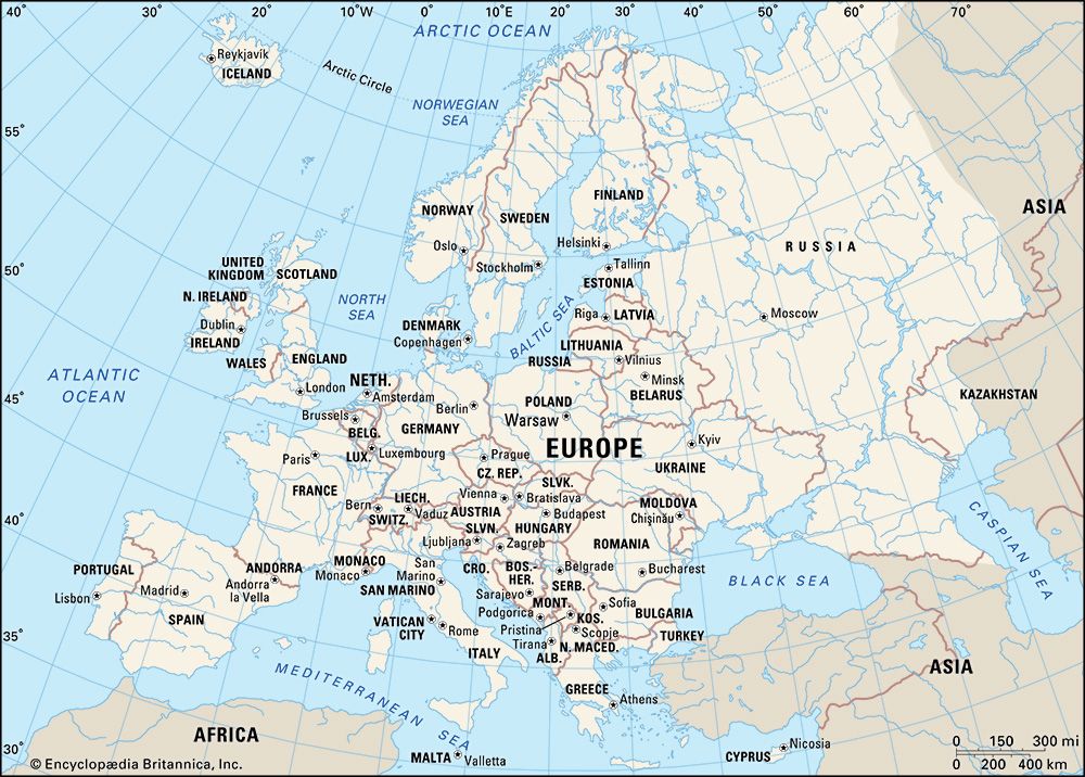
Originating from the Jostedalsbreen area in Norway, this massive ice sheet expanded significantly during glacial periods, reaching as far west as the British Isles, south into central Germany and Poland, and east nearly to Moscowplace/Poland), and east nearly to Moscow. At its peak, it covered approximately 6,600,000 square kilometers (2,500,000 square miles) and reached thicknesses of up to 3,000 meters (9,800 feet).12
The ice sheet played a transformative role in shaping the European landscape through erosion and the deposition of materials like loess, boulder-studded clay, and gravel. Its retreat at the end of the Pleistocene left behind distinct features such as fjords and numerous lakes. The last major expansion of this ice sheet is associated with the Weichsel Glacial Stage, which began roughly 70,000 years ago.324
How do glaciers create landforms like fjords and U-shaped valleys?
Glaciers reshape the landscape through powerful erosional processes, primarily driven by the weight of the ice and the debris it carries.
U-Shaped Valleys
When a glacier flows through a pre-existing, V-shaped stream valley, it acts as a massive abrasive agent. Because ice has high viscosity and a large cross-section, it erodes the valley floor and walls uniformly to minimize frictional resistance, transforming the V-shape into a characteristic U-shaped valley.6
This process is aided by:
- Abrasion: The glacier acts like sandpaper, using rock debris embedded in its base to grind down the bedrock, creating smooth surfaces and striations.7
- Plucking: The glacier removes large blocks of rock from the valley floor and walls, particularly where stress gradients are high or water refreezes in cracks.7
- Differential Erosion: Because larger glaciers have more erosive power than smaller ones, tributary glaciers often cannot deepen their beds as quickly as the main glacier. When the ice melts, these smaller valleys are left high above the main floor as hanging valleys, often resulting in waterfalls.6
Fjords
Fjords are essentially deep, U-shaped glacial valleys that have been submerged by the sea. During glacial periods, massive valley glaciers carved deep troughs, often extending far below sea level due to the immense weight and thickness of the ice. As the climate warmed and glaciers melted, rising sea levels flooded these deep, narrow valleys.89
Fjords are typically deepest in their middle and upper reaches, where the glacier’s movement was most active and erosive.8
What is the difference between an ice sheet and a glacier?
A glacier is a broad term for any large mass of perennial ice that originates on land through the recrystallization of snow and shows evidence of past or present flow. An ice sheet is a specific, massive type of glacier that extends in continuous sheets, covering extensive areas and burying the underlying landscape.111213
The primary differences between ice sheets and other glaciers, such as mountain glaciers, include:
- Scale and Coverage: Ice sheets are vast, covering areas exceeding 50,000 square kilometers (19,000 square miles), such as those in Antarctica and Greenland. Mountain glaciers are typically smaller and confined to specific paths or valleys.1213
- Relationship to Topography: Mountain glaciers are “rivers of ice” whose flow is directed and controlled by the surrounding high-relief terrain. In contrast, ice sheets are continuous, pancakelike masses that flow outward from a center, largely independent of the underlying topography.13
- Classification: While ice sheets are the largest category, smaller versions of these continuous ice masses are termed ice caps.1214
How does the weight of an ice sheet cause the Earth’s crust to sink?
The Earth’s crust subsides under the immense weight of an ice sheet due to a process known as isostasy. Because the crust cannot support the massive load of the ice, it is forced downward. This movement occurs as material within the Earth’s mantle flows away from the area beneath the ice, allowing the surface to sink.17
The degree of this subsidence is significant, typically reaching about one-third of the total thickness of the ice sheet. For instance, the central region of the Laurentide Ice Sheet caused the crust to sink by approximately 1 kilometer (0.6 miles).17
When the ice eventually melts, the removal of this load triggers a process called glacio-isostatic rebound. The crust begins to rise back toward its original position. This uplift is initially rapid but slows over time; in areas like Hudson Bay, the ground has risen more than 300 meters since the ice retreated, and upward movement continues today.17
Sources
- Scandinavian Ice Sheet — Encyclopædia Britannica
- Weichsel Glacial Stage — Encyclopædia Britannica
- Arctic - Continental ice sheets of the past — Encyclopædia Britannica
- Europe - Pleistocene glaciation — Encyclopædia Britannica
- iceberg - Impact on ocean structure — Encyclopædia Britannica
- glacial valley — Encyclopædia Britannica
- fjord — Encyclopædia Britannica
- glacial landform - Glacial erosion — Encyclopædia Britannica
- Quaternary - Landforms — Encyclopædia Britannica
- estuary - Geology and geomorphology — Encyclopædia Britannica
- ice sheet — Encyclopædia Britannica
- What’s the Difference Between a Glacier and an Ice Floe? — Encyclopædia Britannica
- glacier — Encyclopædia Britannica
- ice — Encyclopædia Britannica
- glacier - Main types of glaciers — Encyclopædia Britannica
- glacial landform - Types of glaciers — Encyclopædia Britannica
- Pleistocene Epoch - Tectonic and isostatic movements — Encyclopædia Britannica
- glacier - Ablation — Encyclopædia Britannica
Published on · 3 min read