Scandinavian Peninsula
The Scandinavian Peninsula is a large promontory in northern Europe, spanning approximately 1,150 miles (1,850 km) in length. It is occupied by the countries…
What is Scandinavian Peninsula?
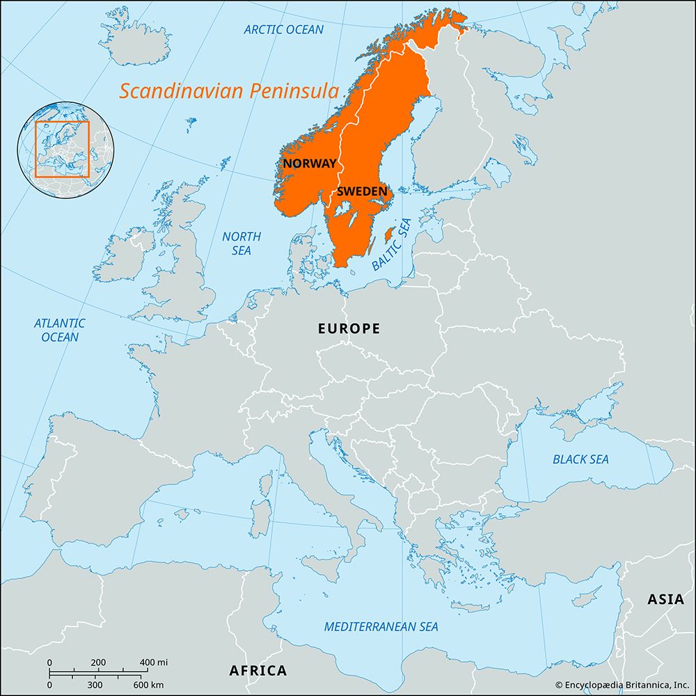
The Scandinavian Peninsula is a large promontory in northern Europe, spanning approximately 1,150 miles (1,850 km) in length. It is occupied by the countries of Norway and Sweden.1
Geographically, the peninsula is defined by a mountainous mass, much of which belongs to the ancient Baltic Shield and was shaped by glaciation during the Pleistocene Epoch. The landscape varies significantly between the two nations:1
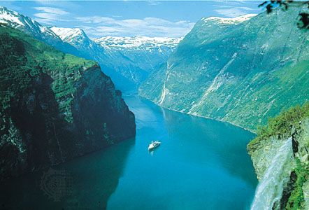
- Norway occupies the western side, where mountains reach the coastline and are deeply carved by fjords.1
- Sweden occupies the eastern side, characterized by extensive slopes that descend gently toward the Baltic Sea.1
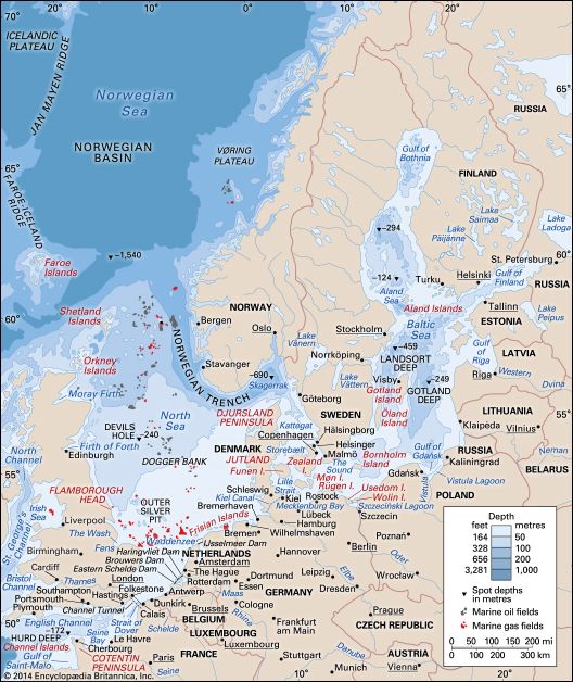
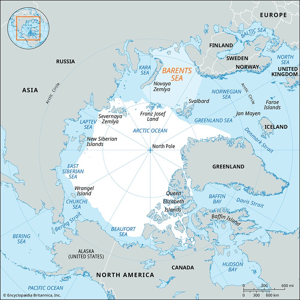
The peninsula is bordered by several bodies of water, including the Barents Sea to the north, the Gulf of Bothnia and the Baltic Sea to the east, the Kattegat and Skagerrak to the south, and the Norwegian and North seas to the west.1
How are fjords formed in the landscape of Norway?
Fjords in Norway are formed through the process of glacial erosion during the Quaternary Period’s repeated ice ages.56
The formation process generally follows these stages:
- Preglacial Valleys: Before the ice ages, rivers carved V-shaped valleys into the landscape, often following fracture lines in the Earth’s crust.6
- Glacial Scouring: During the Ice Age, massive glaciers moved through these existing valleys. Because of their immense weight and thickness, these glaciers possessed tremendous erosive power, scouring the bedrock and widening the V-shaped valleys into characteristic U-shaped valleys.56
- Deepening: The glaciers were so heavy that they could erode the valley floors far below sea level. This explains why many Norwegian fjords, such as Sogn Fjord, reach extreme depths.57
- Marine Inundation: As the glaciers eventually melted and retreated, the sea flooded these deep, U-shaped troughs, creating the long, narrow arms of the sea known as fjords.56
While the glacial origin is widely accepted, some researchers suggest that tectonic activity also played a role in creating the relief that glaciers later modified.7
What is the difference between the Scandinavian Peninsula and the Nordic countries?
The terms “Scandinavian Peninsula” and “Nordic countries” refer to different geographic and political groupings in northern Europe.
The Scandinavian Peninsula
The Scandinavian Peninsula is a specific geographic landmass in northern Europe. It is a large promontory spanning approximately 1,150 miles (1,850 km) and is occupied exclusively by the countries of Norway and Sweden.10
The Nordic Countries
The Nordic countries represent a broader political and cultural grouping. This designation includes:1
- Denmark (including the Faroe Islands and Greenland)
- Finland (including the Åland Islands)
- Iceland
- Norway
- Sweden
While the term Scandinavia is sometimes used interchangeably with the Nordic region, it is more restrictively defined as the geographic core consisting of Norway, Sweden, and Denmark. The Nordic countries are distinguished by their shared history, high levels of literacy, long life expectancies, and deep-rooted cooperation through organizations like the Nordic Council.111123
How did the last ice age shape the geography of Sweden?
The last ice age, dominated by the Scandinavian Ice Sheet, profoundly transformed Sweden’s landscape through massive erosion, deposition, and crustal movement.1314
Glacial Erosion and Deposition
As the ice sheet advanced and retreated, it scoured the bedrock, creating a landscape of fragmented rock and rounded hills. The ice left behind vast deposits of till—a mixture of clay, sand, and stones—which forms much of Sweden’s soil today. In low-lying areas, the melting ice deposited layers of clay and sand, creating the fertile plains found in parts of central and southern Sweden. The ice also shaped the coastline into the characteristic skärgårds (archipelago) landscape, where islands were ground into smooth, rounded shapes by the moving ice.151617
Postglacial Uplift and Drainage
The immense weight of the ice depressed the Earth’s crust. Following the retreat of the glaciers approximately 11,700 years ago, the land began an isostatic recovery, rising slowly to its former altitude. This process raised fertile sea-bottom clays above sea level, creating new agricultural land. Additionally, the retreating ice left behind disarranged drainage patterns, resulting in the formation of Sweden’s numerous lakes and rivers.13161715
Sources
- Scandinavian Peninsula — Encyclopædia Britannica
- Sweden - Earliest settlements — Encyclopædia Britannica
- Scandinavia: Top Questions — Encyclopædia Britannica
- Sweden - Climate of Sweden — Encyclopædia Britannica
- fjord — Encyclopædia Britannica
- glacial landform - Erosional landforms of continental glaciers — Encyclopædia Britannica
- Norway - Relief — Encyclopædia Britannica
- Oslo Fjord — Encyclopædia Britannica
- Sogn Fjord — Encyclopædia Britannica
- Scandinavia — Encyclopædia Britannica
- Nordic countries — Encyclopædia Britannica
- Finland — Encyclopædia Britannica
- Sweden - Soils — Encyclopædia Britannica
- history of Sweden - Earliest settlements — Encyclopædia Britannica
- Arctic - Continental ice sheets of the past — Encyclopædia Britannica
- Sweden - Relief — Encyclopædia Britannica
- Scandinavian Ice Sheet — Encyclopædia Britannica
- Europe - Pleistocene glaciation — Encyclopædia Britannica
Published on · 3 min read