Caratasca Lagoon
Caratasca Lagoon is the largest lagoon in Honduras, located in the northeastern part of the country. It extends inland from the Caribbean Sea for…
What is Caratasca Lagoon?
Caratasca Lagoon is the largest lagoon in Honduras, located in the northeastern part of the country. It extends inland from the Caribbean Sea for approximately 25 miles (40 km) and reaches up to 55 miles (88 km) in width from northwest to southeast.1
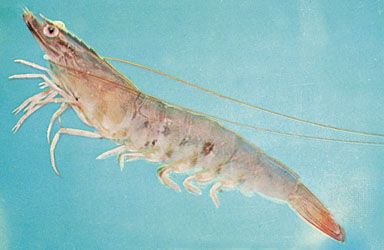
The lagoon is connected to the Caribbean by a 3-mile (5-km) channel. Its landscape is characterized by numerous islands—the largest being Tansín—and low-lying shores surrounded by dense tropical rainforests that produce mahogany and cedar. The area is significant for local industry, as shrimp are harvested from its waters, and the principal town, Puerto Lempira, is situated on its southern shore. Like other coastal lagoons in the region, it supports a variety of aquatic life, including abundant fish and mollusks.12
What is the Mosquitia region known for?
The Mosquitia region, also known as the Mosquito Coast, is a coastal lowland area spanning eastern Honduras and Nicaragua along the Caribbean Sea3.3
The region is known for several distinct characteristics:
- Cultural Heritage: It is named for the Miskito people, who constitute a majority of the population in the Nicaraguan portion and maintain communities in the northeastern region of Honduras.45
- Geography and Climate: The area is defined by a hot, humid climate and extensive forest cover. In Honduras, this region—referred to as La Mosquitia—accounts for about one-fifth of the country’s land area and is characterized by its rugged, sparsely populated landscape.6
- Economic Activity: Historically, forestry has been a significant economic driver in the region. Today, the local population relies primarily on small-scale agriculture and fishing.6
- Historical Significance: While visited by Columbus in 1502, the region became a focal point of colonial interest in the 17th century, eventually becoming an English protectorate before sovereignty disputes were settled in the 19th century.4
How do mangrove forests support coastal ecosystems?
Mangrove forests are vital to coastal health, acting as a critical buffer between marine and terrestrial environments. By trapping sediments with their complex root systems, they reduce erosion and improve water quality, which in turn supports the health of nearby coral reefs and seagrass beds.78
These forests provide essential protection against extreme weather. Their physical structure shields shorelines from damaging winds, waves, and storm surges, significantly reducing the impact of floods and hurricanes on coastal communities.78
Ecologically, mangroves are considered keystone species because they support high levels of biodiversity. Their roots serve as protected nursery habitats for various fish, crabs, shrimp, and shellfish, making them indispensable to the survival of local fisheries. Additionally, they provide nesting sites for many species of birds and are often the first to colonize disturbed coastal areas, facilitating the recovery of these ecosystems.78
What are the main threats to biodiversity in Honduras?
Biodiversity in Honduras faces significant pressure from human activity and environmental stressors. The primary threats include:
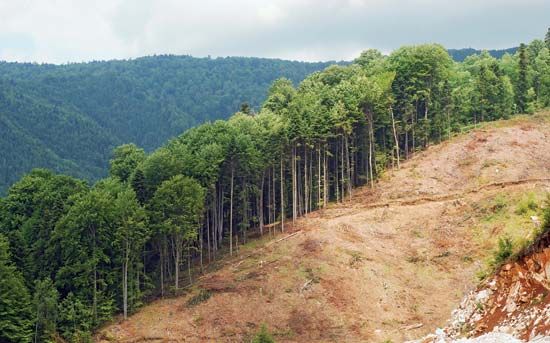
- Deforestation and Habitat Loss: Extensive tree cover loss is driven by agricultural expansion, cattle grazing, and illegal logging. These activities lead to soil degradation and the destruction of critical ecosystems, particularly in remote regions where government oversight is limited.210
- Agricultural and Urban Impact: Coastal ecosystems are increasingly threatened by agricultural runoff and urban development. These pressures degrade water quality and disrupt the delicate balance of marine and lagoon environments.2
- Climate-Related Stressors: Honduras is highly vulnerable to climate-related disasters, such as extreme weather events, which can cause severe damage to both infrastructure and natural habitats. Additionally, climate-related stresses—including drought, extreme heat, and wildfires—disrupt ecological stability and agricultural production.11
While the government has established various national parks and protected areas to safeguard native flora and fauna, challenges in monitoring and enforcement continue to limit the effectiveness of these conservation policies.210
Sources
- Caratasca Lagoon — Encyclopædia Britannica
- Honduras - Plant and animal life — Encyclopædia Britannica
- Mosquito Coast — Encyclopædia Britannica
- Honduras - Relief — Encyclopædia Britannica
- Honduras - The people of Honduras — Encyclopædia Britannica
- Mosquito Coast — Merriam-Webster
- mangrove: Top Questions — Encyclopædia Britannica
- Amazing Mangroves — Encyclopædia Britannica
- Mangroves Matter - Learn more — Encyclopædia Britannica
- Honduras — Encyclopædia Britannica
- Honduras - Agriculture, forestry, and fishing — Encyclopædia Britannica
Published on · 3 min read