Madhya Bharat Plateau
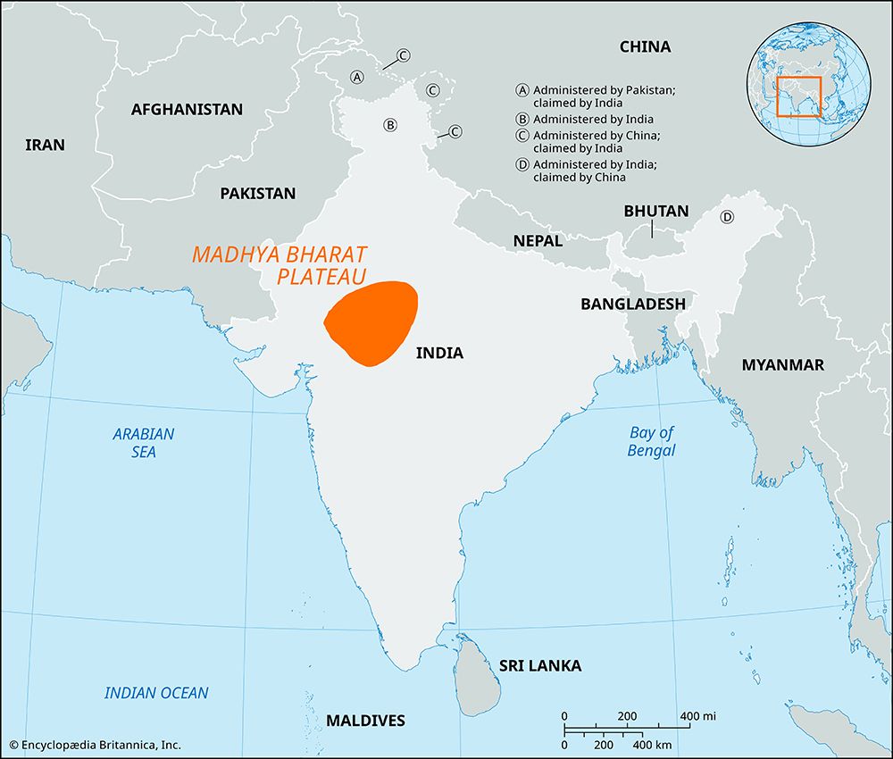
The Madhya Bharat Plateau is a significant geographical feature of central India, spanning approximately 22,000 square miles across northwestern Madhya…
How does the Madhya Bharat Plateau contribute to India’s overall geography and ecosystem?
The Madhya Bharat Plateau is a significant geographical feature of central India, spanning approximately 22,000 square miles across northwestern Madhya Pradesh and central Rajasthan. Characterized by a basaltic bedrock and an average elevation of 1,650 feet, it serves as a transitional zone between the Upper Ganges Plain and the Central Highlands.1
The region plays a vital role in India’s ecosystem and economy:
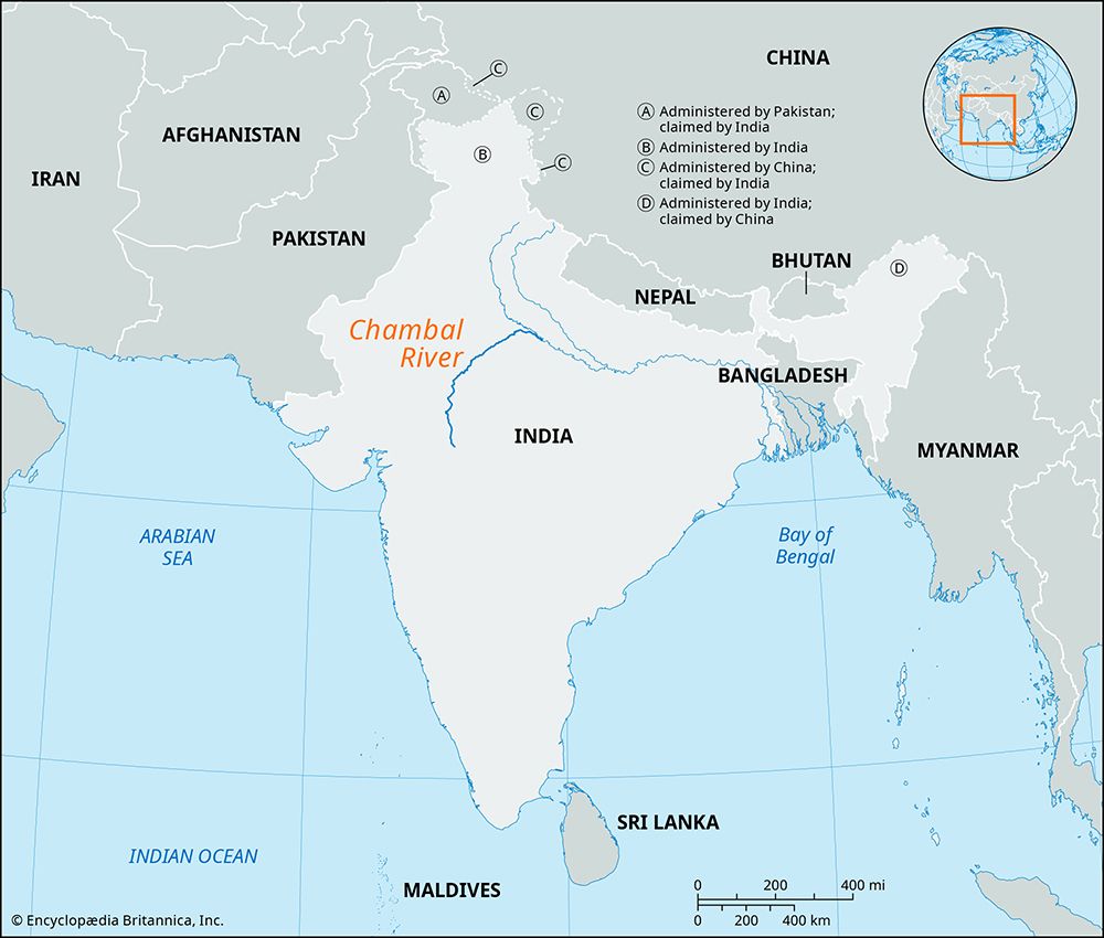
- Hydrology and Energy: The Chambal River and its tributaries, such as the Sind and Parbati, drain the plateau. The Chambal Valley Project, centered on the Gandhi Sagar Dam, is critical for providing irrigation and hydroelectric power to the region.1
- Biodiversity: The plateau supports diverse vegetation, ranging from savannas to moist and dry deciduous forests, including teak. The National Chambal Sanctuary is a vital conservation area for the endangered Ganges river dolphin, crocodiles, and gavials.12
- Economic Contribution: The plateau is an agricultural hub producing cereal grains, pulses, and oilseeds. It is also rich in mineral deposits, including iron ore, copper, and limestone, which support local industries.1
What are the major geographical features of the Madhya Bharat Plateau?
The Madhya Bharat Plateau is a distinct plateau located in the northern part of the Central Highlands of India. Its major geographical features include:
- Topography and Bedrock: The plateau covers approximately 22,000 square miles with an average elevation of 1,650 feet. Its bedrock is composed of uniform basalt, and the surface is characterized by an almost level landscape punctuated by sandstone scarps.1
- Drainage Systems: The region is defined by the Chambal River, which flows through a wide, bowl-like basin and a long, narrow gorge. Other significant rivers include the Banganga, Kunwari, Sind, Parbati, and Kali Sindh.1
- Soil and Vegetation: The area features black and alluvial soils. The landscape supports diverse vegetation, including savannas, moist deciduous forests in the south, and drier deciduous forests in the north.1
- Erosion: The Chambal River valley is notably affected by severe gullying and erosion, a process exacerbated by deforestation and overgrazing.1
What types of wildlife can be found in the Madhya Bharat Plateau region?
The Madhya Bharat Plateau and its surrounding river valleys support a diverse range of wildlife, benefiting from a variety of habitats including savannas, deciduous forests, and riverine ecosystems.
Key wildlife found in this region includes:
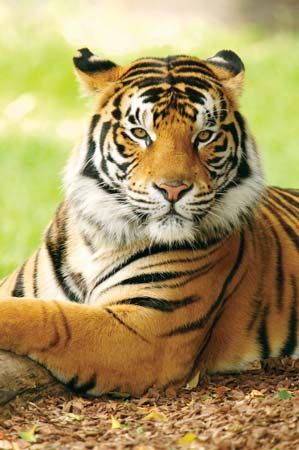
- Large Mammals: The woodlands and protected areas are home to tigers, leopards, jackals, and langurs.34
- Ungulates and Deer: Common species include chital (spotted deer), sambar, blackbucks, mouse deer, and four-horned antelope.34
- Aquatic Life: The National Chambal Sanctuary is a critical conservation zone for the endangered Ganges river dolphin, crocodiles, and gavials.3
- Birds: The region hosts a variety of avian species, including jungle fowl, quail, and bustards.4
These animals are protected within various sanctuaries and national parks, such as Madhav National Park, which serves as a significant refuge for both forest-dwelling and grassland species.34
How has the Madhya Bharat Plateau influenced the culture and lifestyle of the people living in the region?
The culture and lifestyle of the people living in the Madhya Bharat Plateau are deeply rooted in the region’s geography and agricultural economy.
- Agricultural Foundation: The economy is dominated by agriculture, with the cultivation of cereal grains, pulses, oilseeds, cotton, sugarcane, and tobacco shaping the daily rhythms of life. This agrarian focus is supported by irrigation and hydroelectric power provided by the Chambal Valley Project.
- Settlement Patterns: Much of the population resides in rural areas, with settlements often concentrated in river valleys where the land is more conducive to farming. These villages typically follow traditional Indian patterns, where social and religious customs, including the observance of samskara (personal sacraments), remain central to community life.15
- Industrial Influence: While rural life remains traditional, the presence of industrial centers like Gwalior and Kota introduces modern elements, including textile weaving, sawmilling, and the production of machine tools and cement.
- Environmental Challenges: The region’s history and lifestyle are also influenced by the Chambal River valley’s severe erosion and gullying. These rugged ravines have historically been associated with isolation and, in some accounts, as hideouts for bandits, reflecting the complex relationship between the local terrain and human activity.67
Sources
- Madhya Bharat Plateau — Encyclopædia Britannica
- Madhya Pradesh - Relief — Encyclopædia Britannica
- Madhya Pradesh - Plant and animal life — Encyclopædia Britannica
- Madhav National Park: Top Questions — Encyclopædia Britannica
- Chambal River — Encyclopædia Britannica
- India - Cultural milieu — Encyclopædia Britannica
- Madhya Pradesh - Settlement patterns — Encyclopædia Britannica
- Malwa Plateau — Encyclopædia Britannica
- Bhander Plateau — Encyclopædia Britannica
- India - Rural settlement — Encyclopædia Britannica
Published on · 3 min read